[Edmund Kiß was a member of the Ahnenerbe, he pushed for an expedition to Tiwanaku but this expedition was ultimately canceled in 1941 due to the war. A leather bound copy of this work was given to Führer Hitler as a Christmas present by Reichsführer-SS Himmler]
The highlands between the Andes and the prehistoric city by the slanted lake
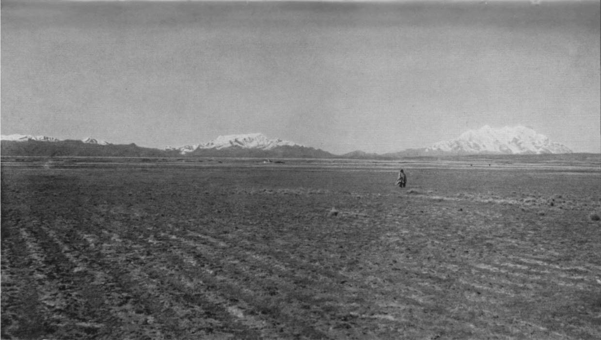
In the north of the South American continent, between the mountain ranges of the Andes, the Pacific and the Royal Cordillera, lies an extensive plateau, which partially belongs to Peru, another part to Bolivia, and a small part to Chile. The natives call this plateau the Altiplano or, more commonly, the Meseta, because it gives the impression of a flat table or surface (Fig. 1). Nevertheless, the Meseta is not flat and includes hills and mountains that, compared to the mountain walls surrounding the plateau with their snow-covered peaks, are considered low.
The highland extends about 200 km in width, namely the width of the space between the Andes, and slopes from north to south, descending approximately 15 to 25 degrees in southern latitude, spanning a distance of about 1200 km. In the north, the so-called Cordillera Crucera, the crossing Cordillera, diverts the Meseta from the Amazonian flowing highland of Peru, but in the south, the Meseta shows no such prominent mountain wall. Here, the highland directly transitions into the salt flats of Chile along the Pacific coast, which steeply descend into the Pacific Ocean. The Andean wall of the coastal Cordillera is also not much higher than the level of the Meseta, creating a basin-like structure open to the south.
This basin-shaped plateau stretching from north to south between the Andes has an average height of about 4100 meters above sea level. In many places, the enclosing mountain chains of the Cordillera rise above the Meseta by about 700 meters, with many peaks surpassing 5000 meters in height, and elevations above 5500 meters are not uncommon.
Nevertheless, there are some narrower or wider gaps in the mountain wall, one of which, as already mentioned, is in the south at the Great Ocean, over the salt flats of Chile. Another gap opens at Mount Sorata and a third near the Bolivian capital of La Paz, next to Mount Illimani. The highlands and surrounding mountains are palaeozoic, meaning their rocks are mainly composed of granite, gneiss, trachytes, and younger lavas. Tertiary formations, such as real sedimentary rocks, are missing. Consequently, the country lacks true limestone because no genuine limestone exists, only highly fossilized organic limestone from former lakes and dried-up waters.
Tertiary deposits can only be found on the eastern side of the Royal Cordillera, that is, on the Argentine and Paraguayan side of the east slope.
Professor Posnansky, one of the best experts on the Bolivian highlands, in a small work "El clima del Altiplano" (La Paz 1911), examined the supposed origins of the Andean highlands, stating that the slow rise of the South American continent in the area where the Meseta is found today had led to the formation of huge masses of water at about 4000 meters above sea level. These expansive lakes, with various water levels, were enclosed by the Cordilleras and their cross ridges. The large, enclosed water masses had no outlets or only a very small one, which had little impact on the volume of water; as a result, their water levels remained largely constant for a long time. Later, frequent earthquakes in South America at various points in the Cordilleras shattered these barriers, and the waters of the large lakes, freed from their confinement, partly flowed through these newly formed outlets to the Atlantic. The rivers opened into the Amazon and La Plata basins.
A second, later outflow of the large water mass that filled the Altiplano basin occurred, according to Posnansky, due to either sudden or slow elevation of the land, specifically the area now covered by Lake Titicaca, and subsequently, the land to the south sank, covering the areas around Poopo and the salt flats of Coipasa, Uyuni, Askotan, and Atacama along with their accompanying lakes. Since this elevation in the south was not as strong as in the north, the water of the large lakes had to flow southward, into Paria, Lipez, and into the Atacama Desert, where traces of this drainage are still visible today.
It is clear that such assumptions of sinking entire lands are substantial; in this case, one can already speak of a sinking and tilting of almost the entire continent, resulting in visible phenomena. All indications suggest that the continent of South America previously lay in another position, and today is "tilted," as indicated in subsequent explanations. Therefore, such an assumption of continental tilting as an explanation for the drainage of water masses and the "tilted" nature of the South American landmass is not unreasonable.
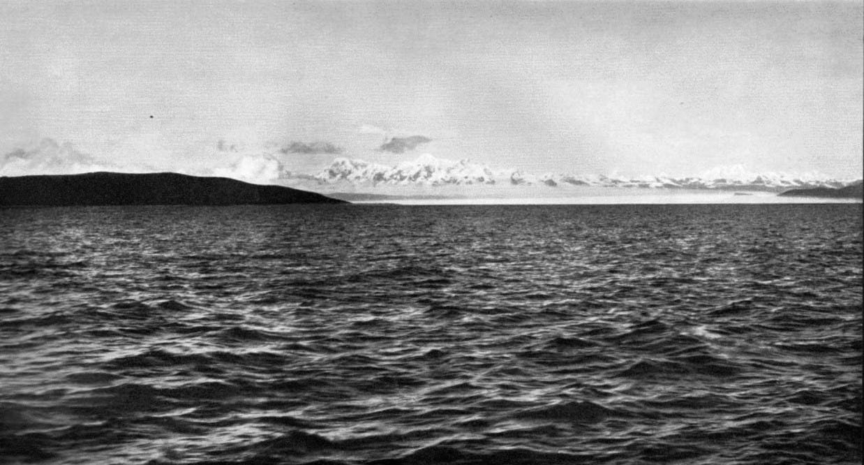
The drainage caused by barrier collapses and the sinking of the land, leading to the complete drying of the ocean-like waters in the highlands, was not total. Significant remnants of the former bodies of water remained, forming lakes such as Titicaca, Poopo, Coipasa, and Uyuni. The study of Bolivia's, Peru's, and northern Chile's landscape, as well as Figure 2, conveys this better than any map study, by showing where the water once stood.
Posnansky supports the claim that the rest of Lake Titicaca's water was "uplifted from the oceans during the Tertiary period" by noting that the lake's currently degenerated fauna has significant similarities to marine fauna, and some genuine marine species are still caught in the lake, which otherwise only live in tropical or subtropical waters. The presence of these marine species in the lakes does not necessarily suggest that the water masses were "uplifted from the oceans"; this will be explained in a later section.
Posnansky also says it is clear that the elevation of the Meseta's height made the water of the lakes colder. Consequently, the degenerated fauna of the lakes no longer had the same living conditions as before, which had warmth and sufficient food. The chemical composition of Lake Titicaca's water is almost identical to that of the oceans, despite the water's current degeneration over perhaps millions of years, while the water itself had been supplemented by significant snowmelt from the Andes glaciers and by rainfall, though these did not need to replace the significant water masses that flowed through the Desaguadero into Lake Poopo and mostly evaporated or seeped away there. The enormous salt deposits formed due to this evaporation and seepage are still visible today in the salt lakes of Coipasa, Uyuni, Askotan, and the Atacama Desert, and in the entire eastern fold of the Cordillera to the coast of Chile. All of them show the path the salty waters took or where they once stood.
The Altiplano, or rather those parts of the highlands that were not covered by water, essentially islands, had flora that has nothing in common with the flora of today, except for the degenerate remnants that still exist. One finds ferns with stunted growth, which now live on a soil and in a climate they are not suited to, instead of thriving in the proud splendor they once enjoyed. Posnansky says this clearly shows that in earlier times, the Altiplano, at an elevation of 4000 meters, must have had a warm climate, and lush plant life extended to the highest mountains and even overtook the Altiplano. The so-called terraced fields, which served agricultural purposes and are still found today, like those on Illimani, prove this. Some are located as high as 5500 meters, where the eternal ice begins, and they must have once been even higher. Where such terraced fields exist, built from rocks and broken stones to form retaining walls to prevent the topsoil from washing away, there must have been plant life. Agricultural products were once grown as high as 5500 meters above sea level, a place where plants can no longer grow today.
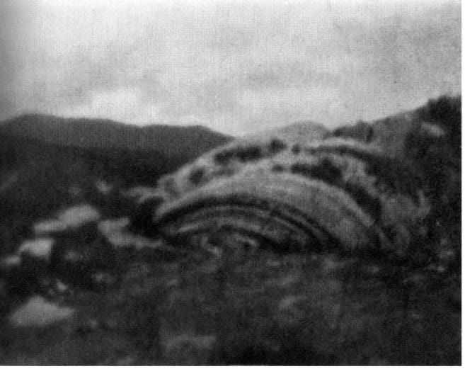
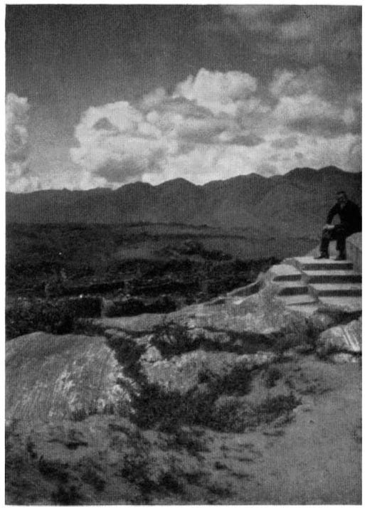
These terraced fields are found not only on Illimani but also across the entire highland and its surrounding mountains, from Cuzco in Peru and further south to Poopo. Posnansky also notes evidence of ice ages in the tropics of the Andes, drawing attention to the fact that such periods must have had an impact on the tropical regions near the highlands. On the Rodadero near Cuzco, for example, one can still find very beautiful remains of terraced rock formations, such as the famous rock terraces carved into the pre-Columbian fortress of Sacsahuaman (Figures 4 and 5). Posnansky therefore writes in his previously mentioned work, El clima del Altiplano, that the geological appearance of the Andean highlands and its Cordilleras clearly shows that one or more glacial periods occurred, covering the continent in ice and snow up to a height just below the modern city of Cuzco. As this city lies 3100 meters above sea level, it appears that a glacial period extended into areas of Cuzco that today have a warm climate, lying near the 14th southern parallel, with a warm climate up to about 3000 meters. This close coexistence of tropical and glacial traces at the same spot near the equator is puzzling, and not only Professor Posnansky has found this remarkable.
Nonetheless, it must have been the case that during these tropical glacial periods, there were regularly occurring ice ages, and it is more likely, according to Posnansky, that these cold periods were experienced by the prehistoric people of the area just as they enjoyed periods of warmer or even tropical climates.
If a large-scale movement in the Earth's crust can be ruled out, then Posnansky's theory of the alternating rise and fall of the continent during ice ages and warm periods becomes more likely. This theory explains the constantly alternating shifts between glaciation and tropical climate as a result of the rising and falling of the land during periods of significant volcanic activity. The geological evidence present in the Andes, which is unparalleled on Earth, provides convincing testimony.
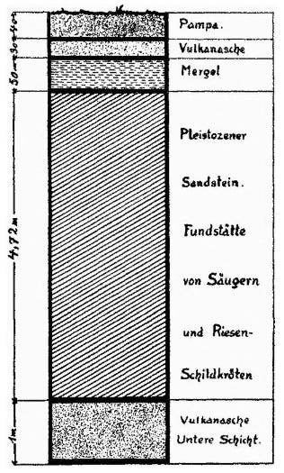
Extensive and powerful layers of alternating volcanic ash, ranging from 30 centimeters to about 600 meters in thickness, cover almost the entire Altiplano, including its upper valleys and steep walls from Alto La Paz to Tiahuanaku. Near La Paz, this ash layer (from the Toba Volcanica) reaches a thickness of about 6 meters. It sits directly above a layer of lignite of small thickness, creating the impression that the ash acted as a choking layer, preventing vegetation from growing. Above the ruins of the pre-Columbian city of Tiahuanaku lies an ash layer, suggesting that Posnansky's hypothesis, combined with a flood that destroyed the city, and major earthquakes and volcanic eruptions, is close to the truth. The stratification above and below the sediment of the “Toba Volcanica” is shown in Figure 3, based on Posnansky’s measurements at Ulloma by the Desaguadero. This evidence suggests that the Andean highlands experienced a warm climate, but according to Posnansky, there is also evidence that humans witnessed an ice-age climate.
Posnansky believes that traces of prehistoric humans have been found on the Altiplano. In 1914, in the first volume of his work “A Prehistoric Metropolis in South America”, on page 18, he expressed the following view:
"The most conclusive and irrefutable evidence, which can be presented on this matter, is that Lake Titicaca, due to its massive water loss, reveals ruins of hewn stone, which belong to a much earlier time than the second Tihuanaku period, and also to an even earlier period, the so-called first Tihuanaku era. I must therefore conclude that in the pre-Tihuanaku era, the extent of Lake Titicaca was significantly smaller than during the peak of the great metropolis."
Posnansky came to this conclusion through the discovery of prehistoric settlements in Lake Titicaca, near the Desaguadero (Pariti, Patapatani). In 1931, he made another discovery, this time on the island of Simiranke, in the Jakonta Palayani basin, one of the smaller basins of Lake Titicaca. Here, Posnansky found buildings whose walls were 3.25 meters thick. Regarding this, the researcher wrote in El Diario in La Paz on July 1, 1931:
"It is known that the Earth experienced several ice ages, during which vast lakes and meltwaters formed, and that Titicaca, once covering the Bolivian-Peruvian highlands, was such a glacial lake... Without a doubt, the Simiranke culture is incredibly old, as such a building must have been built before the ice age, when Lake Titicaca was not as large as it is today, and later stretched its waters over the entire Altiplano."
Posnansky thus speaks very clearly not only of periods of warmer climate but also of glacial periods or ice ages. According to him, the frequent raising and lowering of the continent in South America caused significant climate changes, and he emphasized the difficulties posed by repeated oscillatory movements of the continental crust. This not only complicated determining the exact age of Tihuanaku but also made it difficult to establish the time frame of the frequent climate changes. These oscillations, beginning with the leveling of the continent to sea level in the Tertiary, to the subsequent glaciation, occurred multiple times.
Despite these difficulties, it must be assumed that these repeated climate changes did indeed take place. However difficult it is to interpret, the geology of the Altiplano clearly points to this, and there is no doubt about the fact itself. The unlikelihood of the assumption of continental uplift and subsidence lies in the frequent repetition of these movements. And these difficulties increase if, as Posnansky reports, the continent repeatedly "tilted," that is, was tilted sideways, only to return to a horizontal position again. This must have occurred alongside simultaneous or subsequent uplifts and subsidence!
The credibility of such assumptions will only be fully understood when the origin of several overlapping ancient water basins is recognized, which will likely become clear in the future.
After this brief description of the Andean Meseta and its former climate, it must be noted that in the upper layers and in the surrounding highlands, geological signs of earlier lakes can be found, though their interpretation is not always straightforward, as the following details will show.
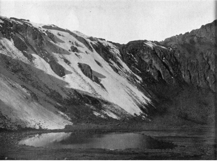
From north to south, the lakes Umayu, Titicaca, Poopo, Coipasa, Uyuni, Askotan, and Atacama lie in sequence. Their continuation forms the well-known salt and saltpeter deserts in Chile, which were once large lakes that have since dried up and seeped away. The total length of this lake chain, as the author knows well, is about the same as the length of the Meseta, approximately 1100-1200 km, while the width corresponds to the space between the two Cordilleras, which is about 200 km, with an expansion at Atacama and Askotan, corresponding to the highland plains, which are enclosed by the jagged volcanic and royal Cordilleras next to the Cordillera Crucera. Additionally, there are smaller lakes in higher elevations in some parts of the Andes, which store their water from melting snow and glaciers that cover the mountains. These are smaller freshwater lakes. Their elevation is often significant. Such lakes can be found at elevations of 5000 meters above sea level.
The average elevations of the major salt lakes of the highlands between the Andes, once again listed in order from north to south, were measured by Professor Arthur Posnansky in La Paz.
Umayu und Titikaka 3812 m
Poopo 3673 m
Coipasa 3667 m
Uyuni 3650 m(?).
The remaining salt lagoons, to my knowledge, have not yet been precisely surveyed—the information from Bolivian and Chilean maps is somewhat imprecise—but they seem to have approximately the same water level as Uyuni.
Lake Titicaca sends its excess water, which is not fed by springs and rivers, but by rainfall and meltwater from glaciers, to the Bolivian harbor town of Guaqui via the Desaguadero, the "drain," to Poopo, with a gradient of 139 meters over a distance of 400 kilometers (about 300 km in a straight line).
Lake Poopo drains into the salt flat of Coipasa and flows partially underground. It only has a gradient of 6 meters over a stretch of about 100 km from Poopo to Coipasa. The salt flat of Coipasa has no outlet, as far as I know. Its water seems to evaporate entirely, with the input coming from rainfall, ice melt, and the outflow from Poopo. Like Poopo, Coipasa suffers from a significant loss of water due to seepage. The same applies to Uyuni, Askotan, and Atacama, which, like the other salt and saltpeter fields, are dry most of the year.
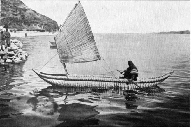
The climate in this entire region, except for the lower-lying saltpeter fields, is rough and cold, with frost below -2°C being common. This explains why so few Indians inhabit the highlands today, eking out a meager living from farming and even more so from fishing (Fig. 6).
On both sides of the mountain slopes of the Cordilleras, and on the highlands themselves and the rising hills—once islands—travelers can easily see, though blurred, natural water marks in the form of eroded rock beds from former shorelines, as the river deltas of ancient streams and rivers form fan-shaped deposits at the same elevation but flatten into gentle slopes. These shoreline marks are most frequently seen near both Cordilleras, less so when crossing the high plateau itself unless one encounters isolated hills, which also bear these marks.
The white limestone bands on the edge mountains of the Meseta are traces of algae containing lime. Such algae still grow in Lake Titicaca and Lake Poopo in many places. Posnansky identified algae that contain up to 80% lime, such as Elodeas, Mirphillium, Characea, Potamogeton, and others. The strong meter-thick deposits, which form the ancient lime shorelines, are largely explained by the growth of such or similar lime algae along the shores of the ancient lakes. Even on the Altiplano of Bolivia, travelers see these shorelines with great clarity. They stand out clearly along the shores of Lake Titicaca, for example, on the famous Island of the Sun, where the limestone band is particularly prominent.
The shoreline on the Island of the Sun is significantly higher than in Oruro at Pooposee because the water level of Lake Titicaca is 139 meters higher than that of Poopo. Thus, it appears that the limestone bands mark the borders of different lakes with varying water levels above sea level. Further, one finds such markings along the entire stretch between Guaqui and La Paz, along the entire course of the Desaguadero at Nazacara, Ulloma, Corocoro, La Joya, Rosapata, and in short, all along the 500-kilometer stretch between Titicaca and Poopo. It is enough to observe this as evidence that the mentioned salt lakes and lagoons, which today are distinct, were once a single, interconnected body of water during prehistoric times, with only occasional dry land as islands. At the very least, this suggests that there must have been many very large salt lakes from the highlands of Peru, Bolivia, and Chile.
The fact that the water levels of the present lakes were once significantly higher is proven by the water structures of a prehistoric city, namely, the city of Tihuanaku. The fact that such a metropolis, with its buildings and dimensions comparable to modern metropolises, could arise in the inhospitable and rough highlands of Bolivia can only be explained by the climate of the land during the Tihuanaku period being warm or at least temperate. The highland was densely populated during the time of Tihuanaku. Terraced fields extended from Cuzco in Peru to Oruro in Bolivia in a length of about 1200 km and a width of about 200 km, covering every mountain and hill in numerous side valleys and ravines, running up to the highest mountain peaks with net-like irrigation systems. These terraces were mostly built on significant mountain ranges in the Andes, and they were constructed to serve agricultural purposes. Considering that approximately 40 such terraced fields extended for a length of 1000 km from the Earth’s surface, one can measure the overall extent of human construction, far surpassing that of the terraces on the Island of the Sun. These terraced fields do not run in straight lines but wind through hundreds of valleys and ravines, curving around hundreds of mountains and hills, extending deep into both Cordilleras. All these terraced fields could have supported a population in the millions and evidently did in prehistoric times, specifically during the time of the Tihuanaku empire, whose cultural and social center was the famous city of the same name.
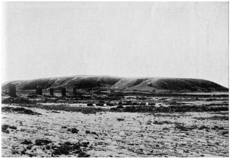
The city of Tihuanaku lies near the station of the same name, along the Guaqui-La Paz railway line, in an elongated valley flanked on both sides by low ridges. About 20 kilometers away, one can see the blue water surface of Lake Titicaca gleaming in clear view 50 kilometers away, with the snow-covered cone of the mighty, extinct volcano Kijjappia (Fig. 7). It was here that the stone buildings, constructed from andesite lava, were erected for the great buildings of the prehistoric metropolis of Tihuanaku.
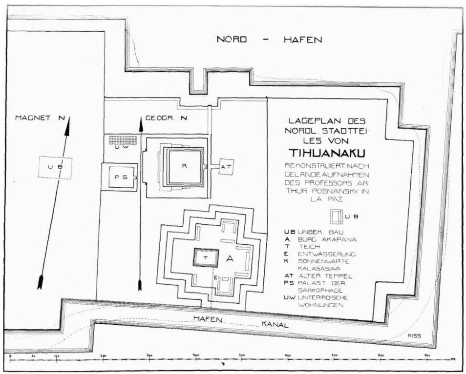
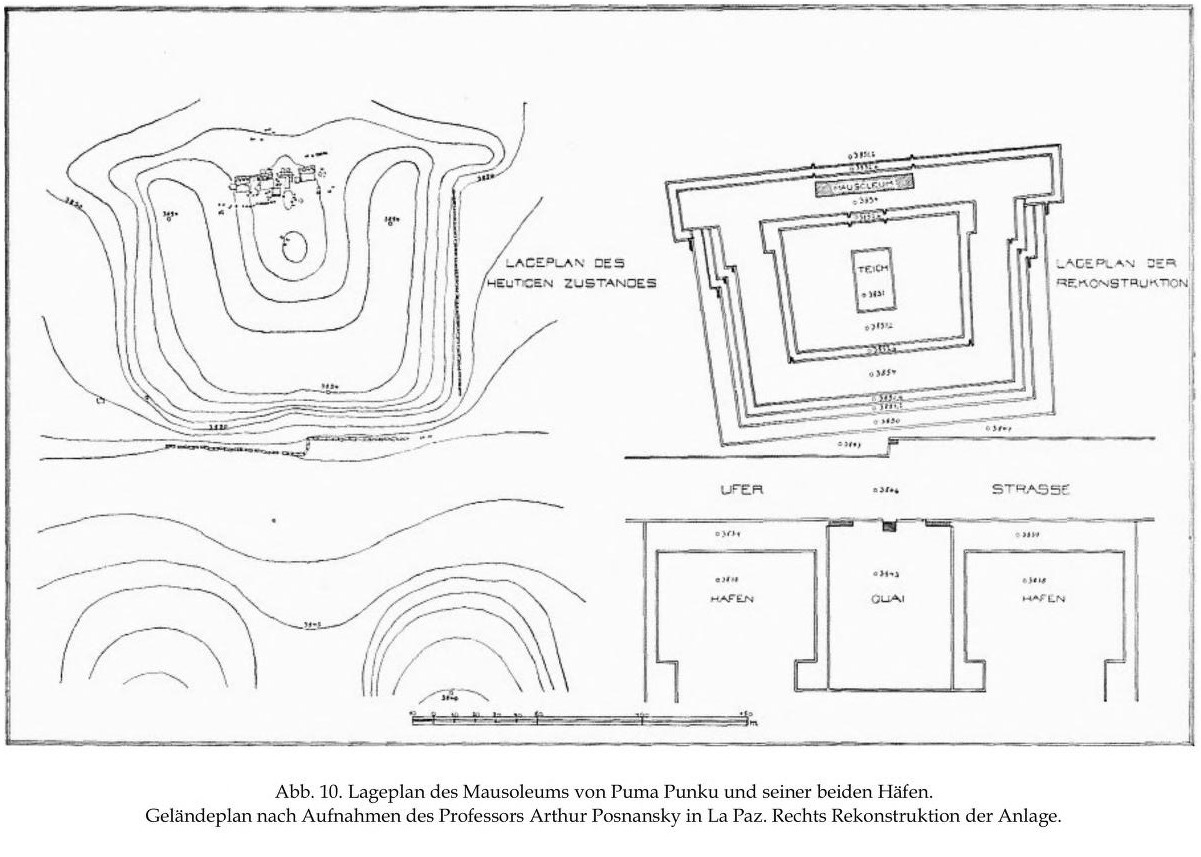
The Pampa of Tihuanaku lies 27 meters higher than the surface of Lake Titicaca. The old city—a sprawling and partially buried field of ruins—lies on dry land at an elevation of 3839 meters above sea level. Nevertheless, it still possesses, in part, five fairly well-preserved harbor basins, namely two north of the ruins of the solar observatory Kalasasaya (Fig. 9), two near the mausoleum structures of Puma Punku (Huma Punku – water gate! Fig. 10), and one in the small, modern town of Tihuanaku itself. The facilities at the northern harbor are the best preserved, as parts of the massive pier walls built from large stone blocks still exist. It is still recognizable today that there was a harbor basin directly north of the solar observatory Kalasasaya. There was also an entrance, allowing ships to dock. From the harbor, the terrain slopes down toward the present-day lake, and visual evidence shows that this area was submerged for a long time, and that the nature of the soil from the western part of Tihuanaku proves that it has completely dried out. The slope is now only 11 meters at the northern harbor, while at the western harbor of Puma Punku, it is 27 meters, indicating that the plain below Puma Punku is at the same elevation as the surface of Lake Titicaca. Remains of carefully crafted stone piers are found in the vicinity of the ruins in several places. A wide, artificially created harbor canal, containing the major structures of the metropolis, stretches through this area, including the fortress of Akapana, the solar observatory Kalasasaya, the so-called Old Temple, the Palace of Sarcophagi, the subterranean dwellings of the lords of Tihuanaku, and other buildings that have not yet been fully excavated and surveyed.
The character of the city of Tihuanaku as a harbor site of considerable size is thus proven, even if it stands high on dry land today, located about 20 kilometers from Lake Titicaca. However, as Professor Posnansky’s measurements in La Paz have shown, the aforementioned shoreline runs about one meter below the pier edges of the northern harbor of Tihuanaku, indicating further proof that the old city once stood on the larger Titicaca lake, and that the construction materials for these ancient buildings were, in distant times, transported from the surrounding islands and from the now-extinct volcano Kijjappia in huge blocks, some weighing over 100 tons.
Thus, the conclusive evidence is provided that the chain of lakes was once a vast, interconnected body of water, or at least separated into a few large lakes, and that the Andean metropolis Tihuanaku lay on an island of this lake or this inland sea chain. One does not need to imagine that the surface of Lake Titicaca was elevated by 27 meters; the waves would have lapped against the piers of the prehistoric city’s harbors during unreasonable periods.
However, where the evidence seems so irrefutable that doubt should not arise, the first difficulties emerge, which seemed to mock any solution until recently. If one were to raise the surface of Titicaca and extend it southward without considering the piers of Tihuanaku’s harbor, the newly formed lake extending southward would have its waters crashing into the harbor walls of the Andean metropolis, running uselessly into the empty air, spanning the Altiplano. A sea would thus emerge, draining southward and southwestward into the oceans immediately.
The case becomes even more hopeless if one imagines raising the surface of Lake Titicaca to the point where Tihuanaku once again becomes a harbor city. As already demonstrated, it would certainly have to be elevated by 27 meters. Then, the waters around this imagined lake would drain with tremendous force into the world’s oceans, and the lake's surface would sink back to where it stands today. The harbors would once again become unusable, and no amount of ocean enlargement would be enough to restore their former function.
One might come to think that the water of the oceans at some time stood high enough—perhaps in the Tertiary—to allow Tihuanaku's harbors to serve their purpose. But, as Professor Posnansky suggests, the continent must have been connected with the oceans since time immemorial and that the Andes rose alongside the South American landmass, which was uplifted from the oceans of the Earth.
There is no doubt about this. The chemical composition of the great lakes on the highlands is the same as the oceans, except that the salt content in Lake Titicaca has been significantly reduced over thousands of years by the addition of fresh rain and glacial water, making its waters brackish rather than salty. Poopo, however, is so salty that the fish fauna it receives from Titicaca via the Desaguadero can no longer reproduce and is gradually dying out. The remaining, more southerly lagoons are true salt lakes or entirely dry salt flats. These are indeed remnants of ancient ocean basins that now lie at high elevations (around 4000 meters).
But even if one were to admit that the oceans at some point rose high enough for Tihuanaku's harbors to serve their purpose, or conversely, that the South American continent was 4000 meters lower in elevation, the harbors would be functional again. However, if the ocean level were a meter below the northern harbor of Tihuanaku, the riddle would remain, as the shoreline bands would still not align. One would have to assume the entire continent tilted northward and rose in the south to refill the old sea basin. However, no matter how one imagines the surface of the modern lagoons to have either risen or fallen, the newly formed imagined water surface would never align with the actual shorelines. The horizontal projections of the newly raised or lowered surface would always cut across the meticulously planned shorelines at awkward angles. They never match. Here lay a great unknown until recently, one of the greatest mysteries of the highlands between the Andes, where the presence of these shorelines was known, but their exact path and the fact that they formed a contiguous line were not understood. It did not concern shorelines of different lakes with different water levels.
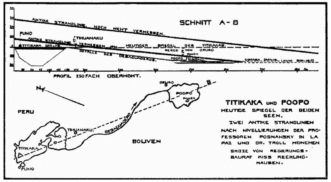
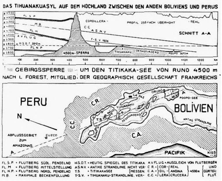
To eliminate other issues and bring proof that the observed shorelines marked the boundary of a single, massive enclosed lake with a single water level, Professor Arthur Posnansky undertook a research expedition from Titicaca to Poopo and Ullagas in November 1926, following the waterways of the Desaguadero. He precisely mapped the course of the shoreline using several instruments, including the leveling tool. The results of this survey, carried out over 40 days, were recorded by Hanns Hörbiger in Mauer, near Vienna, and by the author of this book with the permission of Professor Posnansky in three sketches, which are printed in Figures 8, 11, and 12.
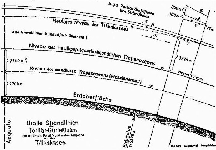
Gratitude must be expressed here to the selfless scholars in La Paz. To represent the position of the shoreline (as seen in Fig. 8, section A–B, lower slanted shoreline marked with Y) on paper, a 250-fold distortion of the elevation scale had to be applied. Only in this way was it possible to vividly illustrate that the mentioned shoreline was not horizontal but slanted, running downward from north to south. In the process, it does not lose its straight character; it is merely "tilted." This proves that the seemingly different shorelines of several lakes are, in fact, the boundary of a single interconnected water body, an inland sea that stretched across the entire highland between the Andes and only allowed a few islands to rise from the water wilderness, islands that are still recognizable today by the traces of former human settlement.
The surveyed shoreline begins in the department of Puno in Peru on the shores of Lake Titicaca and its islands, then runs straight southward, passes one meter below the pier edges of the northern harbors of Tihuanaku, and sinks gradually further until it intersects the extended mirror surface of Lake Titicaca, from which it follows the slope of the Desaguadero, albeit slightly more steeply, so that the former lake lay at the same "tilted" angle as today's Desaguadero. The difference is that the present-day Desaguadero lets its waters flow into the valley, which the lake of the past did not. From Poopo, Coipasa, and then Uyuni, the "tilted" shoreline coincides with the surfaces of these lagoons, so that the lake in these regions reached its end and was at most connected to larger lakes through a winding watercourse or a narrow passage.
The surveyed shoreline thus indeed runs slanted downward from north to south, and this fact has not been overlooked since November 1926, nor has the other fact that the Andean metropolis of Tihuanaku is situated on this tilted, southward-falling shoreline. The sloping shoreline clearly demarcates the boundary of a "tilted" lake from prehistoric times and not the boundary of various lakes with different water levels. Therefore, the old city on the Andes did not exist on a tilted lake; rather, something else must have occurred, as later events would show, that caused the water body to tilt slowly toward the south.
Of course, the experiment of trying to fill this lake basin with water again would also fail, with the attempt to make Tihuanaku's harbor facilities usable for navigation failing once more.
Nonetheless, large ships likely docked at the piers of Tihuanaku for thousands of years, unloading valuable and heavy cargo, and sailed away with the products of the city. Tihuanaku’s wealth was surely not due to its seafaring capabilities, for the Tihuanakans were not poor! This is proven all too clearly by the magnificent luxury buildings, which will be discussed further, monumental buildings that have nothing to do with practical structures, aside from perhaps the hill fortress of Akapana, which served to protect the city from enemies.
The water of the tilted lake, however, did drain away at some point, as it does today, which may have filled the ancient basin.
Professor Posnansky in La Paz, along with Neeb, Falb, Uhle, Stuebel, and Nestler—perhaps the best experts on the Altiplano—hold the view that the onset of an ice age in the tropics caused the continent of South America to tilt, with the melting ice masses in the north exerting pressure on the lands in the south, causing them to sink, while the north rose due to the ice load.
It is correct that tropical Tihuanaku was once buried under ice, just as it must have been under water for a long time. The Old Temple (Figs. 13 and 14) of Tihuanaku lies, according to Posnansky's view, below glacial sediments. That it was once completely submerged is not in doubt. The great platform of the solar observatory Kalasasaya in Tihuanaku is covered by a thin layer of lime deposited in the water, so firmly that a chisel must be used to scrape off a sample for analysis. This thin lime crust is very similar to the lime found at the shoreline of Lake Titicaca and suggests a far more massive layer at the Freitreppe of Kalasasaya. Posnansky therefore holds the view that the great Andes lake, the inland sea of Tihuanaku, was either gradually or suddenly tipped to the south, causing it to tilt. During this event, much of its water drained southward and southwestward. In the process, dams of higher-lying freshwater lakes broke due to earthquakes, releasing their water into the inland sea and causing a flood wave that destroyed Tihuanaku.
This assumption is likely and also corresponds to the observations, as the Andean metropolis was destroyed by a sudden event, likely a flood wave, and its construction was abruptly halted. The bones of humans and animals, including now-extinct species, lie in chaotic disarray for miles in the alluvial deposits of Tihuanaku. This bone sediment reaches a thickness of 3.5 meters at one accessible point for observation. This spot is located near the ruins of Tihuanaku. The railroad runs through a hollow path, and this path has a wall height of 3.5 meters, without the bone sediment being cut through. Under the tracks lies the same eerie sediment of white-gray lime, containing immeasurable amounts of larger and smaller bones, fragments of colorful and painted ceramics, jewelry, copper, bronze, and more. With what catastrophic suddenness the city’s construction was interrupted is demonstrated by the silver and copper mason’s plumbs found lying next to unfinished constructions, alongside piles of worked building blocks with nailhead carvings, which were likely to be placed in the following days but now lie in place to this day, never reaching their intended destination (Fig. 15).
One could be satisfied with Professor Posnansky’s interpretation, difficult though it is to believe in the tilting of a vast continent or a general rise or fall. Movements in which the shoreline of the prehistoric lake remained as straight as an arrow seem to suggest that the overall tilting of the landmass is in question here, not the vertical rise in the north and the sinking in the south. Such vertical movements of the shoreline, it would seem, must have received a jump or shift. The technical instinct rebels against this, as tiltings of continental masses on this scale would likely entail significant climate changes, which cannot be explained solely by such shifts, even when added to the other factors of uplift and subsidence.
A new question mark arises that has not been noticed before, because it is blurry and faint further up in the Cordillera, written on the walls of gneiss and granite.
A second shoreline lies above the first, which is marked in Figures 8 and 11 with a Y. The second shoreline, also marked in Figures 8 and 11 with a Z, runs obliquely from north to south. Its exact course is not yet known because it has not been surveyed; it lies higher than the first shoreline marked with a Y. At the edge of the uppermost shoreline Z there are several flat hills that one could imagine loading up with shovels. The Indians burn in the calm country from these shells a very coveted and well-paid lime mortar.
It is not known at what gradient the upper shoreline Z runs, since the south falls off a bit steeper than the one marked with a Y lower shoreline. To explain this second, upper shoreline with the means of current science does not help, even assuming a tilting of the continent has no effect, since the first shoreline Y had to rise once (Ice Age), then sink (warm climate of Tihuanaku), then tip (water flow), but then rise again (rough grassland) and finally set horizontally again (current state of the lakes). And this must have happened repeatedly in about the same sequence, since Posnansky recognized several Ice Ages and several climate periods.
The upper shoreline marked with a Z in Figures 8 and 11 now ends in voids in Argentina and Chile. It is also a shoreline that suddenly opens into the open air, as Professor Posnansky confidently assures. To fill this shoreline that opens into the air with water, one must allow the continent to sink down to the level of the ocean's surface and tilt it back into a horizontal position. To completely fill it, the landmass of South America must have been much lower, about 4300 meters lower, to allow these shorelines to fill, and it must have risen again until it reached today's elevation. It must also have simultaneously tilted by a certain angle to the south. These movements, both positive and rotational, occur along with the lower Y-marked shoreline and the mentioned climate fluctuations between Figures 8 and 11, making it somewhat difficult to mentally follow all these movements. In terms of an inner sea, the upper Z-marked shoreline cannot be acting since it now exists whether horizontal or not. The presence of a gap in the path of the upper shoreline, namely on the Pacific coast and in the Argentinean Cordillera, excludes the possibility of the existence of a once horizontal and now closed inner sea, because it must have been closed at one time not to immediately drain out.
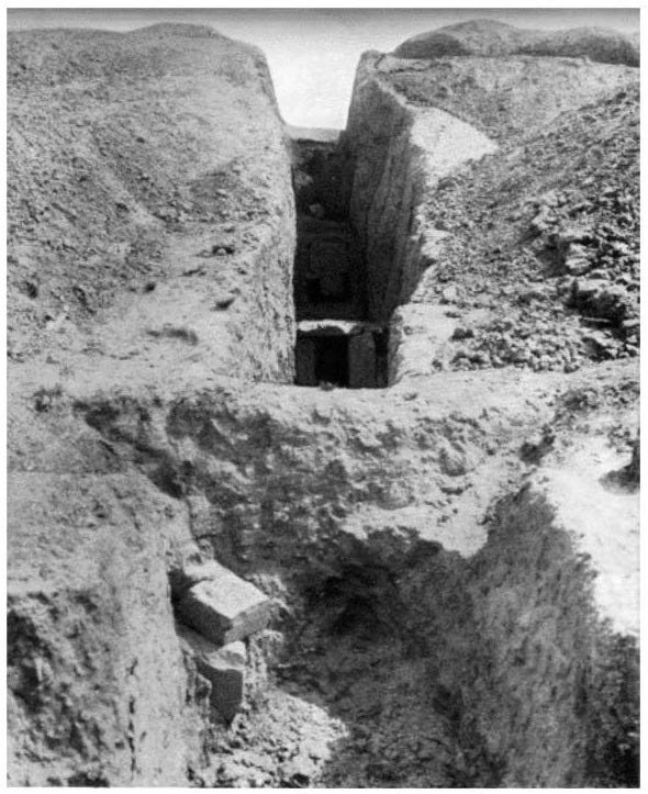
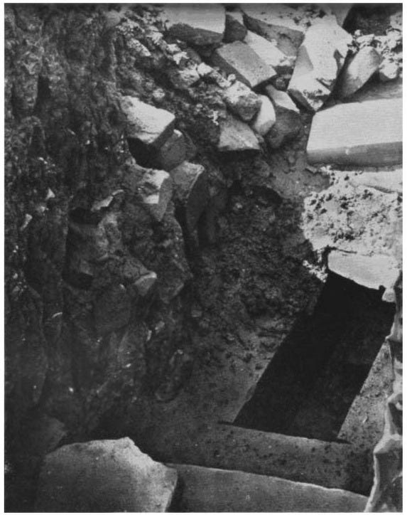
Here, the assumption of the uplift, tilting, sinking, and reorientation of the South American continent loses credibility due to frequent recurrences, because to fill this highest shoreline Z, the continent would have to sink right down to sea level. Otherwise, the gap is inconceivable, or the water would have to rise about 4300 meters! Also, the repeated climate changes of the Andean highlands require a repeated rising and sinking of the land from 0-4000 meters and in between. All this seems unbelievable because of the repeated protruding tilting and reorientations and the multiple movements in the sinking rights in both positive and negative senses.
The overall picture of the geology of the Andean highlands is so complex and almost enigmatic that it is ultimately reassuring to know at least one fact precisely, namely that the old metropolis Tiwanaku was connected to the "slanted" lake of the lower Y-marked shoreline, which also determines the age of this venerable ruins site. Therefore, it should be briefly mentioned that there is yet another third shoreline (marked as X in Figure 11) not on the highlands between the Andes, but it clearly belongs to the other two seen on the Bolivian Altiplano. This third shoreline marker lies on the slopes of the Pacific Cordillera on the seaward side, and it lies about 600 meters lower than the Y-marked, now middle shoreline. The presence of this lowest X-shoreline makes the picture even more confusing, as it also extends the aforementioned repeated rising and falling of the continent, which, seen in a time-lapse, now appears to be fluctuating and stamping on a magmatic base like a ship on high seas, rising and falling.
Since no new theory about the origin of the slanted shorelines on the highlands of the Andes has been published since 1926 AD, the previous assumptions about the repeated uplifts and sinkings of the continent, as well as its repeated tilting to the south and reorientations, along with alternating climate periods, varying from almost tropical to cold climate in several recurrences, form the sketchy strokes of the picture one makes today about the genesis of the Andes.
In any case, the Andean metropolis with its well-known and famous Sun Gate of Tiwanaku and the Y shoreline, the ancient lake, and the port of Tiwanaku are inextricably linked and inseparable. This fact, which cannot be emphasized sharply enough, should capture the reader's kind attention in the further discussions of this book. For the inseparable association of the prehistoric city of Tiwanaku, its buildings, its Sun Gate with the sloping lake of the same name, is the core piece for closely connected reasoning or at least for the attempt of such. Specifically, the tentative dating of the slanted shoreline will provide evidence for the era of creation of a particular part of the old city, namely the Sun Gate of Tiwanaku, as on the other hand, the Sun Gate will provide evidence for the timing of the old city and the formation of the slanted shoreline designated as Y in Fig. 11.
Both attempts at mutual proof should not be led on the basis of contemporary theories but should be based on a theory posited by Hanns Hörbiger in Mauer near Vienna, namely the theory of the World Ice. The reader is therefore invited to patiently collaborate on this working hypothesis, whose provisional evaluation must be allowed. The simultaneity in the creation of both, namely the ancient city with its port facilities and the Sun Gate with its hieroglyphs next to the sloping lake, should serve each other as mutual supports on the basis of the World Ice doctrine, suggesting that progress in understanding may be achieved on this much-challenged foundation than was previously possible.
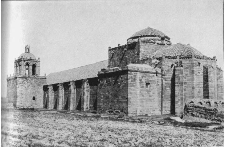
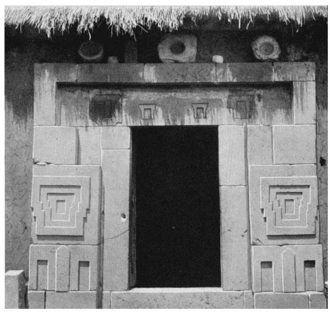
Since the buildings of the ancient metropolis themselves display a cultural height that is astonishing given the city's ancient age, the following briefly discusses these buildings to convey an impression of the culture and civilization of a city whose centerpiece still today is the famous Sun Gate of Tiwanaku with its mysterious inscription.
In the illustrations and drawings, along with plans of ruins, reconstruction attempts are predominantly shown because much has already been published about the ruins of the prehistoric city of Tiwanaku, but to my knowledge, reconstruction attempts have not yet been made.
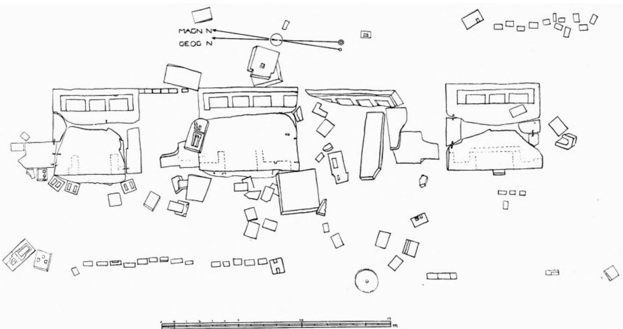
Figure 9 shows the layout plan of the core city of Tiwanaku, drawn by the author based on his own local measurements and those of Professor Posnansky. Other extensive city parts, such as the significant necropolis and burial complex of Puma Punku in the southwest of the core city, are not represented in drawing 9, because accurate comprehensive surveys of Tiwanaku are not yet available, only exceptions of individual buildings, which will subsequently be presented as plans of ruins, photographs, reconstruction attempts, and diagrams.
The structure marked as A on the layout plan (Fig. 9) represents the Akapana Fortress in its blueprint, a stepped construction in three tiers with quite sizable dimensions. The dimensions of the fortress are approximately 200 by 200 meters. The supporting walls have largely collapsed or have been buried, so the stepped structure is only vaguely indicated now. However, Figure 16 shows the stair-shaped formation of the blueprint very clearly in the shading. On the east side of the fortress, the supporting wall of the ancient fortress was excavated by Posnansky. It is likely that more extensive parts of the supporting walls are still hidden under the rubble. Given the vast size of the complex, continuing the excavations will be challenging, especially due to the high costs.
On the upper platform of the fortress, there once stood several buildings, but only parts of their foundations are preserved. In the middle of the platform was an artificial pond or lake, which no longer exists because in the 16th century, a Spanish soldier and gold digger excavated the entire platform searching for gold. This likely destroyed not only the remains of the lake but also the main remnants of the buildings, barracks, warehouses, etc. The large depression now present in the middle of the upper platform is therefore not that of the pond, but the pit dug by the Spanish treasure hunter. The original elevation of the pond is, however, well-known since the start of a drainage channel that opens out on the Akapana plateau is almost completely preserved. This channel, running through the three tiered terraces into the moat and harbor canal, likely served to drain the artificial pond swollen by rainfalls. Posnansky refers to this conduit as the "Cloaca maxima" due to its size. It is constructed from heavy masonry slabs and andesite blocks and has remained almost completely intact due to its durable construction. The conduit was accessible. Figures 17 and 18 show the current state during excavation. To prevent theft of the valuable stones, the conduit was buried again after photographic documentation was taken.
The ruins of Tiwanaku continue to offer a bewildering abundance of individual buildings, whose purposes are dubious and likely to remain so, because too much of their substance has disappeared over the millennia and been incorporated into other constructions of a more modern type. Not only are several state buildings and churches in Bolivia's capital, La Paz, such as the large cathedral at the city's plaza, partly constructed from this conveniently pre-worked masonry material of the prehistoric Andean metropolis, but nearly all churches and larger buildings within a wide radius of Tiwanaku contain essential parts of the massive quarry that once was a mighty city.
The church of the present rural town of Tiwanaku (Fig. 19) is entirely composed of the stonework from the nearby ruins of Akapana and Kalasasaya. In front of the church's surrounding plaza lies an open colonnade, whose perforated outer wall is supported by 24 capitals. More such capitals have been used as decorations in the manor houses of the surrounding fincas, providing shade in the passageways that offer pleasant coolness under the burning subtropical sun during the day. Also, the abundantly available sculptures of both figurative and ornamental types are largely no longer found in the ruins of Tiwanaku but have also been used to decorate manor houses. Even a native farmer near Tiwanaku, who calls himself Cazika and occupies the so-called Casa del Inka, has assembled the entrance door of his otherwise modest dwelling from sculpted stones with undeniable taste (Fig. 20). He was able to easily gather these stones from the nearby area. In this way, the door of the Christian Indian bears the pagan ornaments of a bygone era. Contrary to other locals residing in the modern town of Tiwanaku, who have also retrieved similar ornamental stones from the ruins, he refused to chisel out the unchristian ornaments and replace them with Christian ones as the local priest had demanded. The astute Indio of the Casa del Inka proudly shows rare visitors to his home how he has arranged his place in the style of his "ancestors." That his mules eat from a beautifully carved trough with engraved stair figures and large spiral bands bothers him as little as it does his riding animals.
As one walks through the streets of the town, it is surprising to see that they are paved with large and small slabs of multicolored stonework, for such luxury is only usual in the capital of Bolivia. But when one's foot suddenly steps on a half-worn niche stone, it immediately becomes clear where all this wealth comes from. The ruins are so close! The foundations of the houses, the portals, and sometimes even the window surrounds are taken from the great, marvelous quarry, and chickens and pigs feed from water channels that are sealed with mud at both ends. These stones, naturally, also come from the ruins.
As one walks to the railway track that runs near the town and observes the numerous bridges spanning streams that swell into rivers during the rainy season, one recognizes the color and structure of the building material from the old metropolis. And when a part of a valuable high relief has been incorporated, any ornaments protruding too far have been orderly chiseled off. Considering the gravel material used to underlay the rail tracks, which was also taken from the ruins, one can grasp how European civilization has sinned against prehistoric culture.
In the finca of a high-ranking Bolivian official, the majordomo has at least recognized the purpose of the stone channels that fill the ruins in abundance and has constructed a proper and very pretty courtyard drainage system from them.
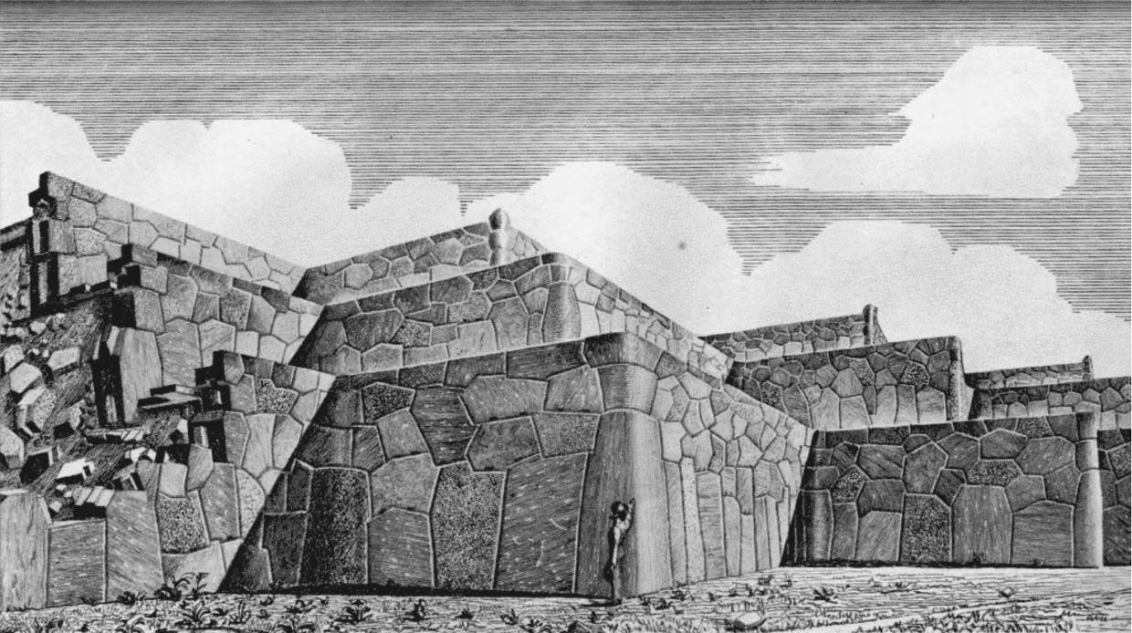
It's a miracle that any stone remains in Tiwanaku at all, and if the remaining blocks weren't so heavy that they passively resist removal, and if they weren't so sturdy that they withstand the pistol shooting practices of foreign tourists, and even attempts to blast them with powder and dynamite have not always been successful, surely nothing would be left. Undoubtedly, the ruins have been plundered for millennia by the many peoples and their rulers who have played their part on the Meseta between the Andes, starting with the Incas and going back to the peoples from the darkness of prehistoric times when the Quechuas built their enigmatic giant walls (Fig. 21). Yet, what had been done in terms of plundering was nothing compared to what advancing Christianity of the Conquest has accomplished in this regard. Spanish chroniclers from the first decades of the conquest still spoke of towering walls they found in Tiwanaku. Today, they are no longer there but are incorporated into the numerous Christian churches scattered across the country.
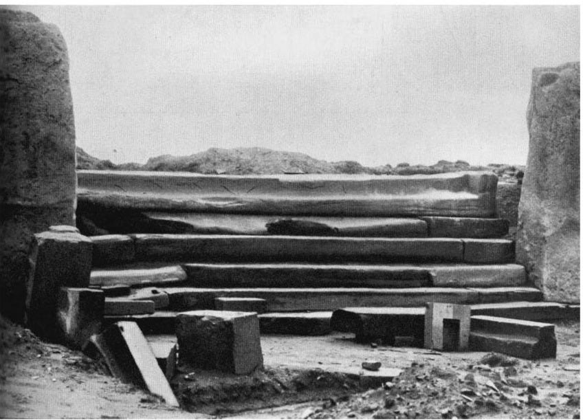
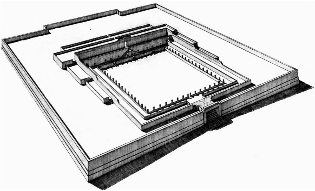
The Kalasasaya, the spacious solar observatory of prehistoric astronomers, has also been mutilated, but its remains, with their impressive dimensions of 135 x 118 m, are still large enough to give an idea of what it may have looked like in the past (Fig. 22, 23, 24, 25, 26, 27, 28, 29, 30, 31, 32, 33, 34, 35 and 36). The Kalasasaya is not the largest complex in the Andean metropolis (Fig. 9 marked K), the Akapana castle is considerably larger, as is the stepped structure of the Puma Punku mausoleum, which will be discussed later, but the solar observatory with the famous Sun Gate of Tihuanaku seems to have been one of the most important complexes in the old city. Since the purpose of the Kalasasaya is now sufficiently clear, an attempt at reconstruction could be made, even if the complex at Puma Punku, for example, presented fewer difficulties from a purely architectural point of view. The Kalasasaya has been plundered except for the heavy, giant pillars of its surrounding walls (Fig. 22), the east portal with its monumental open staircase (Fig. 23 and 24) and a few stones inside the complex and those that are still lying under the shrouds. If a valuable floor is uncovered with a spade inside the building today, one can be sure that the slabs will have been stolen the next morning to be used for some courtyard paving in the modern town of Tihuanaku.
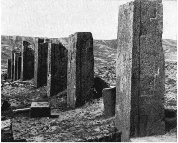
The fact that the stone robbers could not remove the heavier pieces is very significant in one respect, as they had to leave the most important pillars in their places. For the reconstruction of the building, the great age, which Posnansky estimates to be about 13,000 years, is significant only insofar as one must be careful not to approach the task with a modern construction sensibility. The mindset of the prehistoric builders was so alien to our thinking that it is quite difficult to put oneself in the spirit of that distant time.
The floor plan of the Kalasasaya complex is essentially preserved and so clear that it is accurate to the centimeter. The situation is different with the structure, for which there are fewer clues. Fortunately, the preserved Sun Gate shows on one side the famous frieze adorned with bullet scars from discerning tourists, which must be discussed in depth in the last section of this book due to its high significance, and on the other side, a series of large and small niches stacked upon one another. Since a displaced gate stands both at the nearby cemetery and near the Akapana, each continuing the figurative frieze above the lintel, it suggests that all three portals were set in one wall, over which the mentioned frieze extended like a long decorative band. On the other side of the wall, the niches must have been arranged in a rhythmic sequence. Moreover, a well-preserved monolithic facade model made of andesite lava lies near the solar observatory, so the design of the "Sun Wall" can no longer be in doubt. The Sun Gate stood in the middle of the wall on the still-preserved foundation, and from this spot, observations of the rising and setting sun likely took place (Fig. 24).
The contour lines that Posnansky has surveyed (Fig. 24) clearly show that the Sun Gate and the Sun Wall must have stood on the highest elevation within the building's interior. This was also necessary for the purpose of observation.
The interior layout was built in the usual terraced form. Around the lowest terrace, there probably was a colonnade with the capitals that are now embedded in the ambulatory of the Christian church in Tiwanaku, especially since some of these capitals still lie around inside the Kalasasaya today (Fig. 37). Since they do not carry dowel holes on their upper edges, it is reasonable to assume that they were covered with wood, if at all, and that the walkway behind the columned hall had a canvas covering to protect from the sun's rays. The innermost area, surrounded by columns, which Posnansky calls the sanctum sanctorum, may have been a body of water, similar to the artificial pond on the Akapana plateau mentioned earlier. Within the complex, numerous stone channels still lie today, and those that have been carried away must have been even more numerous, as they are seen everywhere in the yards of the Indians and estate owners in various uses. Since these channel stones had a purpose, it is suspected that they were used as inlets and outlets for water from the interior of the Kalasasaya. A carved floor plan of about 2 by 3 meters in size made of andesite lava, located east of the building in the so-called model workshop, shows this inner space with several access staircases.
The aforementioned model has also made it possible to document the reconstruction of the eastern main portal with its wide staircase on paper (Fig. 39), as it clearly shows the expansion of space behind the portal and the staircases leading right and left to the ambulatories. Additionally, the places on the existing floor plan of the East portal where walls have stood show clear elevations above the surface of the otherwise more weathered stone.
The reconstruction of the floor plan of the interior in the typical niche form of that time is a requirement of the spirit of the prehistoric Tihuanaku epoch, but also a requirement of the contour lines (Fig. 24), which indicate this form in a blurred manner. One would probably find considerable remains of these terraces under the rubble.
The floor of the large complex was probably covered with slabs. Strangely enough, a remnant is still present in front of the eastern main portal. However, if the current population needs building materials, even this last remnant will disappear, as the slabs are not particularly heavy.
The reconstruction of the Kalasasaya solar observatory gives an approximate picture of a monumental building and thus of the art and culture of a great people, because it is a building that can compete with the best buildings of modern times in terms of artistic taste and the grandeur of its architectural spirit. Figures 24-36 illustrate this perhaps better than words can describe.


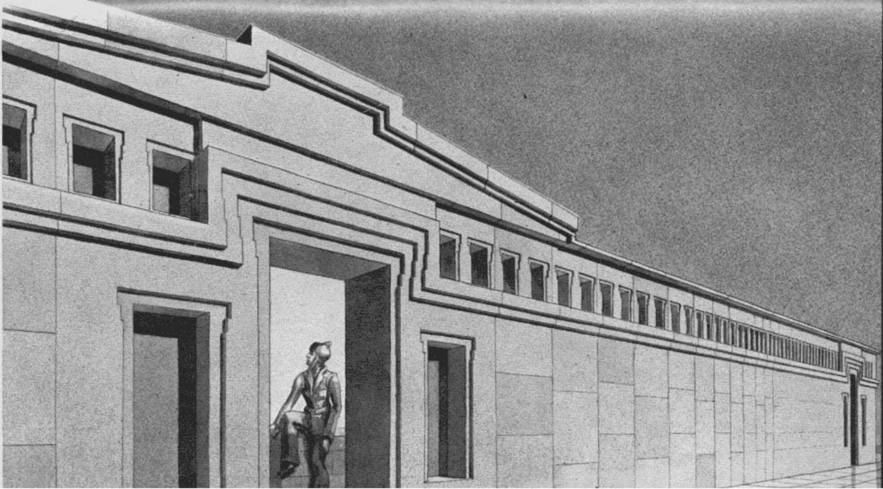
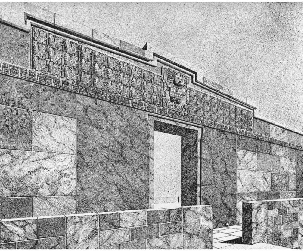
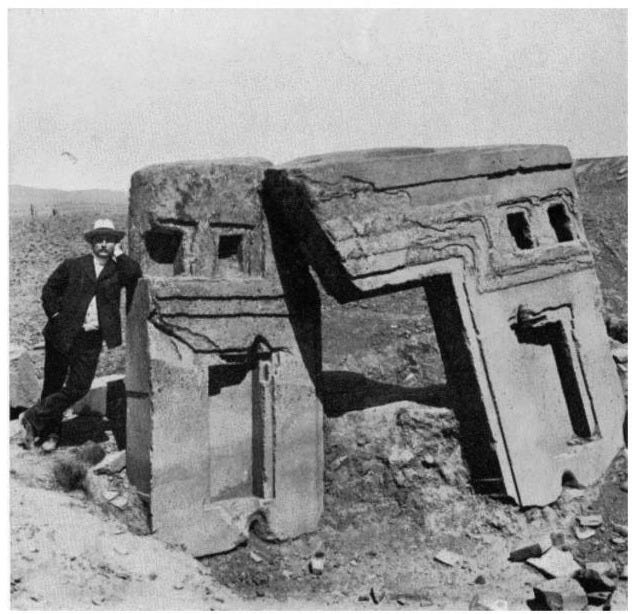
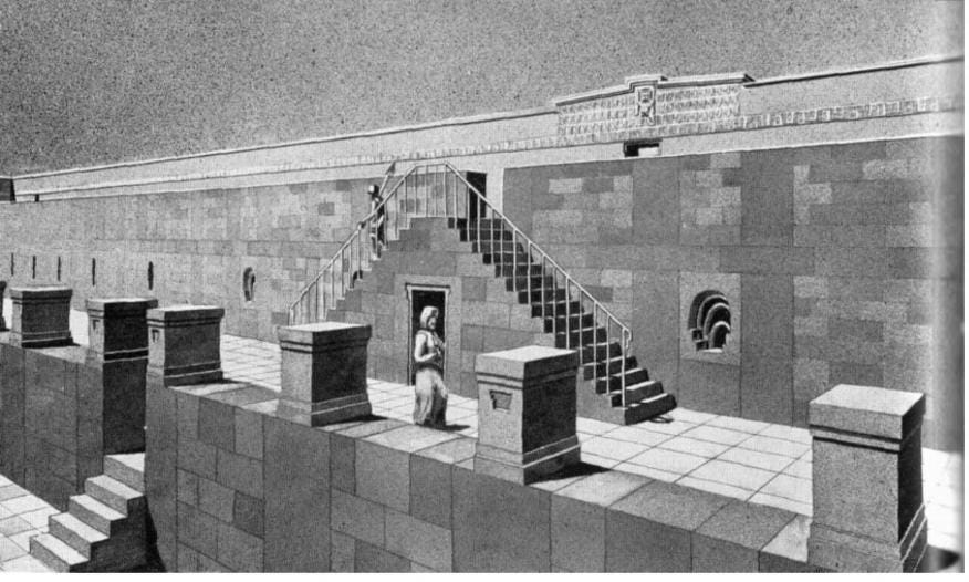
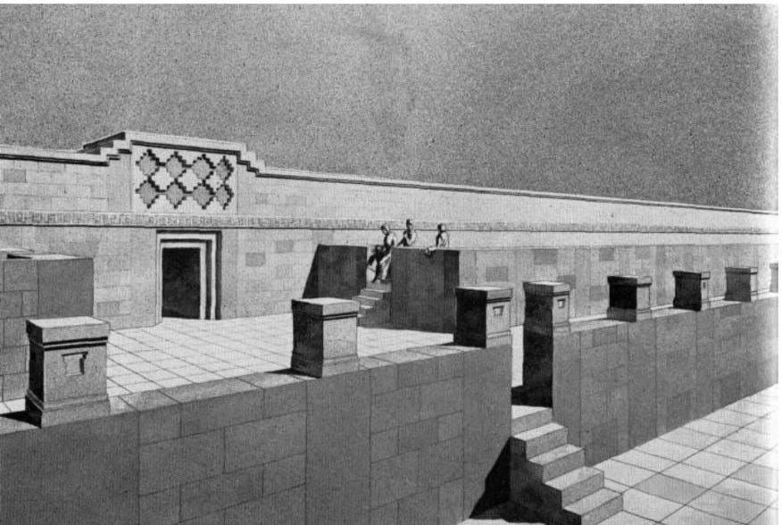
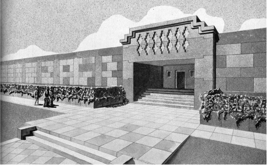
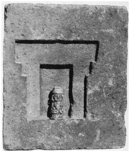
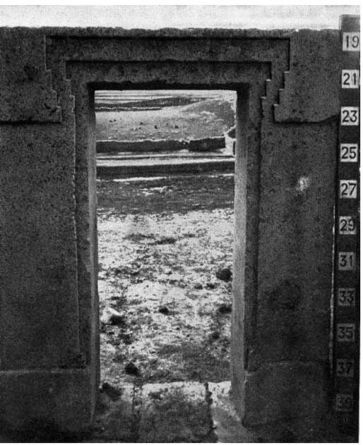
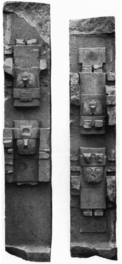
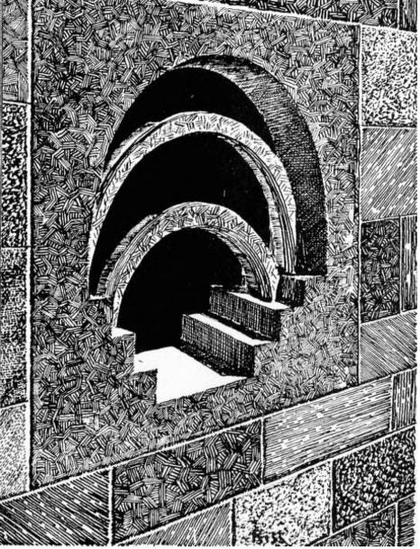
Details of the architecture are shown in Figs. 38, 40 and 41. The drawing in Fig. 42 shows how the artists of Tihuanaku created their tracery windows. The only window of this type found in the ruins is in the National Museum in La Paz. The window closure appears to have been made of a type of glass, for in the dome of the modern church of Tihuanaku such translucent plates - perhaps alabaster - were used as window closures and have been preserved in this way.
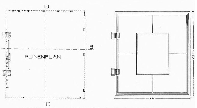
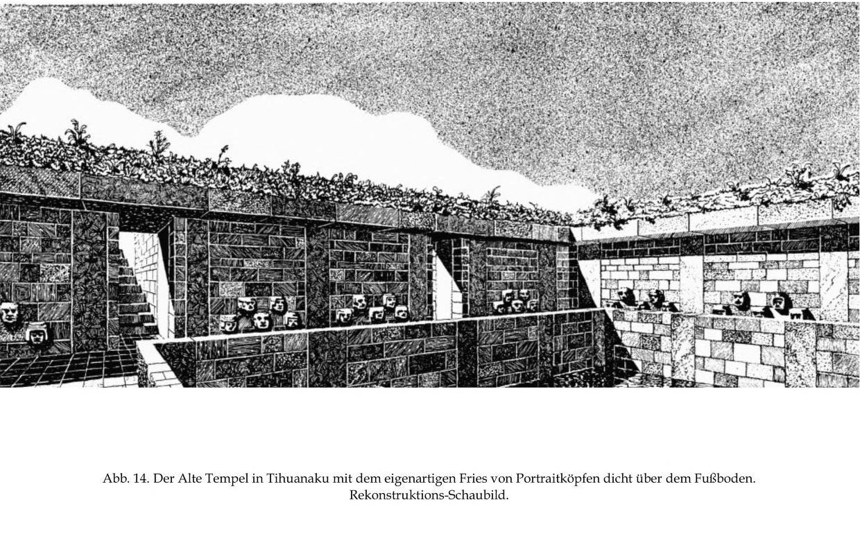
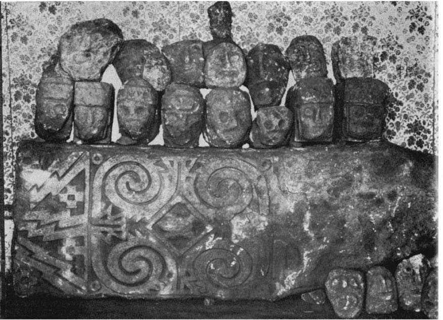
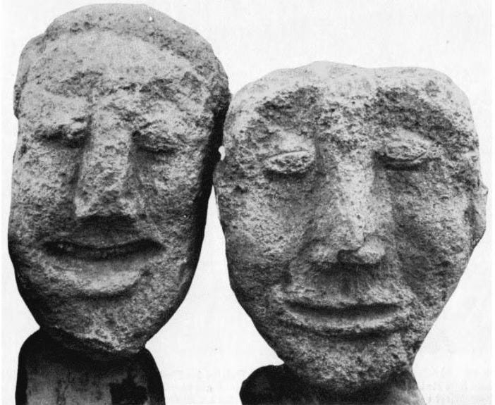
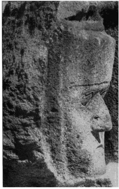
The so-called Old Temple, which has already been mentioned above in connection with the climate of the Meseta, appears to be one of the oldest buildings in Tihuanacu. On the site plan in Fig. 9 it is marked AT. It is built into the earth, so it never stood freely on the ground, since the outer sides of the surrounding walls are in the crudest form and protrude into the earth at different levels. The inner surface of the walls, on the other hand, was flush and bore two rows of stone portrait heads, one above the other, 30 cm above the partially still existing slab floor (Fig. 14 and 43). Even if you were very small, you had to lie down on the ground to look at the stone heads. In the author's opinion, the stone heads are an ancestral gallery. The faces of the stone images are completely different. It was evidently the intention to create portraits. They do look quite archaic (Fig. 44). Portrait heads of a later and quite different period of art, on the other hand, were downright masterly in conception and execution, as shown by the unfinished portrait of a clergyman or scholar (Fig. 45) excavated by Posnansky in the interior of the Kalasasya. This perfectly beautiful portrait of a man evidently of Nordic race is one of the frequent examples of the fact that the construction of Tihuanaku was probably suddenly interrupted in its last and most mature period, as Posnansky says, by a cataclysm that swept away the metropolis of the Andes in the midst of its heyday.
The Old Temple is only preserved in scant remnants. The filled-in interior seems to contain deposits from an ice age, as certain layerings of gravel and mud suggest that the temple was situated in a cold climate for an extended period. The exterior walls are barely maintained up to a height of 1.50 meters. The reconstruction loosely follows the findings made (Fig. 14). However, the stairway accesses have not been found. This suggests that much about the original structure and its uses remains speculative, pieced together from the limited evidence that has survived the harsh environmental and human impacts over millennia.
North of the Kalasasaya lies the North Port, depicted in a reconstructed state on the layout plan Figure 9. The breakwater walls of the small harbor basin just north of the Kalasasaya solar observatory are still partially intact.
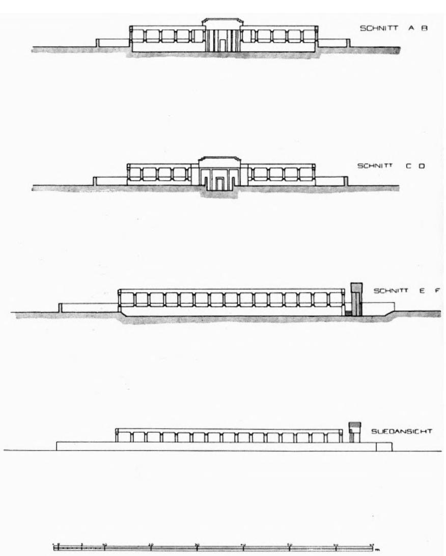
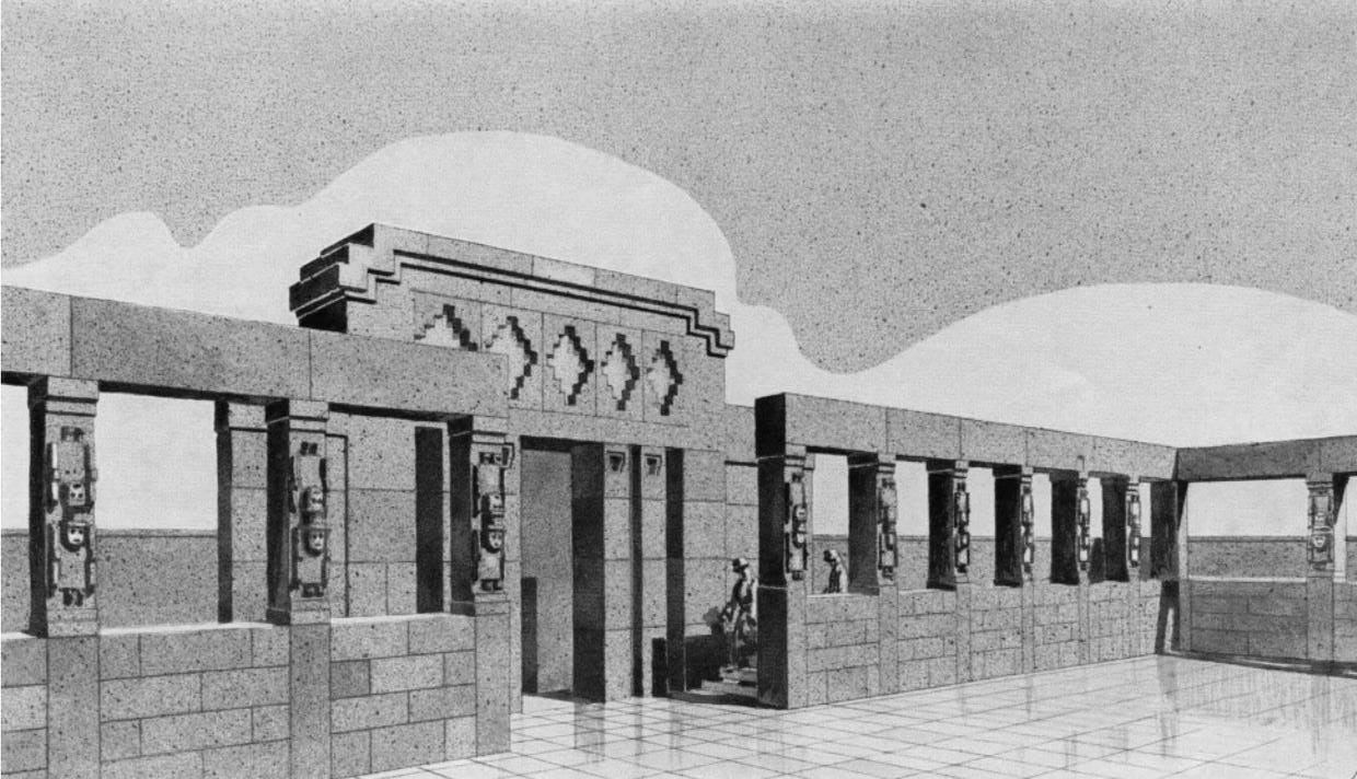
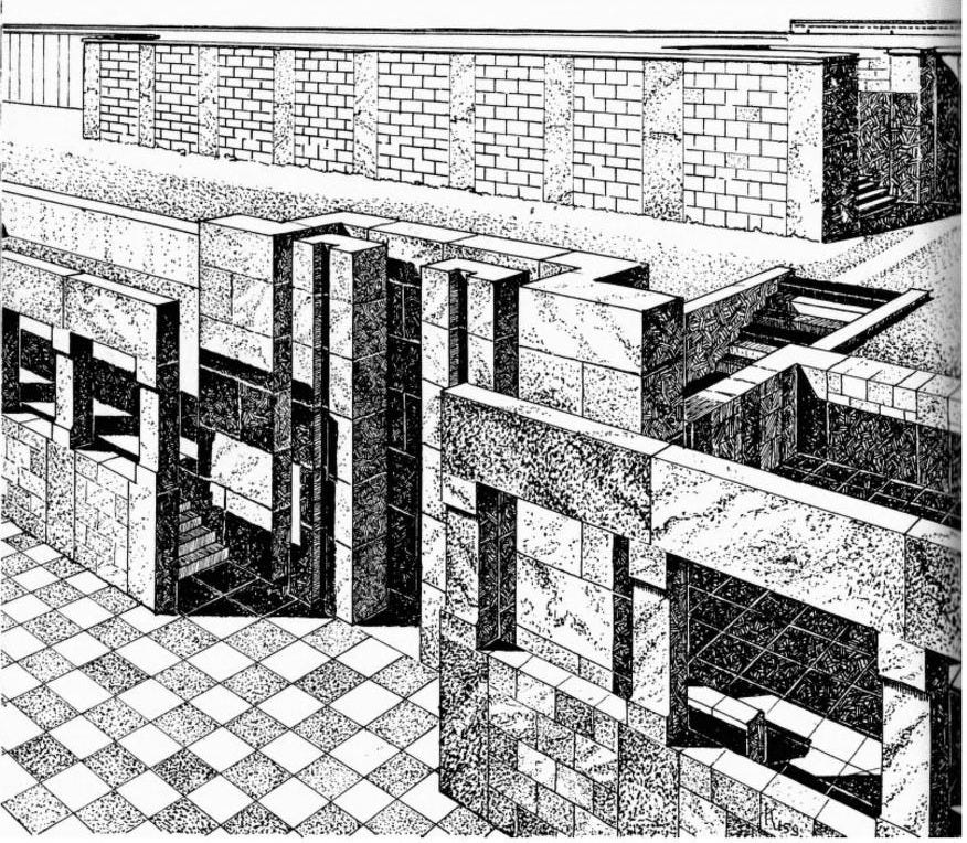
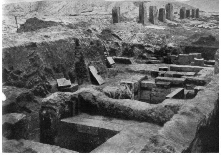
To the west of the Kalasasaya is another structure, known as the "Palace of the Sarcophagi," a name derived arbitrarily from the initially inexplicable layout of the portal building. The purpose of the structure is unknown, and its remains are either minor or have not yet been excavated. Nevertheless, the entrance has been determined with sufficient accuracy for reconstruction. Figures 46 and 47 show the current state in photographs, and Figures 48, 49, 50, 51, and 52 in the reconstruction. From Figures 46 and 52, one can see the staircase that led down to this building. It was composed of black, white, and red stones and must have been very striking in effect.
To the north of this palace of sarcophagi lie the "Baths of the Incas," as they are popularly known. These are not baths, however, but underground dwellings (Fig. 53). It is hardly conceivable that this highly cultured people, who built buildings of the size and monumentality described above, lived in underground dwellings. But the buildings of Tihuanacu date from several construction periods, perhaps four or more, so that it is hardly conceivable that the underground dwellings and the monumental buildings were built at the same time. Nevertheless, the design of some of these dwellings indicates a high level of skill in stonework. These dwellings were not built underground because of poverty! Some of them are so expensive and made of such finely worked material that an above-ground dwelling with many large rooms made of lesser building material could easily have been built in their place. The deeper reason for living in this way will be mentioned as probable in the following section of this book. In any case, there can hardly have been any climatic reasons for living in such modest conditions, such as extreme heat or the desire to sleep cool at least at night, since one would assume that such an ingenious people would have found other ways to live in cool conditions if they had wanted to.
The fact that there were closed, above-ground living quarters in Tihuanaku at some time in its construction is proven by the window already discussed (Fig. 42) and the window shutters made of a glassy, translucent mass preserved in the church of Tihuanaku. The underground dwellings are not only found near the Kalasasaya, but also in other places in the ruins, and especially in the modern town of Tihuanaku itself, where these underground structures are now used as cellars by the Indian inhabitants. The careful treatment of these underground dwellings described above is not the same in all of them. There are also dwellings with roughly hewn slabs. All of these dwellings are very narrow and consist of only one room, which was probably used for sleeping, but certainly for cooking. The dimensions of such a one-room dwelling are 1.20 x 1.40 m and are not even big enough to stretch out for sleeping. A person of any size could not stand in the one-room apartment, as the height is almost only 1.40 m. Cooking in the apartment was done on a miniature stove that stood in a corner. Above it was a circular hole in the ceiling to vent the smoke. In the attached illustration (Fig. 54) you can see the circular hole, which appears as a small oval in perspective, just below the upper edge of the picture. In one corner a steep staircase led to the upper world. In stark contrast to the small dimensions of the apartments and the ridiculously small ovoid floors that no Elaus woman would tolerate today, is the careful construction of the underground structure. Its walls and the slab floor consist of polished, precisely fitted stone slabs, the joints of which are pressed together so tightly that even today not a drop of moisture can penetrate into the underground chamber. Some of the pieces have double grooves and springs at the joints to give the structure even greater elasticity. The low ceiling consists of thick, polished stone slabs made of the same material as the floor and walls (Fig. 53 and 54).
The above-ground residential buildings from the Tiwanaku era that are still extant are only found in Sillustani, on a peninsula of Lake Umayo, 20 km north of Lake Titicaca. These "residential towers" demonstrate a remarkable level of culture, as it requires a well-trained stonemason to construct such a dwelling tower with a main cornice and a rounded ceiling slab so carefully that even today, one can try in vain to fit a pocketknife between the joints. The stone towers of Sillustani are earthquake-resistant and have withstood all ground tremors to this day, as the massive basalt lava blocks are joined together with strong grooves and tongues. The attached Figure 55 does not show a collapsed structure, but an unfinished one, whose completion was prevented by some event.
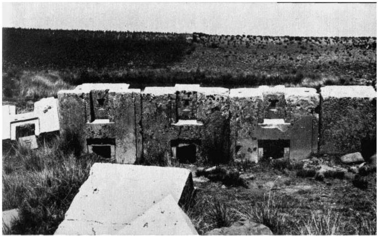
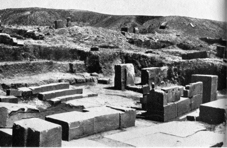
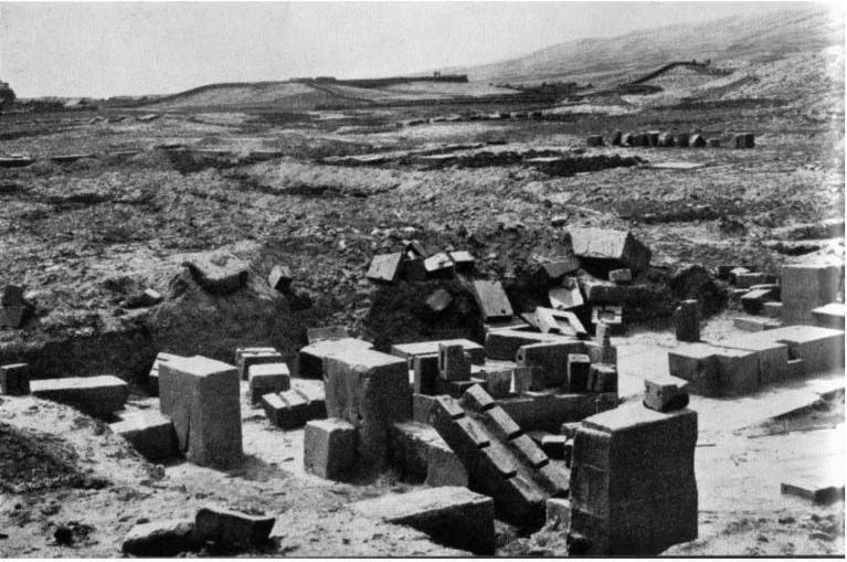
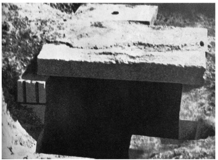
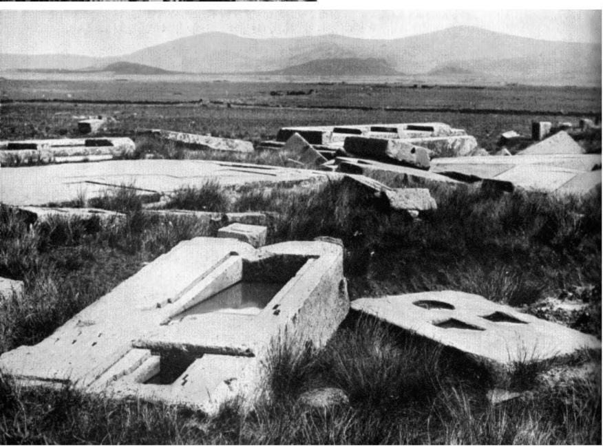
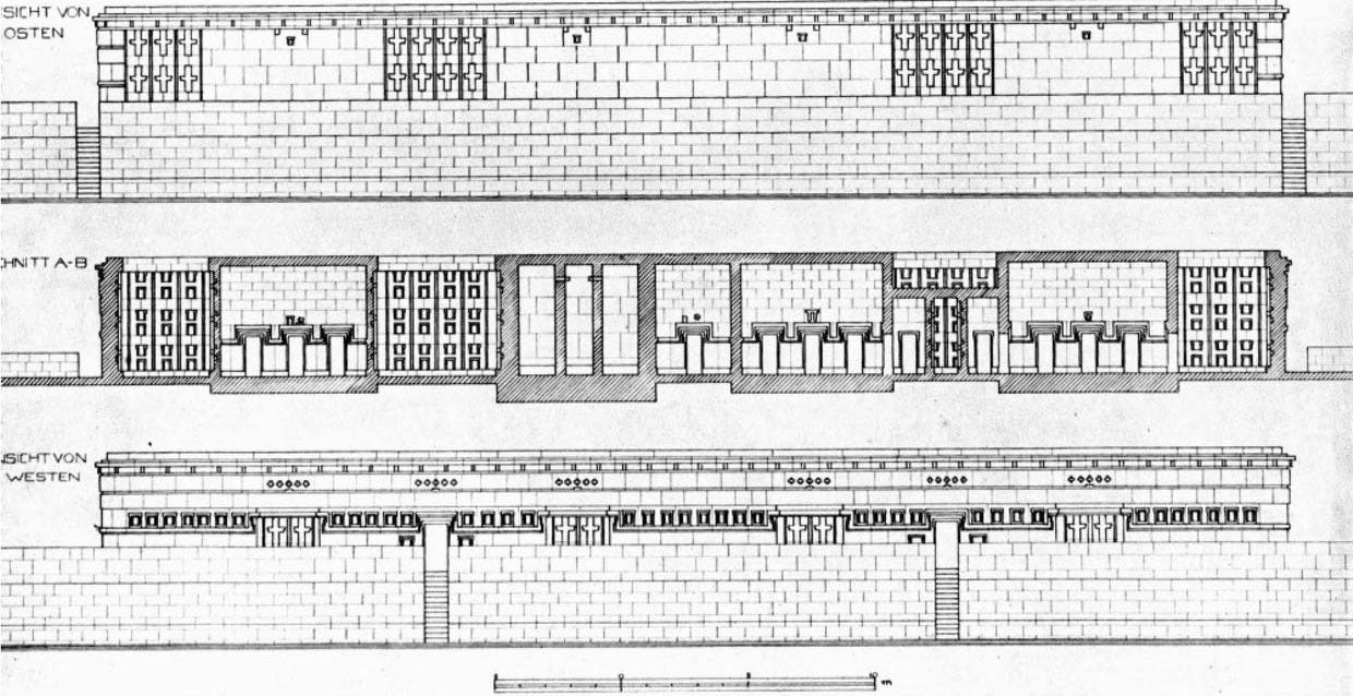
Close to the former lake of Tiwanaku, within the ruins city, there is a place called Puma Punku by the locals. It encompasses a large field of debris with a distinctly visible core of massive blocks of trachyte and andesite, which once formed the foundations and walls of a very artistically mature complex, likely a mausoleum that probably served as a burial site for priests or kings (Figs. 15, 56, 57, 58, 59, 60, and 61).
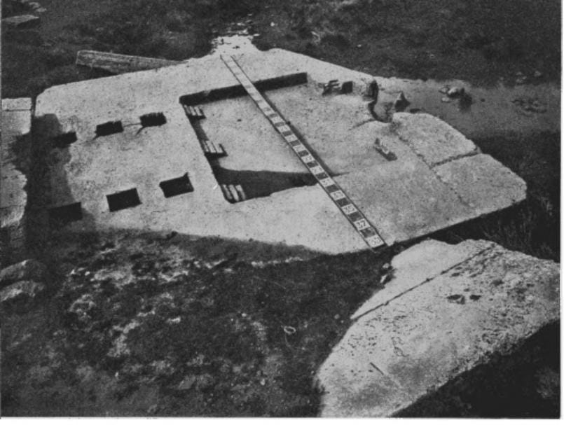
The ruins of Puma Punku are situated on an artificially created hill—similar to Akapana—that was terraced with masonry support walls. Unfortunately, this site, like all others in Tiwanaku, has been used as a quarry for millennia, welcomed by those who wanted to build structures of a modern kind with the carefully hewn and precisely ground stones. Fortunately, it was not possible to transport the stones, weighing about 10 tons, away from the site, as the poor road conditions on the Bolivian highlands did not allow it. In this way, many things have been preserved that would otherwise have surely disappeared, especially stones important for attempts at reconstruction, including the monolithic portals and the heavy stones covered with artistic sculpture work that let the structure of the old building be recognized with sufficient clarity. Moreover, the layout of the complex is engraved with all desirable accuracy on the floor slabs, some of which weigh over a hundred tons, and the places where walls once stood have remained as elevated surfaces due to less weathering, making a reconstruction feasible.
In front of the entire complex is a double harbor basin (Fig. 10). A larger-than-life idol, adorned with carved fish ornaments and representing a deity of the lake, still stands today at the spot where the quay, the landing place for ships in the harbor of Puma Punku, was located. Between the harbor and the mausoleum, there was likely a riverside street about 30 meters wide (Fig. 62).
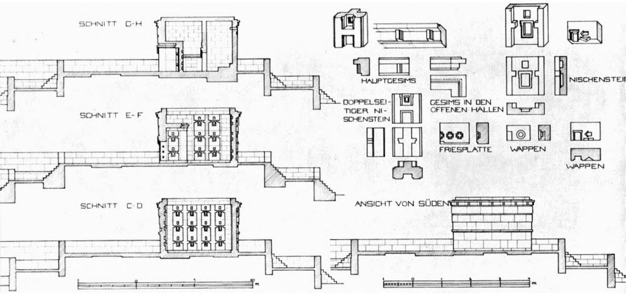
Interestingly, and quite astonishingly, the discovery of a Greek-styled main cornice was made. It even carries triglyph-like consoles at intervals of one meter under the plate (Figs. 63, 64, and 65). A second main cornice, a staggered piece but without triglyphs, is also present. The treasures of art still buried under mud and debris are likely to remain unearthed for a long time, as funds for expert excavations are not currently available.
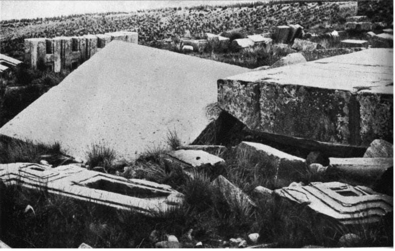
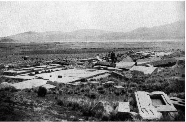
The foundation slabs of the mausoleum weigh between 60 and 100 tons (Fig. 66). The floor plan is largely carved into this solid base (Figs. 66, 67, and 68). The walls and ceilings of the building were made of gray-blue andesite lava. The individual pieces were connected with bronze clamps and dowels, as is still common today. No mortar was used. The joints were pressed so tightly together that a binding agent was unnecessary. Dowels and clamps were cast on site in still-existing stone molds, probably in sand beds.
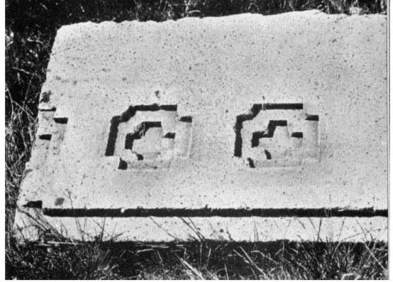
The sculptural work is of surprising accuracy and sharpness; the stones are precisely rectangular. Some of them look as if they were just completed. The portals, similarly to the Sun Gate in the Kalasasaya, were carved out of a single block of andesite, together with their lateral niches. The stones with ornamental decor formed interesting decorations when stacked, covering one side of the walls with a multitude of niches and simultaneously adorning the other side with a group of crosses (Figs. 69, 70, 71, 72, 73, and 74).
Some other stones with enigmatic carvings have been interpreted by the author as frieze parts of main cornices. Reconstructions are shown in Figs. 73 and 74.
From a wide staircase platform, two doors led into the interior of the building to open halls, whose walls were covered with niches of various types and sizes - perhaps to hold small idols (Figs. 64, 65, 66, 67, 68, 69, 70, 71, 72, 73, and 74). Through tiny sluices, one entered the ante-chambers, which were also covered with heavy stone slabs, of the likewise covered burial chambers. From there, very small doors led into individual cells that served to accommodate the mummies of the deceased. On the western exterior side of the building, a series of large, outward-facing niches were located in front of the burial chambers, where altars likely stood. The Puma Punku Mausoleum was used for the burial of only 13 deceased.
Other mausoleums, but with even smaller cells, are present at other places in the ruins field of Tiwanaku, so it is assumed that the Puma Punku complex is the largest, but not the only one of its kind in the prehistoric metropolis by the sloping lake.
The Puma Punku Mausoleum was never completed. It shared this fate with a large part of the other buildings described above. The heavy stones still stand today where the mason had placed them, to be moved one of the following days. The chisel lies next to the started sculptural work, the plumb bob of silver or bronze also, because it was forgotten when leaving at the end of the day, and perhaps it was hoped to be found the next day at the start of work. The plumb bob and chisel still wait for the polisher and mason, and the stones, lined up near the floor plan slabs, will no longer be moved, although they have waited quite a long time for it (Fig. 15).
Figs. 62-75 show the appearance of the mausoleum in the author's reconstruction.
A number of other buildings in the ruins field of Tiwanaku still await exploration and especially measurement. The description of the buildings of Tiwanaku has been made as briefly as possible. Particularly, the reconstruction attempts should convey to the reader the probable appearance of a metropolis that existed by the "sloping" lake of Tiwanaku in unknown times, which today would not refill no matter what attempts were made to achieve this. Thus, once there was a high culture on the shores of this sloping lake, probably encompassing a population of millions, whose nutrition for long periods was secured by the cultivation of the aforementioned terraced fields on the slopes of Bolivia and Peru. Although many buildings and components of Tiwanaku come from various art epochs separated by millennia, the overall picture of the city, as the reconstructions try to show, is not uniform. However, it is certain that at the time the harbors were usable, the city had at least the same extent as in later epochs, especially the Akapana fortress with its surrounding harbor canal and the Kalasasaya were present, and that Puma Punku with its two harbors already existed in its original form when large cargo ships still sailed far over the sea to fetch the building blocks from 50 km away at Kijappia.
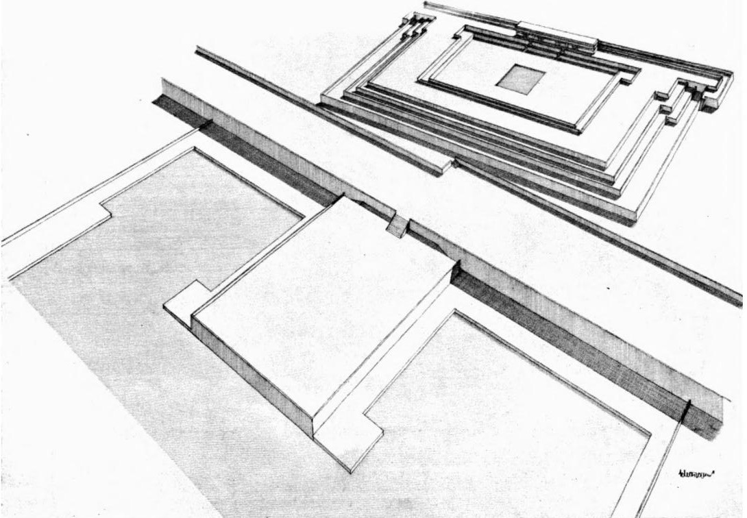
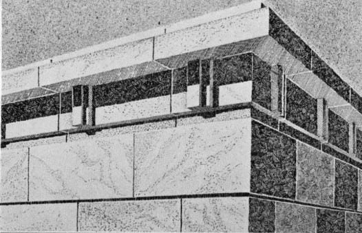
If some uncertainty has been introduced into the assumption that the high culture of Tiwanaku already existed before the Meseta tilted along with the continent of South America and then rose to create the current harsh climate, which makes the actual high plateau almost uninhabitable, and if further repetitions of these movements with the presence of two shorelines on the shore mountains of the old lake make these movements of an entire continent even more unlikely, then the next section may attempt to provide another explanation.
This explanation shall, as previously mentioned, be based on the Hörbigerian theory of cosmic ice.
The Land of the Andean Metropolis Tihuanaku in the Light of Hanns Hörbiger's World Ice Theory
The World Ice Theory holds that our current moon, Luna, is not the first and only moon that the Earth has possessed. It asserts that Luna was captured by Earth's gravitational pull not too long ago and has been bound to it ever since. The World Ice Theory posits that Luna was once an independent planet, which had its own orbit between Mars and Earth around the Sun. Since this planet Luna had a much lower mass and density than Earth, it was doomed, due to the resisting medium of space, to shrink toward the Sun faster than the heavy Earth does, which in contrast is more resistant to this inhibiting medium.
This inhibiting medium, according to the World Ice Theory, consists mainly of rarefied gases and dust masses, which can be found primarily in interplanetary space, but also in interstellar space, though not with the same density. If such an inhibiting medium exists, then all bodies forced to move through it must, over time, experience visible deceleration. According to Kepler's laws, their orbits must gradually spiral closer to the central body they orbit, bringing them nearer and increasing their orbital speed. A moon, orbiting between Mars and Earth, must therefore, over the course of millennia and millions of years, gradually approach Earth's orbit and eventually come into conflict with it. In particular, encounters between two planets can lead to the smaller of the two being captured by the larger, and it then becomes a satellite of the larger planet. Such a satellite, according to Hanns Hörbiger, is our Luna, which was also once an independent planet.
Before the capture of Luna, the Earth experienced a moonless age.
But there were predecessors to Luna, other moons that approached the Earth over the course of aeons, and which were captured and bound by the Earth's gravitational pull in the same way as happened with the Moon Luna, which today is our Earth's moon. All of these moon predecessors were doomed to the Earth, for just as they, as planets, shrank their orbits due to the aforementioned resistance of space and were then captured by the Earth, they first shrank as satellites and drew closer and closer to the Earth's surface. Eventually, they came so near to the Earth's surface that they were torn apart by the Earth's immense tidal forces and their fragments finally crashed tangentially down to Earth.
During the time when the capture of the so-called "Kanon moon," the predecessor of Luna, occurred and was approaching the Earth through the gravitational pull, the Andean massif rose at the location we today call the Bolivian and Peruvian Meseta, perhaps 7,000 meters above the level of the Earth's non-lunar ocean. This ocean, compared to today's, with an average water depth of 2.5 km, had a much shallower depth at that time. It was only about 1-1.2 km deep. This estimated ocean depth serves to describe the likely conditions before the lunar capture. It is entirely possible that the Earth's ocean depth was still even lower, meaning that the landmasses of the Earth were mostly exposed, and the oceans were small in extent. Thus, Earth was still missing the water mass it would later receive after the break-up of the Kanon moon, which, according to the World Ice Theory, was covered by a frozen ocean. The later increase in this ocean mass from the Tertiary satellites created the rise in ocean levels to the degree we observe today.
As a result, the Bolivian Meseta, though under a tropical sun, was at such a height that it probably had a similar, if not even friendlier, climate than it does in the present time. Likely, there was no significant human culture on the Altiplano during this time of the Kanon moon's capture, as the quality of life for human cultures worldwide was so favorable in the pleasant climates that there was no necessity to cultivate these high plateaus.
This state hardly changed when the predecessor of the current moon, Luna, the so-called “Känomond,” fell into Earth's dependency, transforming from a planet into a satellite. This event had significant consequences for Earth. The mutual tidal forces of the two celestial bodies initially caused the ocean at the time to flow in a flat tidal wave toward the equator, leaving the northern and southern regions. A flood-induced displacement of the previously existing equilibrium occurred across the entire Earth, and since the newly captured tertiary satellite significantly lagged behind Earth’s rotation, it tried to pull the Earth's water masses backward around the globe. Its efforts were only partially successful, much like today with Luna, due to Earth's land barriers that prevent the formation of a reverse-flowing belt current around the globe. Seismic and volcanic disturbances of considerable magnitude must have been the result of the cosmic event of the Känomond's capture, but the misfortune of the moon's capture primarily affected the inhabitants of the lowlands. The few and likely impoverished inhabitants of the highlands between the Andes of South America, if there were any at all, would have likely escaped with minimal distress. While the fields of these people may have suffered from the ash fall from the fire mountains of the Andes, it is unlikely that the thinly populated land could have experienced a true catastrophe.
However, a noticeable difference, albeit slight, would have been observed on the Meseta compared to the pre-Känomond period, specifically an improvement in the climate. Not only would the sea level of the highlands have decreased due to the rise of the Earth's oceans at the equator, but the air bulge that lay over the Cordilleras might have also become denser due to the tidal movement of the Earth's air masses from the poles toward the equator. This means that the atmospheric shield against the radiation of heat received from the sun became stronger, allowing higher temperatures to develop on the highlands. At the poles, however, frost began to extend its cold arms toward the middle latitudes, as is the case today at the beginning of the lunar epoch, as the atmospheric cover was sucked away by the moon’s tidal forces, making the heat shield incomplete and reducing the warmth provided by the atmosphere for the Earth's crust.
Further drainage in the high and soon also the middle latitudes brought about a drying of the Earth’s sphere from the poles toward the equator, accompanied by an ice age that gradually spread into lower latitudes. The approaching satellite drew away the Earth's warming protective layer, the atmosphere, from the polar regions, leaving only a thin, ineffective cover as insufficient protection against the cold.
The living space for humanity, along with Earth’s fauna and flora, steadily diminished. Without being fully aware of this fact—since it involved time spans that no historical research of that era could establish—the inhabitants of Earth were pushed toward the equator. Even here, space became increasingly limited. The rising oceans already rolled backward around the globe in towering tidal waves at the zenith and nadir, moving counter to Earth’s rotation. The orbital speed of the tertiary satellite remained far behind Earth’s rotational speed for long periods. Due to the inclination of the satellite’s orbit relative to Earth’s equatorial plane, the tidal waves did not flow uniformly but intermittently surged northward and southward, covering vast land areas that were subsequently avoided by both humans and animals. On the unstable shores of the lower latitudes, at the edge of the ice, some peoples likely fought hard for survival, while others found refuge in the mountains of the ancient continental highlands. The initial settlement of the Andean Meseta may have occurred during the period of the retreating, broader belt flood and the already-forming backward-flowing tidal waves. The development of these backward-flowing tidal waves and the reverse-flowing belt current was a phenomenon caused by the Känomond. As long as Earth's rotation significantly exceeded the orbital speed of the tertiary satellite, the water masses at the equator were pulled around the globe as a ring flood. However, as the satellite shrank and its orbital speed increased, coming closer to matching Earth’s rotation, the waters of the belt flood gradually divided into two backward-moving tidal waves that followed the backward-circulating tertiary satellite in the zenith and nadir. Long before the rolling backward tidal waves formed into distinct, backward-moving flood hills, a balance was achieved for a few millennia between the backward-flowing belt flood and the backward-wandering flood hills. Thus, while the overall flood continuously increased in line with the continuous approach of the Earth's satellite, a balance was achieved as the ring flood split into separate tidal waves. Even though this balance was only apparent, it resulted in several thousand years of relative stability, where the water level in inland seas connected to the open ocean through narrow passages generally no longer rose. Such a narrow, winding waterway to the sea formed a natural flood buffer, similar to what we know today, which would have been highly effective during the pre- and post-moon periods due to the rapidity of the tidal changes. From the south, intruding seawater could only travel a few kilometers inland and quickly lost its damming effect when the tide turned, even if the tidal wave itself was occasionally quite high. It was therefore possible that indistinct shorelines could form in protected areas of the Andes mountain range, especially on the leeward side of the water flow, which hinted at the water levels of the ancient ocean. The lowest of the three shorelines, labeled X in Hanns Hörbiger's drawing in figure 11, likely formed during this period. It is also possible that the first cult structures in Tihuanaku and on the Meseta plains, now covered by Lake Titicaca, were built during this time, supporting Posnansky’s theory when he attributed an “infinitely great age” to the structures he found at Lake Titicaca, near Siminake, in Jakonta Palayani. Perhaps the most remarkable of all temple buildings, the so-called Old Temple of Tihuanaku (figures 13, 14, and 29), also dates from this time. As the backward-moving and finally backward-creeping flood hills, always following the approaching moon, developed, it is likely that the Andean highlands were abandoned for long millennia. The flood hills circled the so-called "wedge regions," bringing with them the cold of a series of small ice ages in the tropics—ice ages that visited the Andean Meseta in hundreds of occurrences. These mini-ice ages, even in the tropics, are explained by the World Ice Doctrine due to the fact that the tertiary satellite not only uplifted the flood hills but also dragged along two separate atmospheric bulges, which towered above the flood hills. The areas between the flood hills and the atmospheric bulges above them, the wedge regions, inserted themselves between the flood hill zones and were therefore deprived of air to some extent. Therefore, even near the equator, ice ages occurred, although not with the severity experienced in the polar and middle latitudes. When Professor Posnansky identified multiple ice ages that affected the near-tropical Bolivia from the geological record of the Andean Meseta, this is not a mystery for the World Ice Doctrine. It was not merely two ice ages but hundreds that visited the Andean highlands. And when Posnansky claims that his discoveries on the floor of Lake Titicaca prove that humans inhabited the area before the ice age, he is entirely correct, as the World Ice Doctrine explains the reasons. The highlands of the Andes were not flooded by the backward-flowing and backward-creeping flood hills of the pre-lunar epoch.
The rest of humanity during this time likely lived in the lowlands between the flood hills, being pushed around the globe in countless cycles without even realizing it. Entire series of generational successions lay between the different stages of visible change in the existing conditions. The pace of change in the last tens of thousands of years before the moon became stationary can hardly be imagined as slow enough. When the backward-moving flood hills swept away forests and fields, people probably believed that the land was sinking at that spot and, out of necessity, shifted their living space a few kilometers back, though without consciously recognizing the compulsion. Thus, they retreated from the reverse-flowing water hills, unknowingly migrating around the entire globe many times over many generations. Since humanity, unless completely wiped out, is everlasting, one could estimate a span of 50,000 to 100,000 years for this period.
In the stationary era, the time of the one-day month—that is, the time when Earth rotated as quickly as the moon orbited it—this global migration ceased for tens of thousands of years. Humanity’s living space had not only shrunk to a terrifyingly small area, but there was hardly a piece of land where life could be sustained safely and comfortably. The ice-cold ebb zones in the middle and high latitudes, extending all the way to the poles, were inaccessible to humans and animals during this “mountain-building era,” perhaps with the exception of birds, which scavenged along the shores. Every day, the “stationary” water mountains of the flood hills, along with the Känomond, oscillated once to the north and once to the south, inundating the high latitudes with their muddy waters during each swing. Each time, the ebb deposits, along with their sludge and plant matter from tropical regions, remained frozen solid and piled up in daily new layers, forming sedimentary mountains. These daily oscillations were the result of the angle of the moon's orbit in relation to Earth's equator. Since the two planes intersected at an angle, the moon, which was still orbiting but only stationary in relation to Earth’s rotation, performed a north-south pendulum movement corresponding to the amount set by its path through the Tropics of Cancer and Capricorn since its capture.
The high plains of the Andes also became cold as the mild wedge ice ages polished their glacier drums, which today, at an altitude of around 3000 meters above sea level amidst wheat fields under nearly tropical sun, puzzle us—unless we employ engineer Hanns Hörbiger's World Ice Theory to explain them. Without difficulty, the supposedly ice-age-related structures of the Old Temple of Tihuanaku could also be explained, provided geological investigation resolves the question one way or the other.
Since living space during the one-day month, the stationary time of the tertiary satellite, had become so scarce, it is not unreasonable to suggest that even then the highlands between the Andes were inhabited, as these small ice ages under tropical and subtropical sun were at least tolerable and did not prevent the Pampas from greening in lower areas and protected valleys.
And yet, it seems hard to imagine that during such times of great catastrophe, as the era of the one-day month must have been, the Andean asylum could have remained a viable place for humans to live. True, the devastating great floods were absent here. But a terrible guest resided in the sky-piercing mountains of the Cordilleras, especially in those known today as the Lake Andes. This guest was the ash fall from the fire mountains, whose activity still reminds us of harsher times.
Due to the daily shifts in load by millions of tons caused by the northward-pendulating great floods of the nearly stationary flood hills, and due to the deep-seated fracture fissures at the edge of the Pacific Ocean basin being torn open by the push and pull forces of the still very slowly retrogressing tertiary satellite, Earth no longer possessed the rigid cohesion and impermeability that effectively prevented the entry of groundwater and ocean water into fiery magma nests. The encounter of these hostile elements must have been quite frequent during the time of the nearly stationary and later fully stationary satellite. It was particularly along the still-present and noticeable Pacific fracture sink that this encounter likely found especially favorable conditions. The consequences were severe volcanic and tectonic earthquakes of the greatest magnitude, and the continuous activity of countless volcanoes, some of which are still present today as extinct and, in the smallest part, still active fire mountains.
The enormous amounts of lava and particularly whitish ash that must have been ejected during this time are evidenced with shocking intensity by the truly gigantic deposits of the so-called Toba Volcanica, layers of lava ash that cover the Meseta between the Andes. This ash layer, the lower of two known to the author, is seemingly quite uniform, although it varies in thickness. In places, particularly in valley incisions, where this ash deposit piles up to 600 meters thick, these areas are likely the result of accumulations of this material. The average thickness of the lower ash sediment is approximately 6 meters, as observed, for example, along the fracture edge of Alto La Paz.
It is difficult to imagine that settlement of the highlands would have been possible for those witnessing such seismic and volcanic mega-catastrophes. Even far smaller ashfalls today, where they settle on fields, destroy entire crops, spoil grass so that livestock can no longer graze on it—in short, with even just a quarter of a centimeter of ashfall, South American farmers face severe hardship. Therefore, it is hard to consider that remnants of human cultures from the aforementioned period of balance between the receding belt flood and the retreating flood hills could have survived under such ashfalls on the Meseta, let alone continued to inhabit it as fishermen under such extreme conditions. However, given that similar conditions must have existed in other parts of the severely constricted Earth as we have described for the Meseta, it is possible to assume that impoverished humans managed to eke out an existence in somewhat protected areas. Such areas may have existed in small numbers in the valleys of the royal Cordillera, or perhaps on the eastern edge of the plateau, which lies 200 kilometers away from the main fire-breathing mountains. Agriculture and livestock farming, however, were likely not possible. Only in a few bodies of water might people have barely managed to catch fish and shellfish for food.
And what about dwellings? Here, the reader might instinctively think of the underground dwellings of Tihuanaku, which at least provided protection against the worst of the daily, varying-strength ash rain. This possibility cannot be dismissed. It has already been mentioned in the first section that these underground abodes were skillfully secured against collapse from earthquakes. The plates and worked stones were fitted together with triple grooves and tongues (Fig. 54). In any case, this provides a possible explanation for the mystery of the miniature underground rooms, which could not have been built so small out of sheer caprice but rather for practical reasons. Above-ground rooms without windows could have been sufficient protection against ashfall, where narrow, low entrances could be easily secured against the intrusion of ash dust, but such above-ground rooms would have offered no protection against the violent earthquakes of that time. By embedding the interlocking walls into the earth, a collapse during even the heaviest earthquakes could be prevented, so that staying in these small rooms could evoke a feeling of security that people living under such dire conditions would have needed, at least during the night and at meals, if they were not to despair. For all the structures not built into the ground, strong foundations provided some measure of security against the effects of earthquakes. The 3.25-meter-thick foundation walls of the ruins of Siminake, discovered by Posnansky in the Titikaka Lake in 1931, seem to have served such an earthquake-protection purpose. Posnansky also considers the ruins of Siminake, although not from the perspective of World Ice Theory, to be pre-ice age and even older than the structures from the first two periods of Tihuanaku. Therefore, if the so-called Old Temple of Tihuanaku (Figs. 13 and 14) was also built into the earth, we now know the probable reason. It was constructed this way to protect against earthquakes.
After overcoming the "one-day month," that is, during the post-stationary tertiary period when the flood hills freed themselves from their stationary position and, following the satellite, now moved forward and overtook the Earth's rotation as they circled the Earth, the forced but not consciously recognized migration of the remaining human remnants around the globe had to begin again. This time, the migration of people living in the wedge-shaped areas between the slowly advancing flood hills was not backward around the Earth, as it had been a hundred thousand years ago, but forward, following the direction of Earth's rotation and the march of the moon and its two flood hills. Once again, numerous minor ice ages, which inserted themselves into the wedge-shaped areas between the two flood hill domes at the equator, replaced the actual flood periods of the flood hills. For the Andean mountain refuge, these flood periods—those epochs when the slowly advancing "Känomond" (the proto-satellite) stood at the zenith of the Meseta and seemingly refused to move for eons—were not true flood times, for the Andean refuge once again proved to be a genuine asylum. Whereas the kilometer-high flood hills had once rolled in from the east against the royal Cordilleras during the pre-stationary period, they now did the reverse and rolled in from the west against the maritime Andes. Thus, in the "flood shadow" of the declining mountain-building era, tertiary sediments could accumulate on the eastern side of the Cordilleras, while they were absent from the western side of the entire Andean massif.
For thousands of years, the flood domes alternated, anchoring over what is now Ecuador, and let their immense, watery peaks swing north and south each day. According to Hanns Hörbiger's World Ice Theory, these great floods not only created sedimentary mountain ranges but also embedded coal in the frosty ebb zones of the northern and southern latitudes, with the raw material for the coal being extracted from tropical regions and transported as pulverized and crushed matter to the near-polar sedimentation zones. When the flood hills began their migrations, whether receding or advancing, it didn’t matter; the pendulating flood peaks scooped entire fleets of marine animals and oil-rich seaweeds from capture bays and layered them in ice graves in the frozen ebb zones, covering them with mud and limestone, and, in never-ceasing daily work, built entire strata of mountains. One might think that the great inundations from the stationary and near-stationary flood hills would also have affected the Andean highlands, storing lime, coal, and petroleum there for today's humanity. After all, the Meseta lay nestled directly within the flood hill peaks, so that its southern slopes embraced both Cordillera slopes whenever their path meandered over the lands of Colombia and Ecuador over millennia. With majestic pendulations, one would expect that the water mountains daily swept across the Meseta, destroying everything in their path, including the ancient temples and underground dwellings, and depositing marine sediments in the southern part of the Meseta, adding or sometimes eroding their great work with each return during pre- or post-stationary times.
None of that happened.
On the Meseta, there are indeed remnants of the sea in the form of saltwater lakes, but no marine sediments. The surroundings of Lake Titicaca are Paleozoic. The Cordilleras are an uplift formed by plutonic masses, mainly granite, porphyry, and trachyte, with gneiss of extraordinary thickness joining them, while on the eastern slopes, layers from the Cretaceous and Tertiary periods are typically deposited. Additionally, the significant coal-bearing sediments are completely absent from the Altiplano. This is not surprising, as these deposits could only form, according to the principles of the World Ice Theory, if the ebb outflows of the flood hills had touched the highlands and deposited their load of organic material there, which would then have been frozen solid in the mild frost of a tropical "wedge ice age."
Nor is there any known petroleum on the Meseta, and it is unlikely that productive oil wells will ever be drilled in the highlands between the Andes. While the basin of the Meseta, nestled between the mountain chains, seems to possess all the characteristics of a good capture bay in terms of the World Ice Theory, such a bay is useless if the necessary animal and plant cargo cannot find its way into it.
From this brief characterization of the Andean highlands, it becomes clear that during the "one-day month" period and the millennia before and after, the time during which mountain-building processes began worldwide through ice-age sedimentation, no such sedimentary mountain-building occurred on the Meseta. The high plateau, located at an average altitude of 4,000 meters and near the equator between the two Cordillera ranges, was neither touched by the flood hills themselves nor by their sediment-bearing ebb outflows, at least not in a way that allowed hardened rock or coal to form under ice pressure. It is evident that since the Paleozoic era, the highlands have been practically spared from all the "destructive" and "constructive" moon-induced floods.
The great catastrophes of the pseudo-stationary periods and the stationary period, insofar as they could have affected the Andean highlands, passed over the Meseta without a trace, quite literally. Since the days of the earliest geological antiquity, the Meseta has been a true asylum, a safe refuge for humans, fauna, and flora, even during the harsh times of seismic paroxysms during the flood mountain ages.
The repeatedly mentioned layers of Toba volcanica, or volcanic ash, which naturally decrease in thickness from the maritime Andes towards the royal Cordillera—since the maritime Andes were home to the vast majority of active volcanoes—are further evidence that floods of larger, destructive scale, like those caused by the flood mountains, could not have visited the highlands. Even the largest, towering flood mountains of the post-stationary and pseudo-stationary epochs were unable to reach the massive ash deposits, disturb them, and transport them southward to solidify them into sedimentary rock, compacted by mountain pressure. The Andean asylum must have remained untouched by all major floods, and the minor ice ages—evidenced by the glacial abrasions described in the first section of this book—which also affected the asylum, must have been numerous but individually of relatively short duration and of minimal geological impact.
Thus, when Professor Posnansky in La Paz, based on his research, believes he has identified two glacial periods from the face of the Meseta, he is certainly not mistaken. However, in reality, there were likely not just two ice ages, or rather mild mini-ice ages (wedge ice ages), but perhaps hundreds, each passing over the Cordilleras with the encircling flood mountains, both in space and time, following the encircling water and air mountains. The periods when the flood mountains were pseudo-stationary (near-stationary) and oscillated north-south over the 80th longitude were times of subtropical warmth, with the air bulge towering high above the Andes, and each time the flood mountains receded, minor or wedge ice ages, with their reduced atmospheric cover, left their marks on the Andean highlands.
It was by no means a shift of a climatic belt of unknown origin, no dramatic equatorial migration of unclear cause, and thus no significant polar displacements were necessary to create such "mild" ice ages in areas close to the equator. Here, as in all interpretations based on the World Ice Theory, the force came from the cosmos, not from the Earth itself. It should be noted for the sake of completeness that minor changes in the position of the poles did occur, which are still evident today in the position of the magnetic north pole on Boöthia Felix. However, these displacements were minor and did not originate from the Earth, but from the gravitational forces of the near-Earth tertiary satellite, also from the realm of outer space. Specifically, the thrust and pull forces of the gravitational field of the proto-moon were capable of displacing landmasses in the zones of tension, where the amounts of tension fluctuated enormously, to such an extent that a polar shift, albeit minor, could occur.
However, these minor polar displacements, made plausible by the World Ice Theory, had little influence on the formation of mini-ice ages in equatorial regions, as neither a full reversal nor even a partial reversal of the poles and equator could occur through the mentioned thrust and pull forces of the tertiary satellite. The polar displacements they caused could never have triggered an ice age on the Meseta. This is only conceivable when considering that the air-deprived wedge areas between the two flood mountains at the zenith and nadir of the proto-moon must have swept over the Andean region during their journey around the globe, just as the water mountains and the proto-moon did.
To understand that it was not possible for the two flood mountains of the pseudo-stationary epochs—during the stationary period, the asylum endured the cold period of the "wedge ice ages"—to reach the Meseta, reference can be made to Fig. 10, which attempts to depict the probable position of the oscillating flood mountains graphically. How the author arrived at the specified heights of the different positions of the flood mountains will be explained later.
Encircling the entire highland, the Meseta, is a very massive rock barrier, over 100 km wide, a wall that rises at least 500 meters above the current level of Lake Titicaca at no point. A quick glance at a map of South America with altitude indications shows that this wall is much higher in most places. The fact that the highland was calculated to rise only 500 meters has the following reason:
For the intrusion of external water masses, the lowest point of the barrier is always critical. Nevertheless, the mountain barrier, which has an average height of at least 4800 meters, provides highly effective protection even with the presence of rare lower areas. In the west, the rock wall of the maritime Andes runs from south to north along the Pacific coast, while in the east, the chains of the royal Cordillera rise. To the north, a massive, almost one-hundred-kilometer-wide ridge, the crossing Cordillera, blocks the Meseta and encloses the highlands at the equator (see Fig. 12). The southern barrier of the Meseta, in the Chilean nitrate fields, is not as high as it is in the north. However, even here there is a minor southern barrier, so the highlands between the Andes are effectively surrounded on all sides by towering mountain walls. The southern wall, though less significant, could be absent without taking away the highlands' quality as an asylum against the lunar floods of the tertiary satellite. Nonetheless, it appears to have played a not insignificant role in the undisturbed formation of well-visible and well-preserved shorelines of later epochs of the proto-moon era.
Looking at Fig. 12, one can instinctively sense the effective protection offered by the mountain wall around the Andean asylum, especially against the water mountains of the flood mountain ages when the month lasted only a day or a little more or less. The positions of the flood mountains during the pseudo-stationary period, in their maximum, minimum, and average oscillations, are tentatively indicated. It is not denied that maximum oscillations may sometimes have overtopped the mountain wall of the crossing Cordillera, connecting with the seawater inside the Andean asylum, which oscillated with less intensity. However, the force of the flowing water was broken from the outset, so that scouring down to the bottom of the then-existing Andean lake was never an issue, and such overtopping likely did not occur frequently.
This statement might provoke doubts, as the reader is familiar with the immense power of the flood mountains from earlier descriptions. To counter this, it should be noted that the peaks of the flood mountains were always and exclusively under the uplift of the near-Earth tertiary satellite, meaning that the dynamically crucial and effective tangential forces of the middle and higher latitudes—thrust and pull forces constantly shifting—could not come into play. In the middle and higher latitudes, where the tangential forces of the near-Earth satellite were present and subjected to daily changes in direction and position due to its oscillations, the enormous effect of the flowing waters could be found. Where the tangential thrust shifted due to the oscillation of the proto-moon, the waters of the flood mountains could, with indescribable force, surge over entire mountain ranges, as though suddenly granted the ability to flow uphill. And indeed, it gained that ability day after day. In the tropics and subtropics, however, along the walls of the Andean asylum, the flood mountain peaks rose and fell majestically without ever being released from the uplift of the satellite, which hovered directly above the peaks. The zones of constriction, the zones of thrust, were far to the south and north of the globe and only there unleashed effects of a magnitude we can hardly imagine.
Furthermore: The idea that the receding flood hills of the pre-stationary period and the advancing flood hills of the post-stationary epoch did not periodically flood the Andean asylum might be even harder to understand. It is not denied that occasional splashes from the massive waves might have reached the asylum over the Pacific or Atlantic Andean wall, depending on the direction of the impact during pre- or post-stationary times. However, more than splashes—sit venia (pardon the phrase)—could not have occurred, despite their possibly significant size in human terms.
The Pacific Andes stretch northward like a massive wavebreaker after the crossing Cordillera securely blocks the Andean asylum. At the lower left end of the map sketch (Fig. 12), the continuation of the mountain range is indicated. At this gigantic wavebreaker, the particularly dangerous, advancing post-stationary flood hills would have broken, and the aforementioned “splashes” would have powerlessly swirled around the hundred-kilometer-wide, staggered stone giants of the Cordilleran peaks of the western Andes, rarely reaching the Andean lake. In such cases, there would likely have been a very high tidal wave by human standards, but any person who built their underground home or mud hut in this area, vulnerable to flooding, would have deserved their fate—punished, as most often happens, by stupidity, which is typically harshly penalized. However, it is safe to assume that none of our human ancestors perished in such a reckless and suicidal manner.
Thus, it is easy to see that the safety of the Meseta asylum did not depend so much on its towering mountain wall—though it was certainly indispensable—but rather that its favorable location near the equator provided security. This security was offered by the proto-moon itself, almost pendulating at the zenith, creating the pure uplift. If the entire asylum had been located just 200 kilometers further north, the maximum and minimum flood mountain peaks in Fig. 12 could not have been drawn with good conscience, as the flood mountain peaks would have been "flat" in such a case, and their oscillations along the meridian would have produced no discernible, let alone mappable, differences in elevation. Directly under the uplift of the satellite, the flood mountain peak would merely follow the curvature of the Earth’s surface, being almost flat, and it is only when the first tangential forces are felt that the water mountain begins to slope gradually, then increasingly steeply, into the zones of pure tangential thrust. This gradual steepening of the flood mountain likely explains why several shoreline lines along the Pacific side of the Andes appear to approach the present ocean level more quickly the further south they are.
From the above considerations, it is thus unlikely that any overtopping of the crossing Cordillera occurred during the pseudo-stationary periods. The unspoiled condition of the highlands, and particularly visual observation—almost more convincing than the drawing in Fig. 12—argues against this overtopping. Anyone who has stood by Lake Titicaca and seen the ice-bound mountains of the 4500-meter-high barrier rising into the transparent sky of Bolivia, far in the clear distance, instinctively feels a sense of safety from the grand events that must have swept beyond the protective Andes walls while the proto-moon, shrouded in clouds, hovered at the zenith, pendulating slowly north and south.
If we imagine shifting the Andean massif 200 kilometers further south, just as we earlier shifted it northward in thought, the asylum as such would be in jeopardy. The sloping water mountains, no longer describable as flood mountain peaks, would fall within the zone of significant tangential forces and would overtop the mountain wall surrounding the Meseta by one to two hundred meters with each oscillation. The tangential forces here in the south would exert such a flow effect on the water mountains that even a higher mountain wall would no longer provide protection. The 200 kilometers southward mountain barrier would no longer be met by vertically rising and falling water but by horizontally flowing water. As a result, the water, driven by its dynamic force and pushed by water from the north, would literally scale and then overtop the wall. It becomes clear that, in its current location, the asylum did not rely so much on its high mountain walls for protection as it did on its advantageous position near the equator.
One is almost inclined to say that the Andean asylum could not be located even one kilometer differently than it is, because if it were situated 200 kilometers further south, the backward-moving or forward-moving flood hills would have entered the alternating tangential zones with their southern slopes. As a result, forces would have been unleashed that would literally make the water flow uphill. The mountain wall of the Andes would have been useless against these periodically outward-flowing masses of water. As soon as the tangential flood force of a large satellite grips a vast amount of water, penetrating through all layers to its depths, it carries it along, even over mountains, just as the World Ice Theory suggests it is capable of lifting entire lands from their positions, merely because the flood force is acting horizontally rather than vertically. It was far more difficult for the tertiary satellite to lift a load than to push or roll it, especially when the medium in question was as mobile as water.
For these reasons, it also becomes apparent why the author had no hesitation in placing the origins of some of the oldest cult and residential buildings—especially those built underground, like the Old Temple of Tihuanaku—during the flood mountain ages. The construction of the Old Temple deep into the ground for earthquake protection, combined with artificial means to prevent collapse from seismic tremors, suggests that it was built during the time of the flood mountains. It also becomes clear that such structures, situated at almost frost-free elevations and lying underground, were protected from excessive weathering, allowing them to endure indefinitely long periods. Only free-standing buildings, exposed to constant weathering and destruction by lichens and moss, can weather away—not those sheltered from these effects. Even the burial of an object, say a work of art, about one meter deep under a protective layer of water-impermeable clay, such as alluvial sediment from streams and rivers or from a minor ice age, would preserve the piece nearly intact, as substantial weathering would be excluded.
If the flood mountains of the pseudo-stationary epochs were unable to reach the Andean Meseta or supply it with marine sediments, this holds even truer for the period following the post-stationary epoch, when the advancing higher belt flood began. Despite the tertiary satellite-driven ocean rising near the equator, the crest of the flood mountains never again reached the maximum heights of their peaks. The available water volume no longer divided into two separate flood mountains but had to fill the entire ring, which now rolled around the globe with increasing speed.
However, even before the ring fully closed, a post-stationary period of balance must have set in, during which the overall ocean level no longer appeared to rise. This occurred in much the same way as during the reverse pre-stationary balance briefly mentioned earlier. In particularly protected locations, in remote sea bays or large inland lakes with a north-south orientation and a narrow, poleward-facing access point, a period of apparent stillness in the general rise of the global ocean could occur.
This epoch seems to have been especially favorable for the sea bay or inland sea of Tihuanaku—what we now call the larger Lake Titicaca—because the aforementioned low protective barrier of the asylum was also present in the south of the Meseta. During this time of post-stationary tertiary balance, when the ocean level had risen to around 4000 meters above today’s sea level, the vast Andean lake of Tihuanaku (Fig. 76) remained stable for a certain period, about one to two thousand years, without significant fluctuations in its water level. While outside the asylum, the flood mountains stretched into long tails because they could no longer follow the advancing satellite as separate flood mountains, and while the ring flood balanced out and refilled, the water level of the inland sea of Tihuanaku remained steady. The small amounts of floodwater that occasionally tried to enter from the south, through the narrow passage at the Chilean nitrate deserts, were effectively intercepted along narrow, winding paths.
At the same time, the repeated periods of minor ice ages in the wedge zones between the flood mountains, with the flattening of the flood mountains on the Meseta, had entirely ceased. The proto-moon now orbited the Earth in about 20 of today’s hours—meaning the year had several hundred months!—and dragged only the remnants of the great flood mountains in elongated distortion around the Earth. Since the water level of the larger sea of Tihuanaku now matched the ocean’s height and was near the equator, the climate of this entire region naturally became subtropical, or even fully tropical due to the favorable sea location. This consideration explains the discoveries made by various researchers on the Andean highlands, which prove that remnants of a tropical fauna and flora are still found today on the Meseta. The former existence of a true, unadulterated tropical flora and fauna at a time when the larger Tihuanaku sea was at ocean level is therefore no longer mysterious.
During this important period of calm development in the Andean highlands, human cultures that had persisted with tenacious will to live in the underground dwellings of the Meseta must have developed significantly within a few centuries. A people, hardened by millennia of extreme hardship, entering a time of peace and abundance, was well-suited to achieve within a short period of a few thousand years what they actually did achieve: the kingdom of Tihuanaku and its capital of the same name. Even today, we can trace the shoreline of the former inland sea (Fig. 8) along the granite walls of the coastal mountains, and it is no longer a mystery why this Y shoreline, surveyed by Posnansky in 1926, appears slanted from north to south for our modern measuring instruments and sense of equilibrium. This shoreline simply represents the boundary of a once perfectly horizontal lake, a lake that would have been level even by our modern instruments at that time. It corresponded largely to the southern slope of the flood ring, which, due to increasing tangential forces towards the poles, sloped down until it disappeared around the 30th southern latitude in the ice of the middle and higher latitudes.
Thus, the slanted Y shoreline has revealed its secret. It was only a mystery for as long as it was not understood how it could have risen to such a significant elevation. Initially, one might have thought it was not a shoreline of a sea that had risen so high, but the mark of an inland lake whose basin, along with the continent, had tilted for some reason. It is also understandable that, in the absence of better explanations, the hypothesis of melting ice was adopted to account for the peculiar tilting movements of a giant continent in multiple repetitions.
However, there was no need for a tilting of the continental massif to create the slanted shoreline, nor for a rise in northern South America and a sinking in the south to make it possible. Nor was any latent force within the Earth, suddenly or slowly released, required to raise the landmass to today’s elevation of around 4000 meters, so that the slanted shoreline and salty sea remnants could be found in their current position. It was also unnecessary for the Andean lake, along with its Meseta, to have risen to even greater heights to allow for the ice ages Posnansky identified, and then to sink back to today’s sea level to allow for the presence of marine fish fauna otherwise found only in tropical seas. What now dwindles in the harsh Meseta are remnants of tropical fauna and flora, as seahorses are typically found only in warm marine waters.
All the climate fluctuations that we can discern on the highlands between the Andes, from unmistakable traces, did not result from vertical displacements with unclear causes and repetitions. Instead, the wedge ice age logically existed alongside the subtropical and tropical climate, both temporally and spatially, following each other in multiple, even hundreds of repetitions. No other force can be held responsible for this except the tertiary satellite and its constant approach to the Earth due to interplanetary space resistance. Again, the force behind all these phenomena did not originate from the Earth itself, but solely from outer space.
Since the climatic conditions during the formation of the slanted lake of Tihuanaku were very favorable for flora, fauna, and humans, it is no wonder that the ruins of Tihuanaku are located right on the shores of this former slanted lake. The city on the slanted lake no longer holds any mysteries, except perhaps that cautious scientists may still hesitate to attribute such an ancient age to a cultural center like Tihuanaku, even though they must admit that the explanations based on the World Ice Theory are flawless, and that this theory has been correctly applied as a working hypothesis. These scientists are reluctant to work with age figures that exceed 10,000 years, and the age figures for Tihuanaku seem monstrous and thus unbelievable to them. Even the World Ice Theory cannot provide an exact age for Tihuanaku, not even an estimate; it can only offer relative values from satellite times. We do not know how long each satellite era lasted, nor do we know whether, for example, the "balancing" period between advancing flood mountains and advancing belt floods—the time when Tihuanaku was built—lasted 1,000, 2,000, or more years. We also do not know whether the long moonless period between the fall of the tertiary satellite and the capture of our moon, Luna, lasted millions or just hundreds of thousands of years. However, one thing we do know—and it will be hard to dissuade us from this conviction, even if the age of Tihuanaku cannot be estimated—is that it must be measured in millions of years!
It takes both courage and a thick skin to claim such things in a book intended to be taken seriously, and as the author, endure the silent contempt or knowing smiles of specialists. Fortunately, it seems that the argument based on the World Ice Theory is not without considerable support. For those who are not convinced by the city on the slanted lake that its origin must be placed in the post-stationary period of the proto-moon era—if the mystery of this city and its slanted lake is to be solved at all—they may find confirmation in the ideographs of the Sun Gate, detailed in the final section of this book. The author hopes this confirmation will silence even the doubters who were not satisfied by the explanation of the shoreline formation in the second section of this book, based on glacial-cosmological foundations, and who refuse to consider Hanns Hörbiger's theory, even as a working hypothesis.
It was already mentioned in the first section that the prehistoric inclined shoreline Y of the lake of Tihuanaku also lies on the banks of the Desaguadero and its surrounding mountains. However, here Professor Posnansky was able to demonstrate that during the time when Tihuanaku flourished, large animals were present on the Altiplano, such as the giant tortoise, which are tropical animals. Since large mammals from the red mud of the lake were excavated from Tihuanaku layers at Ulloma by Professor Rudolf Hanthal and Dr. Ivar Sefve, and these were contemporaries of Tihuanaku, this sufficiently shows that without any forced thinking, there must have been climatic conditions at the inclined lake, which was at the same level as the ocean at that time, that were conducive to the existence of such tropical animals as the seahorse and the giant tortoise. The flying fish, a typical inhabitant of our warm oceans, must also have been present in the sea of Tihuanaku during that time, as it is depicted on the Gateway of the Sun, so realistically that the sculptor likely saw it not only frequently but also may have fried it in a pan. The presence of tropical fauna alongside the highly cultured people of the city of Tihuanaku is thus no longer a mystery. The sea level at that time, under a tropical sun, simply provided the favorable living conditions for these animals, without the continent having to sink to the current sea level.
The explanation offered by Hanns Hörbiger's Welteislehre (World Ice Doctrine) has the advantage of unity. All the phenomena and conditions on the Altiplano, which were presented as unresolved in the first section of this book, can be interpreted through the one force that led to the various geological, climatic, paleontological, and even archaeological conditions. Taken out of this context, one might find explanations of various kinds for different states and phenomena, but all seem to suffer from a sensitive shortcoming according to the author: a lack of unity. Complicated explanations are always more questionable than simple ones. And simplicity is often said to be the criterion of truth.
In the ongoing interpretations of many mysteries from the Meseta of Bolivia and Peru, the mystery of the port city on solid land at nearly 4000 meters above sea level also disappears. Tihuanaku could use its ports without concern. The water did not flow south out of the inclined lake, as it would in a present-day attempt to fill the lake basin, assuming such an attempt could be made. For millennia, during the time of equilibrium after the stationary tidal bulges with the preceding higher belt flood, large seafaring ships sailed from these ports and returned from distant lands to the city. At the time of the inclined lake, this inland sea had not only the already considerable size of today's Lake Titicaca, about 200 km long and about 80 km wide, but perhaps, at a width of about 200 km, it was almost 1100 km long and teeming with islands and islets. The shores and islands provided limited space for a population of millions, and this large population was forced to sustain itself from the previously described agricultural terraces, which covered the surrounding highlands in hundreds of steps. When considering the depth and length of these terraces, as there is hardly a spot in the Andes mountains free of them, one gains an idea of how densely populated the land must have been at that time.
It is not at all surprising that this was the case. During the post-stationary "equilibrium" period, at the time of the inclined shoreline Y (Fig. 8), nearly all human remnants of the entire earth crowded onto the small area of the Meseta, the safe asylum within the mountain wall of the Cordilleras. Those who had endured and survived the great catastrophic periods of the tidal bulge ages, fighting bitterly for their lives, now sat in the asylum of the highlands, using the respite provided by the tertiary satellite as a pause in the ongoing disaster. The rest of the earth, perhaps with the exception of the Abyssinian highlands near the equator, was almost uninhabitable, as the higher belt flood covered the other tropical lands and, with unpredictable oscillations, also endangered the coastal areas of the higher latitudes, where only a narrow zone was available for hunters and nomads to eke out a hard and meager existence. The advancing ring flood of the post-stationary time almost reached the areas of polar and subpolar glaciation, which on the northern hemisphere of the earth may have extended into the latitudes of the Mediterranean.
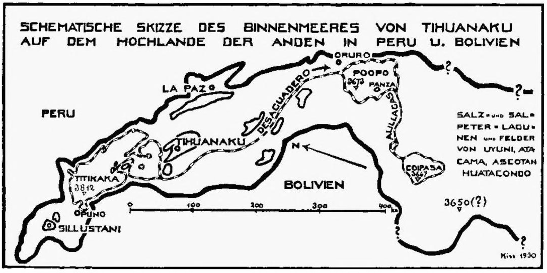
And so, there was a mountainous asylum on Earth, a refuge that was not only safe from natural disasters but also climatically pleasant! Rich tropical and subtropical vegetation, along with the corresponding fauna, flourished along the shores and on the islands of the fish-rich lake. The fish wealth of the lake is not indicated by the small and rare fish that the indigenous people now catch in Lake Titicaca, but by the discovery of several fossilized Orestias (fish) of impressive size. These fish were about five times larger than the current fish living in Lake Titicaca. These fossil fish were unearthed by a German engineer during well drilling near Tihuanaku. Additionally, another city of clear Tihuanaku style, located about 15 km north of the metropolis near the Bolivian port of Guaqui, above the slanted shoreline, is still visible today in ruins, and other buildings in the Tihuanaku style also stand elsewhere above the Y shoreline. Thus, it is likely that the entire Meseta was densely populated. The cultural level of a people is usually expressed in their buildings. If we judge the people of Tihuanaku by their buildings, it could only have been a people of unusually high education and good artistic taste. Particularly noteworthy is the grandeur of their architectural mindset. The Kalasasaya, the Mausoleum of Puma Punku, and the Palace of the Sarcophagi all evoke the finest creations of classical times. In this context, attention should once again be drawn to Figs. 27-36, 51, 62-75, which provide an impression that these large buildings were purely luxurious creations. In line with the tropical climate, these were also open, low buildings, designed to accommodate a number of visitors, similar to our large stadiums and open-air theaters.
Since Tihuanaku was at the level of the sea at that time and near the equator, it is also understandable that the terrace constructions of the farmers extended up to the highest mountain peaks, which at that time were, of course, relatively low mountains and hills, corresponding to the sea level of that period. These mountains were ice-free and, therefore, cultivable. If today the agricultural terraces on the ice-covered giant Illimani disappear under the ice at 5600 meters altitude, that does not mean it was the same back then. On the contrary, it is certain that under the dense, towering air bulge that the proto-moon pulled towards itself, even mountains such as Sorata, Illimani, and Iliampu, which extended only 2,000 to 3,000 meters above the sea level of the time, were ice-free. Thus, the summit of Illimani still had a climate conducive to the ripening of maize and wheat.
At the shallow shores of the slanted sea, in the area where the city of Oruro, Bolivia, is now located, and where the Island of the Sun lies in Lake Titicaca today, in hundreds of quiet bays, lime algae grew. Their descendants still flourish along the shores of Lake Titicaca, and over about two millennia, they deposited the lime of their dead plants on the lakebed, where it accumulated into meter-thick layers stretching for kilometers and solidified. On less sheltered and steeper shores, the relentless surf eroded the rocks, and rivers and streams deposited delta-shaped sediments into the lake, which are still visible today from a distance, resembling a horizontal band running across the hills, revealing the boundaries of the ancient slanted lake.
At this point, during the most important period in the development history of the great Andean lake of Tihuanaku, we must pause briefly to clarify the astronomical and calendrical conditions that prevailed during the construction of the Andean metropolis of Tihuanaku and its harbors. To do so, we will refer to a drawing, No. 533, that Hanns Hörbiger created in 1927 to approximate the conditions of the post-stationary period of the tertiary satellite age (Fig. 88). To fully grasp the overall plan of events, from the capture of the proto-moon to its dissolution, it is recommended to also study Hörbiger’s drawing No. 531 (Fig. 87).
In Fig. 88, stage 24 is marked with a strong circle, representing approximately the stage that clearly shows the post-stationary balance between advancing flood mountains and the advancing high belt flood.
According to the legend for stage 24 on the left edge of Fig. 88, the duration of a day was T = 29.4 hours (in today's terms). This means that during the balance period of the Y shoreline and the harbor city of Tihuanaku, days were longer than they are today, as today's day is 24 hours, but back then it was 29.4. The days of the post-stationary tertiary balance between advancing flood mountains and advancing belt high floods were thus considerably longer than they are today, and this had a compelling reason. The stationary period, the time of the one-day month, had not ended all that long before, and up to this stage of the stationary moon and stationary flood mountains, the satellite had only slowed down Earth's rotation, as it lagged behind the Earth’s rotation. In doing so, it dragged the enormous water masses of the terrestrial ocean backward around the Earth. This backward dragging acted like a brake on Earth's rotation for many tens of thousands of years. Therefore, Earth's rotation slowed, and the days became progressively longer. After overcoming the stationary age of the moon and flood mountains, the opposite occurred. The tertiary satellite drew closer and closer to Earth and, according to Kepler’s laws, had to continually and ceaselessly increase its orbital speed. From that point on, it pulled the Earth's water masses forward around the Earth, overtaking Earth's rotation. While this initially happened slowly, the effect on Earth's rotation was minor, but it increased over millennia, and by the time of the often-mentioned balance stage, it had already achieved significant results. However, these results were still far from making up for the rotational losses of the many tens of thousands of years of the pre-stationary era. The period of effective rotational acceleration for Earth was yet to come, specifically in the following times of the advancing ring water mill of the high belt current. However, that time had not yet arrived. The days of the post-stationary balance were still quite long, at 29.4 of today's hours, and the current 24-hour day was only reached much later.
Since the number of hours in a solar year, calculated in today's hours, amounted to 8760 back then as it does today, it is clear that during the balance period of the Tihuanaku era, the tertiary solar year must have had approximately 298 days (8760 ÷ 29.4), not 365 days as we have today. The tertiary days were simply longer than ours, but they still fit into a solar year that was likely practically the same as today's.
While the length of days was already quite different from ours, the moon's orbit around the Earth during the solar year showed even greater differences compared to today. In our current time, the moon, Luna, circles the Earth about thirteen times a year. However, during the time of the Y shoreline, it orbited much more frequently! The legend in Fig. 88 shows us that the duration of the proto-moon's orbit around the Earth at that time was Mt = 19.6 hours (in today's terms). This means that the proto-moon would orbit the Earth not less than 37.2 times in one twelfth of the year — a period we cannot accurately call a "month" as we do today — and about 447 times in a solar year! With the proto-moon being only about 6 Earth radii away from the Earth (R = 5.9 r, according to the legend in stage 24 of Fig. 88), the inhabitants of Tihuanaku must have experienced nearly 200 solar eclipses per year, as the sun would have been eclipsed almost daily due to the close proximity of the giant satellite. To summarize the calendrical conditions during the time of the Tihuanaku balance and the Y shoreline:
Day length was about 29.4 of today's hours.
The number of days in a solar year was about 298.
The proto-moon orbited the Earth 37-38 times in a twelfth of the year.
The proto-moon orbited the Earth about 447 times in a solar year.
There were approximately 200 solar eclipses in a solar year.
After this brief pause to clarify the calendrical conditions of the Tihuanaku balance period, we temporarily leave the time of the slanted Y shoreline and its ancient metropolis to consider the further development of the Andean highlands and its sea.
The second hand of the cosmic clock, which famously counts seconds in millennia, continued to tick, and Tihuanaku became a legend, faster than the lords of this proud city on the Andean lake could have imagined. This probably occurred without any catastrophe. The lake simply began to rise again, and as we know from previous discussions, it rose again, though people at the time might not have known this so precisely, as the thousands of years of deceptive balance had passed. People probably said, as they might today, that the foundations of the harbor piers and the large buildings constructed close to the sea's surface were beginning to sink. The harbor area of Tihuanaku sank into the water, the buildings of the lower town became unusable, and they were abandoned. People likely held out for a while in the upper parts of the city. Even the high terraced complex of Puma Punku gradually submerged deeper into the rising lake. The mausoleum hall, which had originally been built about 11 meters above the water level of the harbor, was eventually engulfed by the flood (Fig. 77). According to an ancient legend, which apparently still existed during the Spanish conquest of Upper Peru, chronicler Diego de Alcobaca recounted that the lake once washed against the walls of the hall of Puma Punku.
Initially, the lake rose very slowly because the final centuries of the balance period still had to be overcome. The previously mentioned lime algae must have settled on the floor of the Kalasasaya, as the staircase and platform of the eastern portal of the Kalasasaya (Fig. 23) are covered with a thin layer of lime deposited in the water. This indicates that the solar observatory stood in shallow water for an extended period, perhaps several decades.
As the lake continued to rise, driven by the relentless approach of the proto-moon, the slanted shoreline disappeared beneath the surface of the sea, which steadily rose, slowly but surely overcoming the water levels of the post-stationary period of the balance.
It is likely that the inhabitants of the highlands did not give up their struggle for survival, even after losing their city. Instead, they likely cultivated their terraced fields at ever-higher mountain elevations, using the last remnants of land that fate had left them to grow their daily food. They probably did not suffer from a worsening climate, as the sea, pulled upward by the ever-nearing proto-moon, continued to rise and likely brought about further climate improvement, resulting in an almost tropical climate even on the highest peaks of today's giant Cordillera mountains. What the rising sea took from them in terms of living space, the increasing warmth provided for plant growth. The inhabitants of the sea, the fish and mussels, probably retreated into the vast bay of the world ocean, into which the inland sea on the Meseta had now expanded. However, the constantly rising sea left no time or opportunity to rebuild a new culture with massive structures like those of Tihuanaku.
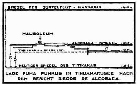
The Känomond continued to shrink closer to Earth through the interplanetary medium, orbiting the enormous sphere of its master more and more rapidly, while the sea rose ever higher. As the time of the tertiary satellite's independent existence was nearing its end, when it was only a matter of a few thousand years before it would be torn apart by the tidal forces of the Earth and fall to its surface, the last opportunity arose for the formation of the final shoreline of the fully flooded tertiary deluge basin. Fig. 11 designates this last shoreline, which also slopes from north to south above the Y shoreline, as Z. This Z-line is naturally not as clearly defined as the Y-line, nor could it be. Unlike the Y-line, the uppermost Z shoreline did not have a deceptive pause for its formation; rather, it owed its existence to the slower filling of the flooded basin near the end of the Känomond era. In reality, the Z-line is not a typical shoreline with wave-cut notches and firmly cemented lime bands; it is instead heavily eroded and difficult to identify in some places. However, it found a way to help itself be recognized. In the relatively calm and sheltered bay of the Andean asylum, there seems to have been a great abundance of common mussels, particularly piling mussels. As noted in the first section of this book, such common piling mussels are found in almost inexhaustible numbers along the uppermost Z shoreline at about 4300 meters above sea level, lying under the open sky, so much so that one can still shovel them away today, as part of a small-scale indigenous industry burns them into lime for construction. Since they were never subjected to any pressure or conditions that would compress or cement them into limestone, they have simply remained in place to this day. Large stretches of this mussel horizon in the mountains above the Meseta may still lie buried, as they were covered by mud for some time but were later partially exposed by rainfall.
The last crashing waves struck against the high-rising mountain heights, marking the final flood boundary of the Känomond era and creating the broad, washed-out, and intermittently disappearing uppermost shoreline, which is still visible today as the Z-line in Fig. 11 on the slopes of the shore mountains of the former great inland sea of Tihuanaku. This line, which has a gap in the south in Argentina and Chile, indicates that it once bordered not a lake, but a marine bay. The gap in the Z-line is no longer a mystery under the illumination of Hanns Hörbiger’s theory, as it remains for today's science and its theory of continental uplift and subsidence. No uplift or tilting of the South American continent was necessary to form this last and uppermost shoreline. No vertical movement or tilting created it, but rather the asymptotic filling of the flood basin, caused not by an unknown force rooted in the Earth, nor by an inadequate force like ice pressure, but by the enormous flood force from the cosmos, which, as a tertiary satellite, circled the Earth in just a few hours and, with its last increase in speed, fought against the inevitable break-up upon Earth.
Presumably, the last people of the tertiary satellite age, in those dark days just before the end of the lunar era, hid in caves on the eastern mountain slopes to protect themselves from the raging storms that swept across the Earth. It is also likely that the air ring enveloping the Earth at the equator began to rotate and tried in vain to follow the rapidly skimming Känomond, which swept closely over the Earth's surface. Thus, the last days in the "asylum" of the Andes were likely not pleasant, as the constant flickering between gloomy, cloud-covered brightness and pitch-black darkness brought no joy. It is believed that the people of that time were fully aware that a horrific catastrophe was imminent. And, as slowly as the cosmic clock ticked, the time came when the Känomond, torn apart by Earth's flood forces, broke apart. The first hailstorms of massive stones pelted the asylum, and within weeks, the Känomond had scattered its last remnants over the Earth's surface. Simultaneously, the bay of Tihuanaku began to drain in a flood-like manner, rapidly falling. With the Känomond's disappearance, the flood draw that had raised the waters of the Earth's oceans to such great mountain heights ceased, and the waters rushed in a flood towards the poles. The mud rain, which had fallen from the sky in massive amounts onto the seabed of the tertiary satellite, mixed with the draining waters and was mostly swept away by the flood running through the asylum. What remained of the moon's mud after the draining of the Andean sea was washed down the mountain slopes by rain and left on the Altiplano until today. The larger remnants of the tertiary satellite, the ore and metal mountains, could not be washed away; they sank immediately into the receding lake and still lie exposed on the plain today, as if they had not crashed down with such force. It seems likely that the lake water slowed their fall. One can also marvel at a whole "conglomerate mountain," as Posnansky in La Paz calls it, a mountain like a conglomerate rock, with the significant difference that this conglomerate mountain has been melted and fused on its outer surface. This mountain lies in an alien environment, as the soil of the Meseta consists of sand and gravel down to unknown depths and is covered only sporadically with tough pampas grass. The conglomerate mountain, with its melted crust, rests like a strange intruder, and one searches in vain for traces of burning in its surroundings. It lies directly on and in the unscathed gravel of the former seabed. From this, I conclude that the mountain, like a massive meteor, plowed through the air during the collapse of the proto-moon, heated to a glowing temperature through friction, and then fell into the Tihuanaku sea. The water, however, slowed the impact so much that the mountain did not penetrate deeply into the seabed and reappeared after the lake drained.
Even the aforementioned mussel horizons along the uppermost Z shoreline (Fig. 12) were buried temporarily or permanently, as clay mud sank through the receding waters of the Tihuanaku sea onto the ancient metropolis between the Andes, which had rested undisturbed on its seabed for millennia, and covered it once again. This did not happen on a massive scale; the lake was in motion. Its water not only fell, but also began to flow southward. While the draining flood poured uncontrollably over the rest of the Earth, the Andean lake took its time. It had to drain southward, but the outlets were not large enough to cause a catastrophic, all-destroying surge. The deep mountain bays had to empty, including that of Tihuanaku, but it was not nearly as fast as the world’s oceans draining toward the poles. Still, there was undoubtedly a strong current that carried away most of the collapsed clay mud from the area. By the time the heavy core masses of the tertiary satellite had also collapsed, the ancient city was already dry on its now truly and permanently slanted shoreline. However, it was covered with the gray clay mud of the Känomond ocean bed, resting safely and securely beneath this protective layer.
On the Meseta, the great inland sea of Tihuanaku had vanished, leaving behind a few water remnants in depressions that could not drain due to the mountain barriers. These were essentially the same bodies of water we see today on the high plateau between the Andes, around 4000 meters above sea level: Lake Umayo, Titicaca, Poopó, Coipasa, Uyuni, Atacama, and Askotan.
All these lakes, which were probably only slightly larger than they are today, now each had a horizontal water surface corresponding to the beginning of the moonless era. This was barely different from today, but it no longer matched the former horizontal surfaces of the old Y and Z shorelines. Even if the water could somehow refill the old boundaries, the water volume would no longer fit. The thought experiment from the first section of this book clarifies why the water levels of the remaining lakes now have a different horizontal orientation than they did during the tertiary satellite period.
Hanns Hörbiger’s theory of the World Ice also explains why the large lakes of the Meseta contain salty water and why their fish fauna is similar to, or identical to, that of warm oceans. Of course, it cannot be entirely the same after such a long period of climate change, which has dramatically altered the living conditions of tropical animals. A degeneration of the fauna was inevitable, but it did not prevent them from being recognized as tropical or subtropical.
Thus, the greatest mystery of the high Meseta—the presence of salty marine remnants at altitudes of around 4000 meters—is no longer a wonder. The slanted shorelines X, Y, and Z of Fig. 11 now plainly reveal their origins, and the salt lakes give us clear clues to the heights where the Earth’s ocean, pulled by the Känomond, once crashed against granite walls. They explain the mystery they once posed: why marine remnants with oceanic fauna and flora exist without marine sediments on the high plateau between the Andes, and why the surroundings of Lake Titicaca must be Paleozoic.
The author finds it difficult to believe that the logical consistency and coherence of this section’s argument could provoke too much opposition. Even if a specialist in any of the relevant fields were to discover inconsistencies in the details and raise serious objections, the request remains to consider the overall picture and, instead of condemning and dismissing the entire result due to individual errors, attempt to restore the larger outline based on better knowledge. Both the scientific critic and the author are in a similar position: both are likely to be laypersons in many of the fields discussed. Modern science is highly specialized: the geologist is rarely an archaeologist, the astronomer is rarely a paleontologist, and the zoologist is not an architect. The difficulty of this book lies in the fact that the problem of the Andean Meseta is a universal one, not a specialized one. Merely possessing exact geological knowledge will not solve the riddle of the Andean lakes and the Paleozoic structure of their surroundings. Therefore, one cannot take refuge in the statement, “I don’t understand other disciplines,” when evaluating these discussions. Even the author struggled with the lack of expert knowledge in most of the fields discussed. No single person’s life of diligent study could provide mastery over all the subjects presented here. Thus, the author had to limit himself to outlining his view of the origin of the Andean lake and its slanted shorelines, along with the Andean metropolis of Tihuanaku, in broad strokes. Whether this approach can withstand scientific scrutiny is a question that cannot be answered here. May the criticism proceed, especially regarding the interpretation of the ideographs on the Calendar Frieze of the Sun Gate at Tihuanaku, which will be discussed in the final section of this book.
The Sun Gate of Tihuanaku, Attempt to Unravel its Ideographs
"For a human lifetime, I have sought to penetrate the mysteries of this continent and its prehistoric metropole, yet I have not succeeded in going deeper than the width of a fingernail."
Professor Arthur Posnansky, La Paz 1928
The words that precede this section on the deciphering of the ideographs of the so-called Sun Gate of Tihuanaku outline the difficulties that confronted the researcher in La Paz when he tried, through the effort of his entire life, to interpret the riddles given to him by the prehistoric city on the slanted lake. These resigned words were spoken by the scholar at his Tihuanaku Institute in Miraflores, as he sat on a December evening in 1928 by the fireplace with the author of this book. Over the fireplace, the lonely German researcher in distant Bolivia had hung a cast of the Sun Gate frieze, so that he could always keep it in view. And back then, Mr. Posnansky, whose knowledge of American matters was remarkably vast, confessed that in Tihuanaku questions, he was considered an authority and that after thirty years of work, he was still stuck in the beginnings.
These words about being stuck in the beginnings referred to the content of the calendar frieze from Tihuanaku, which is inscribed on the Sun Gate and still awaits interpretation. Posnansky has found a possible interpretation and published it, and this interpretation will be briefly presented below. However, the researcher in La Paz is also aware that his interpretation is incomplete.
In contrast, the author of this book, who has found problems in the work of others and not least in that of Professor Posnansky, problems that, illuminated by a novel spotlight, seem to give up their problematic nature. Therefore, the reader should not expect new findings or archaeological discoveries in this section on the Sun Gate in Tihuanaku but rather a presentation of a different method, not previously practiced, to clarify and explain the factual material at hand.
Therefore, the proposal of an interpretation of the ideographs of the Sun Gate from a different basis than has previously been applied, should find friendly and above all patient ears. Patience, because the reader is asked to become familiar with a line of thought that is entirely new, whose understanding is essential for grasping what is to be presented. If this prerequisite is met, then the author believes and hopes that the reader, like him, will be deeply amazed and, perhaps for the first time, able to read the ideographs of the famous Sun Gate.
The object itself is at least briefly known to the larger readership, for in almost every illustrated magazine, in almost every travelogue describing Bolivia’s artistic treasures and antiquities, the Sun Gate of Tihuanaku has been shown and depicted repeatedly (see illustrations 31 and 32). However, neither an earnest attempt has been made to decipher the mysterious script nor, as far as the author knows, has anyone, other than Professor Posnansky in La Paz, dared to publish their views on the interpretation of the Sun Gate frieze. Therefore, it is likely that only the researcher in Bolivia deserves the credit for having brought some light to the mysterious symbols.
That there were nearly insurmountable difficulties in deciphering the script, no one knew better than the scholar in Bolivia, and his sigh, that after more than thirty years of research, he had not penetrated a fingernail's depth into the mysteries of the Andean metropolis of Tihuanaku, is fully meaningful and applies to the Sun Gate as well. And even though, after a long time, he now believes he has found the interpretation of the hieroglyphs of the Sun Gate frieze, he knows only too well that much remains dark, which must be left to his successors to clarify.
Before addressing Professor Posnansky’s attempt at interpretation, the present material must be described as concisely as possible, and the accompanying images will help clarify the description.
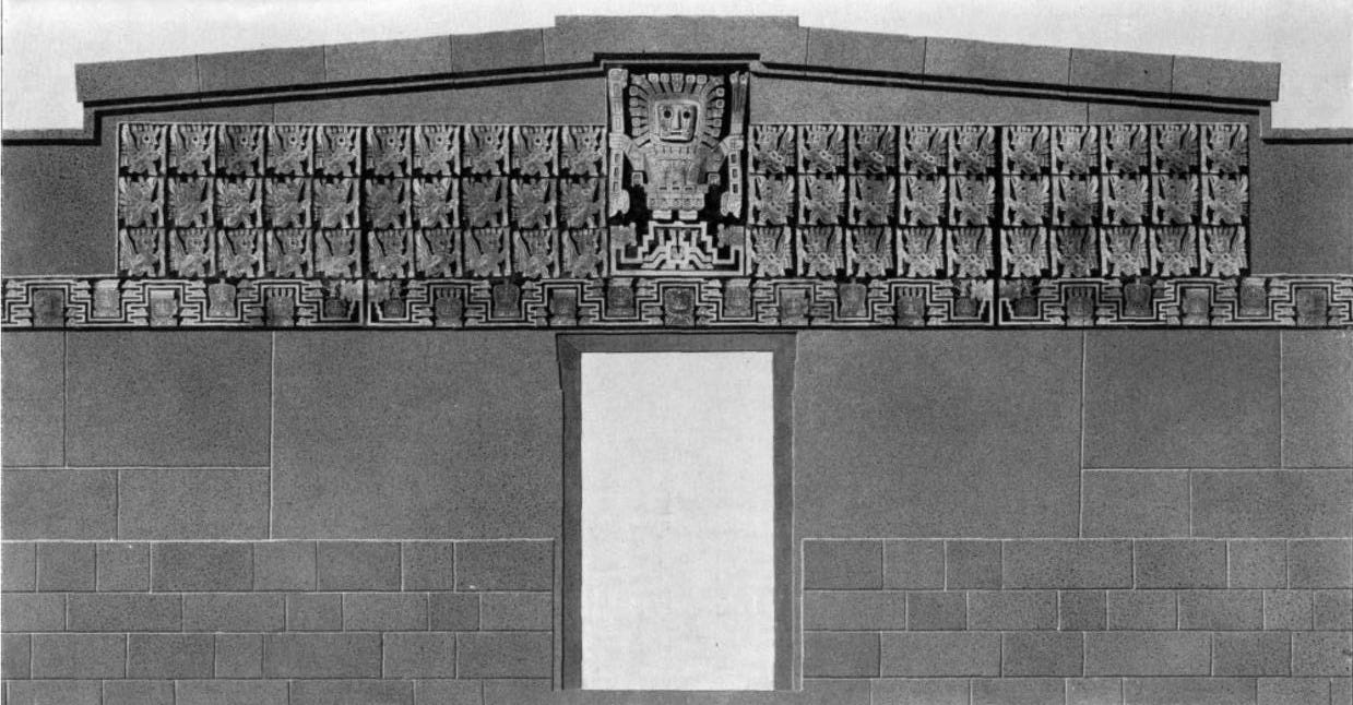
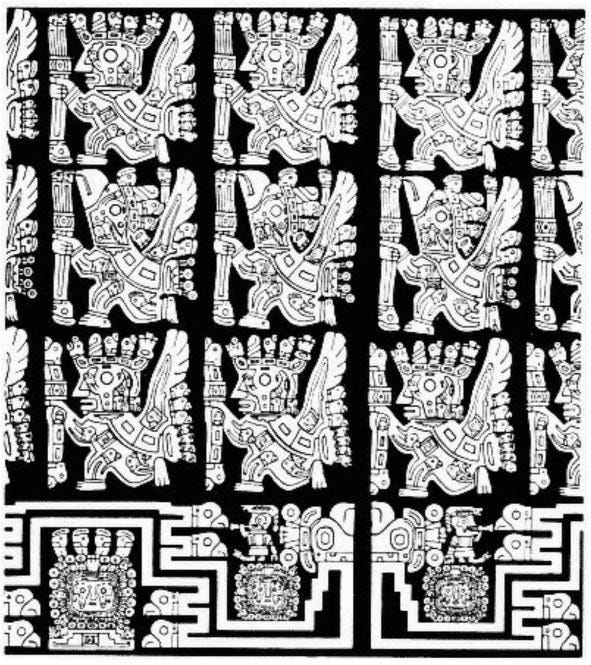
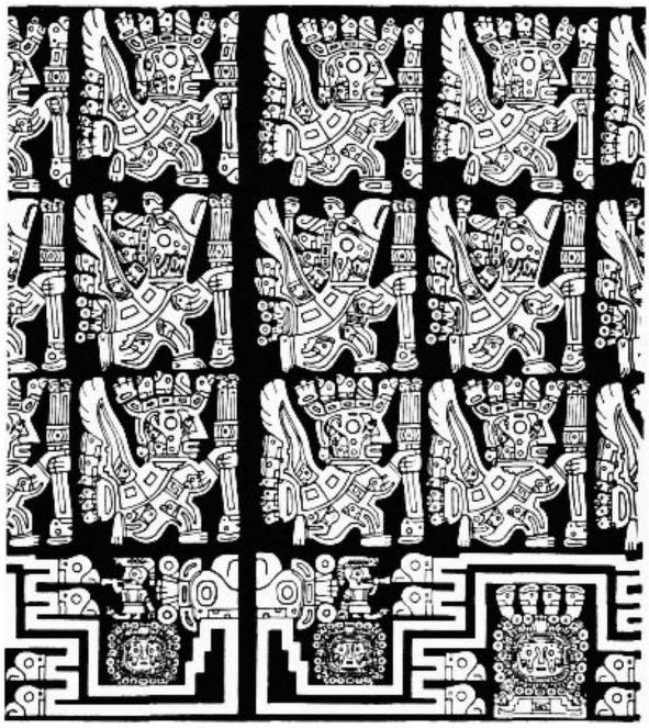
The so-called Sun Gate (figs. 30, 31, 32, 33, and 78) consists of a monolithic block of gray-green andesite lava, weighing about 10 tons, with a carved doorway of human height. Above the doorway is the frieze of figures, which, directly above the lintel, is enclosed by a meander band featuring stylized human faces in a continuous sequence, their eyes "winged," giving the impression of representing symbolic figures of flying movement, possibly of time. The meander band (figs. 81 and 82) has clearly visible interruptions, which are distinctly depicted in illustrations 78, 79, and 80 to draw attention to them. In the photograph (fig. 32), these interruptions are not as distinct, but by comparing with the drawings, they are easily identifiable. That these interruptions are meant to mark the end of a series is symbolized by each with a double-crowned condor with a head sharply directed outward, and the interruption by the vertically aligned head indicates the end of the meander bands on both sides. Immediately following on the left and right are vertically aligned condor heads, indicating the beginning of a new section of the meander band. Our description focuses on the pictorial representations and symbols within the middle section between the interruptions. The reasons for this will be explained below.
Within the meander band between the interruptions, human faces are laid out symmetrically, intertwined with the meander band and equipped with winged eyes. Each of these faces is surrounded by a radiant corona of symbols, almost like a wreath, and almost every one of these 11 heads bears a headdress composed of a series of repeated symbols that can also be found in organized groups around the faces and form radiant patterns. The middle radiant face in the meander band carries a kind of coat of arms, while the outer ones at the ends, crowned with double-crested condor heads, do not, but at the winged faces, a small human figure appears instead of a coat of arms, holding a trumpet in one hand and a human head in the other.
In the individual meander fields, there are always two pairs of uncrowned condor heads indicating the enclosed face in the respective meander section.
The meander frieze is not, as it initially appears, continuous in thought and design, for the idea doesn't come up because the aforementioned caesuras on each side interrupt it. These caesuras, which also clearly conclude the image groups of the winged scepter-bearers above, represent a thoughtful closure. Such an ending could hardly have been expressed more clearly with the means of a pictorial script.
The gate depicted in the photograph (Fig. 32) now shows clearly that the representations following the left caesura on the left side of the sculpture panel are indistinct and difficult to discern. Studying the original reveals that the figures on the left side of the left caesura are only suggested, carved with less care, and partially unfinished. This section of the frieze appears to have been carved at a later time, but certainly by a different hand, showing less skill. This left frieze section repeats exactly the mirrored image of the middle section between the two caesuras but suddenly stops, as the stone runs out. This suggests no further frieze sections were intended or executed.
The same indistinct sculpting is also visible to the right of the right caesura, on the right side of the gate, though it is more difficult to recognize in the photograph (Fig. 32) than on the left. Examination of the original clearly shows that the extensions on the right side were also worked later or by another hand and, like on the left, were unfinished. The relief on the right side fades out gradually, also unfinished. On both the left and right, the figures break off suddenly at the end of the stone. Here, too, the figures were unfinished, indicating that no further frieze sections were intended or executed. Evidence for this comes from the discovery of another gate from Andesite Lava at the Akapana fort, protruding from the ground. This gate also features a meander frieze with radiating heads, and the sculpture at this portal was not created by the same hand that carved the frieze of the middle part between the caesuras of the Sun Gate.
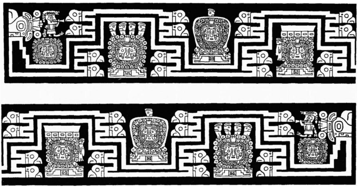
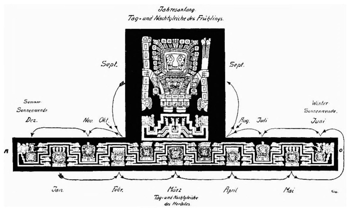
Since the difficult-to-recognize extensions on both the right and left caesuras of the Sun Gate either demonstrate another, less skilled artist or represent an incomplete addition, the discussion will focus only on the middle frieze section, which most likely represents the original portal decoration, as the side extensions are merely exact repetitions of the middle section and therefore offer nothing new. Furthermore, it will become clear during the discussion that the explanation of the middle section is sufficient to understand the meaning of the hieroglyph.
A twelfth radiating face, this one without a "crest helmet," like the assembled symbols above the faces with the winged eyes, is the main figure, with a strongly reduced human body carved, standing on a rich, stepped pedestal exactly in the axis of the doorway (Fig. 82). Like the other 11 body-less faces of the lower meander frieze, this figure’s head is also surrounded by radiating shapes arranged in a circle. Presumably, the gate owes its name "Sun Gate" to this radiating arrangement, as, in memory of the solar cult of the Incas and their predecessors, this gate was considered a sun gate, and the individual faces were regarded as representations of the sun.
In addition to the main figure, most of the 11 other faces in the meander frieze stand on stepped pedestals, also bearing multiple symbols, some of which match the symbols seen in the radiating circles of the winged faces. To the right and left of the described twelfth full figure, up to the caesuras, there are 15 rows of figures aligned, with a total of 30 figures in rows of 10, running either toward or away from the main figure depending on the perspective (Posnansky's view vs. the author’s view). These full figures show archaic artistic expression. The top and bottom rows carry human heads with winged eyes and crowns, some surrounded by radiating shapes, while the middle row features condor heads with similar assembled crests. All these figures hold scepters in their hands, depicted with wings, and their eyes are also winged, marked with what Professor Posnansky calls "motion symbols."
An unusual feature is not only found in these thirty figures but also in the main figure. They are all depicted with four fingers instead of five, and in the group of thirty winged scepter-bearers, their feet show only three toes. The ideographic signs, both individual and composite, such as the pedestals, the symbols in them, the rays, figures, crest helmets, etc., seem to be symbols drawn from the simple folk’s imagination, for they are essentially very simple signs.
Posnansky identifies 34 simple and composite signs or symbols. Fig. 83 presents the most important ones, especially those that are not composite signs. Based on the numbering of the signs in Fig. 83, the following offers a probable symbolic interpretation of the signs, with the author following Posnansky’s interpretations:
1, 2, and 3. Simply crowned, doubly crowned, and uncrowned condor heads. All three likely symbolize daylight and seem to all represent the same concept, namely "light."
4. Two condors lying opposite each other, a double sign. They likely mean the same as 1-3, but may also hint at the mating season of condors during the month when the crest was placed upon them.
5. Doubly crowned toxodon. This very likely represents the sun, as Posnansky considers this extinct animal a sun animal.
6. Condor symbol in the wing. The symbol of movement of light, time, or hour, used in the winged eye to indicate daylight.
7. Condor(?) on a crescent moon symbol. Meaning unknown. The curve over the moons may represent a condor.
8. Pedestal with condor sign and the so-called "male" sign. Likely symbolizes the pedestal for the monthly faces.
9. Human head. Likely represents "overcome enemy."
10. Puma head (with wide mouth). According to Posnansky, a moon-dedicated animal, representing the principle of evil.
11. Winged fish. Meaning unknown but will be examined later in connection with the days of the month.
12. Fish head. Symbol of the main food of the people from the sea, symbol of the moon, rain, and water.
13. The "female" symbol. Found on the pedestal, usually with male symbols, or on individual figures.
14. Uncrowned condor head. Symbol of the bringer of light.
15. Shell. Symbol of another food source from the sea.
16. Ornament framing the monthly faces. Likely no symbolic meaning.
17. Trident. Represents the toxodon, symbol of sunlight.
18. Toxodon head. Symbol of sunlight.
19. Winged eye. Symbol of vision.
20. Most frequent and perhaps most important symbol: moon, according to Posnansky.
From this list of "symbolic" signs, it becomes apparent that there are relatively few and simple symbols like "sun," "light," "moon," "fish," "shell," and "head." These symbols are repeated so often that they mostly serve as symbols, even in combination, rather than to express abstract concepts.
If, for example, several, about 5 different fruits are drawn on paper, the simple count of the fruits results in the number 5, but the symbolic meaning, however, is different, and the entire group of different fruits could also have the meaning of "still life." Similarly, the symbols on the Sun Gate seem to be used, so that the following interpretations could arise when interpreting the ideographs of the frieze:
Single signs as pure numbers - signs = 1 - regardless of their other symbolic meaning,
Single signs as symbols,
Groups of single signs as symbolic picture writing.
If these interpretive attempts also apply to the Sun Gate frieze, the following explanations aim to demonstrate this.
For the interpretation of the meander frieze and the symbols of the main figure, the signs surrounding the twelve faces are important, making them appear like radiant suns. Crests, headpieces, and bases of the individual faces and figures are preferably composed of the individual signs.
The back of the gate (Fig. 30 to 33) has larger and smaller niches on both sides above the opening, arranged in two rows one above the other, with the upper row of niches seemingly intended to extend along large stretches of the continuation of the wall. The evidence for this is a model from Andesitlava found near the mausoleum of Puma Punku, and the facade of niches clearly establishes this. However, for interpreting the ideographs, this is irrelevant.
Posnansky considers the frieze of the Sun Gate to be a stone-hewn annual calendar. It should be noted that this view can also be accepted from the perspective of global history.
According to Posnansky's interpretation, there are 11 "real" months in the narrow meander frieze directly above the doorway, framed by the double-crowned condor sections on both sides, as mentioned in the bilateral caesurae (Fig. 82). The twelfth main month, unlike the 11 others shown in full form, stands on a high, stepped pedestal precisely in the axis of the doorway (Fig. 82). The interpretation that these twelve months represent solar months remains unquestionable, as the division of the year into twelve parts is very obvious based on the faces in the frieze.
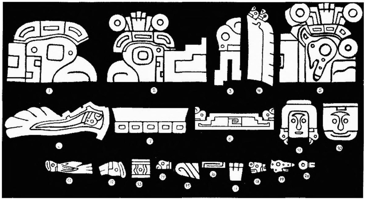
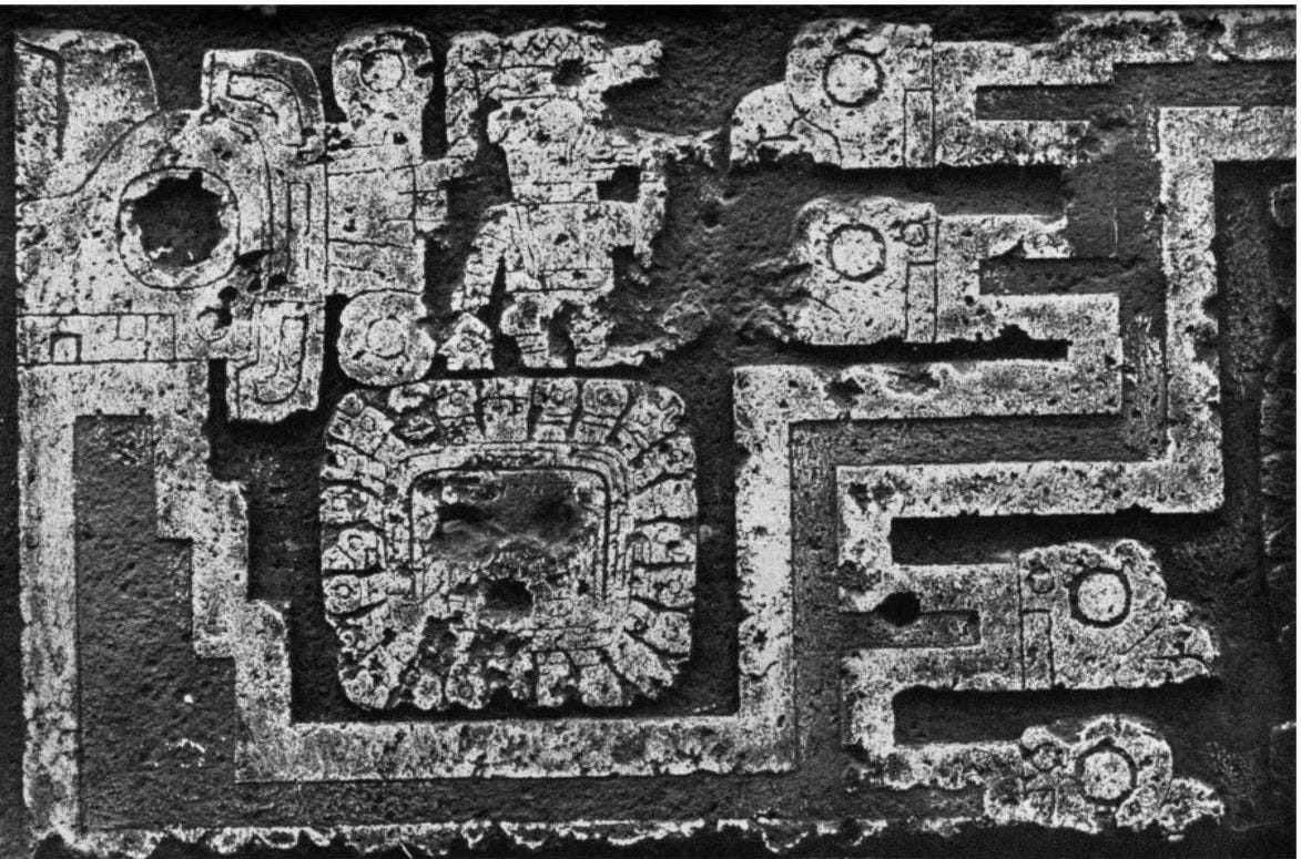
The prehistoric builder's script could not have depicted the division of the year into twelve months more clearly and understandably than it is. It results from the simple counting of the twelve faces.
The central main figure, according to Posnansky, represents the month of September, the month of the spring equinox of the southern hemisphere of the Earth. The smaller, similarly crowned month head positioned directly below on a stepped pedestal and in the narrow meander band must therefore represent March, the month during which the autumn equinox occurs on the southern hemisphere of our planet.
Accordingly, at both ends of the frieze – always up to the double-crowned condor caesurae – are the two solstice months, with December on the left side, marking the summer solstice of the southern hemisphere (on December 22nd to 23rd), and June on the right side, marking the winter solstice (on June 22nd to 23rd). Both are particularly significantly represented by armored and helmeted trumpeters who blow at the sun's turning point and hold in their hands the head of a defeated enemy who probably intended to steal the sun but was prevented just in time from his intentions. The long-drawn left foot of the trumpeter, drawn in a childlike way, clearly shows that the sun's march direction is now going backward again. Moreover, the tips of the outstretched foot carry a head of the holy solar animal Toxodon, leaving no doubt that this is the reversal of the sun because the Toxodon's head on the helmet of the trumpeter vigorously indicates a return (Fig. 84).
The belief that the twelve faces with radiant symbols represent the months of the year is due primarily to these solstice trumpeters, who leave no doubt about the nature of the meander frieze and the main figure. Without the trumpeters, one could raise objections to this interpretation, but the two trumpet-blowing figures give clear evidence, on the one hand, while the remaining signs on the stone calendar leave no room for further doubt.
The correct designation of the months, according to Posnansky, arises from the arrangement of the equinoxes and solstices. The numbering of the months between the openings of the meander band is very meaningful and surprisingly clever because it doesn't simply depict a calendar that indicates both solstices and both equinoxes while also making the other months legible in between.
It was no longer possible to align the months sequentially since the solstices and equinoxes would no longer lie correctly in the annual course. Instead, another, but equally clear, method had to be found to make the months readable. The ancient sculptor achieved this by using the meander band, which for its two purposes had the great advantage of opening once up and once down, so that in the counting of the months, a meander section could always be skipped (Figs. 78 and 82). Starting from January, Posnansky counts the month heads in the downward-open meander fields and receives, from left to right: January, February, March (vernal equinox of the southern hemisphere), April, May, then moving up to the double-crowned caesura condor head for June (winter solstice of the southern hemisphere), July, August, and extending into the main month of September (spring equinox of the southern hemisphere, marking the beginning of spring and the beginning of the year), October, November, and finally December (solstice of the southern hemisphere). For this review of the count, the use of Fig. 82 is recommended.
Thus, this method of counting the months presents no difficulties, and the style of representation is so clear and convincing that it is hard to imagine a better artistic expression of making both the individual months countable and clearly depicting both solstices and equinoxes in the frieze. The stone carver had no other possibility in his script to bring his thoughts into a table like this. And it is improbable that one could have invented any other pictorial representation in picture writing that recorded the months so clearly without abandoning the meander band.
This also simultaneously dispels the common assumption that this is a "Sun Gate" if one still adheres to today's prerequisites regarding the interpretation of calendars. In essence, it is a solar year with its "months," and the months carry the radiant crowns. It would also be appropriate to call it a "moon" or "months" gate, a solar-year or calendar gate, and if the term "Sun Gate" continues to be applied, it is only because this gate is famous in literature and folklore under this name.
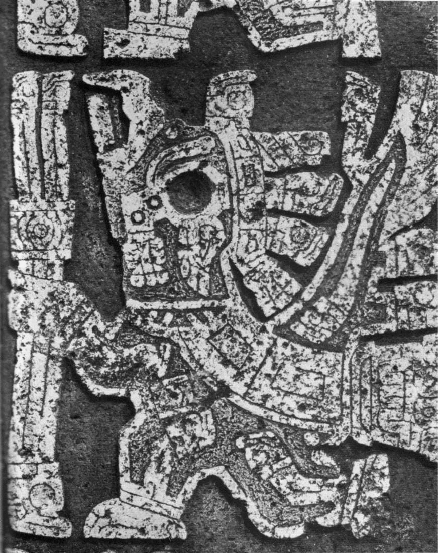
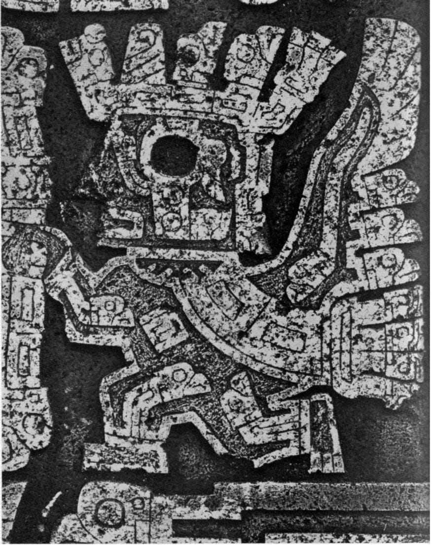
Since the interpretation of the months is so surprisingly simple and the division of the year is carried out so logically, after some practice, even the count of the individual months, starting from the bottom left through the downward-open meander fields up to the upward-pointing meander openings, poses no difficulties. One can hope that the calendar will continue to prove logically consistent and can be deciphered in the same simple and plausible way, provided no further information, such as the days, hours, or minutes, should be included. After all, the reading of the month calendar for the common man from the people of that distant era in their pictorial writing was particularly simple and clear, as shown, for example, when the sun passed over the southeast corner of the Sun Watch of Kalasasaya during the summer solstice, when viewed from the midpoint of the Sun Gate (Fig. 24). Since the gate stood over the observation point A of Fig. 22 inside the Sun Watch and was probably connected for a long time to the still-existing foundation, it was accordingly aligned with the sun's position at the summer solstice on the morning of December 23, when the trumpet blast of the December trumpeter of the summer solstice on the southern hemisphere came from the frieze. Likewise, during the solstices and equinoxes, the sun indeed passed over the midpoint of Kalasasaya and over the middle of the east gate, and thus the depiction of the two solstice and equinox months of the frieze, which lie exactly over the middle of the doorway of the Sun Gate, is accurate. The same thing occurred during the winter solstice when the sun rose over the north pillar of the east wall of the watchtower. This time, the June trumpeter corresponded to the turning winter sun.
Reality and representations on the calendar frieze thus correspond at least in these most remarkable months. At that time, the meaning of the old gate frieze was still unknown, and the continuation behind the condor caesurae no longer existed, the observer recognized that when the sun passed, the departure of the sun was over, because with the caesurae, the frieze ended on both sides.
To find further interpretations of the calendar, Posnansky now began searching for the number of days in the year, as anyone would do, who had already found the months. He had to search for the number 365, the number of days in our solar year, and had to try to determine whether these 365 days could be recorded in groups of 30 or 31 days or perhaps even 28 or 29 days somewhere in one of the months. The allocation of days for leap years probably wouldn't have even been required for such an ancient calendar, and it would have been enough, and much for the calendar knowledge of that prehistoric time, if the correct number of days for the years had been included in the stone table.
Of course, Posnansky immediately sought the days where they logically belong and where there was enough space for the stone carver to place the correct number of days, even with small deviations such as 30 one time and 31 the next, etc., namely on the monthly faces.
But here, completely unexpected difficulties arose, discrepancies of a very special kind, as there are calendar details that are simply incorrect by today's standards. These difficulties could not be mastered by Posnansky and will not be mastered by any person who, like the solar year with its current 365 days, must stick to the idea of hours and minutes that has existed since humanity has known them.
The reader is asked to first follow the same path as the author, who logically counted the days of the year.
This path leads through the months, where the days must be placed in order to total, when multiplied by 12, the total number of days in the year.
So, we begin counting, as we are accustomed to, and as we know from our paper calendars, with January. On the stone calendar from Tiahuanaku, this January is the second month head from the left caesura (Fig. 89, 96, 81, and 82), with its stylized face.
Since all months, except for the solstice and equinox months, wear crests, it is possible that these simple symbols are meant to represent month names, such as "January," "February," and so on. This possibility is admitted. For example, the four fish over the head of the January month symbol could mean the "Fish Month," that is, the month when fishing in the lake of Tiahuanaco was especially favorable. It must be acknowledged that the symbolic meaning of the individual month crests, in their various compositions, remains unknown. The fact that these symbols, however, can also be read as pure numerical values is of great significance, as will be discussed later.
The result of our count is also that we found 24 ray symbols around the heads of the months twelve times, and in two months, an "additional" fish, which credibly and logically increases the number of days to 290. Since it is very striking for anyone who has sailed across a tropical sea when such a flying fish suddenly slaps onto the deck and simply adds itself, it seems justified to assume that these two fish were indeed thought of by the sculptor as "additions." However, the result is not yet bold enough to say whether it is now 288 or 290 days, which we could deduce from the annual calendar; we will see whether the year has 365 days.
With these lines of thought, which the reader has likely followed along with, one would come close to the solution of the sun gate hieroglyph or would have already achieved it, as the author himself struggled with the 288 and 290 symbols, and we know that Professor Posnansky did the same. It seems that anyone who has engaged with the day-count problem has encountered difficulty and Posnansky found himself hopelessly stuck.
In a publication by the scholar on March 30, 1930, in the newspaper "Diario" in La Paz, Bolivia, Posnansky therefore refrains from explaining these 12 x 24 = 288 symbols, which according to more recent assumptions do not appear to be day symbols. He lets the matter drop and suggests another interpretation based on a different foundation, which is why this new interpretation of the calendar will be discussed next.
Posnansky had attempted to interpret the three rows of figures (Fig. 78, top, right, and left of the main figure) as thirty human and semi-human figures with wings, to be counted as days, but even here the number of days, namely 30 x 12 = 360 days, was better, though still not accurate with the actual 365 days of the year. The sculptor would have done better and acted more clearly for the people if he had attached the days to the months where they belong, and only then perhaps sketched out the hours above the meander frieze to the right and left of the main September figure. Because the hours would have been too small in scale to be attached to the monthly symbols. The artist must have known, as we do today, that the days belong to the months and not the hours to the months. Why, then, didn't he attach the days to the months, where only 24 or 25 symbols were needed? 25 figures in the ray circles, where there are 30 or 31 depending on the number of days in the individual months? Artistically depicting this was clearly a challenge, especially for the months with 31 days, as well as the month with 28 days. It was certainly not easier to depict 30 or 31 day symbols instead of 24 in the circle.
So, we proceed to interpret the calendar as counting and explaining the twelve months of the year with their solstices and equinoxes, along with their solstice months. Everything else remains unclear and will remain unclear under the circumstances we are accustomed to today, thinking we must believe what we have always thought. Yet, it is hard to believe that an artist, who solved the representation of the months so brilliantly and clearly, would not have been able to also fit the days correctly into the months, especially since this task is much easier than the representation of the months with their solstices and equinoxes.
It seems, then, that he was unable to do so.
If Professor Posnansky still published the interpretation in "Diario" on March 30, 1930, then in my view, the interpretation of important parts of the calendar frieze failed, with the exception of the interpretation of the months, which of course claims correctness, and their interpretation should not be diminished. After all, he remains an honored pioneer. The neglect of 288 versus 290 ray symbols around the twelve month heads, as well as the further neglected 157 symbols in the monthly frieze, and then another 660 neglected individual symbols in the decade-week frieze, leaves several significant unknowns, which remain unresolved, since with conventional methods of modern calendar science, no interpretation can be found.
Instead, a different theory is now proposed, which may initially seem very strange, even bewildering, and there is a request not to immediately put the book down. It may at least be entertaining to follow the thoughts, even if it is not meant to be taken seriously at first glance, as it may possibly be an unexpected truth.
The author presents the following theory:
The sun gate frieze of Tiahuanaco represents a calendar with 12 year sections. Solstices and equinoxes are represented on the calendar.
Each of these 12 sections has 24 days, only February and April have 25 days.
Each of these days has thirty hours.
Each of these hours lasts 22 minutes.
Again, the reader's patience must be asked for. Also, the request not to immediately call the doctor after reading the four points of this theory to have the poor author taken to a cold water treatment facility. He assures that he is healthy and that it is not easy for him to suppress a broad grin at the emerging, potentially deadly laughter.
What follows in the subsequent section, on glacial cosmology, is not fabricated, but rather calculated with overwhelming enthusiasm for the creator of world ice, powerfully and mysteriously, and results inevitably from the outcomes of the second section of this book.
The author was also, like Professor Posnansky, faced with the puzzle of the sun gate frieze, and never intended to decipher its symbols. He had only studied the results of Posnansky's work and, during many conversations on the subject, learned part of what Posnansky had gathered on the topic during his life.
After a deep immersion into the material while in South America and back in his homeland, the investigation into the Sun Gate frieze was put aside until the examination of what seemed like an entirely different field—namely, the characteristics of ancient shorelines on the highlands of Bolivia and Peru—took an unexpectedly surprising turn.
From the previous section of this book, it is known that the city of Tiahuanaco, during one of its main building periods, was located on the shores of a large Lake Titicaca. The still-existing harbors of this city indicate a period of intensive seafaring on this lake. At the same time, it should be remembered that the lake's waters "tilted" within the boundaries of the shoreline, beginning at Puno on the shores of Lake Titicaca in the north and gradually sloping towards the south, disappearing in the salt deserts near Oruro in Chile. The lake was not really "tilted," as today's shorelines suggest, because the Earth's axial norms were displaced by the presence of a now-extinct Earth satellite.
If we were to bring our current moon to about six Earth radii from the surface, we would see that the basin of the lake would shift again, filling the lake's basin once more, allowing water to flow southwards again. The lake would no longer be "tilted" but would instead appear completely "level."
This observation is only intended to remove the mystery of the once "tilted" shoreline of Tiahuanaco for some readers. Even though the shoreline itself has not changed position, its shape, direction, and extent were influenced by the gravitational forces of a nearby tertiary satellite in much the same way as they are today. In this sense, the forces responsible for tidal floods during this period and the fluctuations of the water levels are very much like what we see today with the tides of the ocean. At the same time, the symmetry of the lake’s water levels provided a sense of balance for life in Tiahuanaco.
Today, however, the shorelines appear shifted due to the influence of tidal forces from this past satellite. Consequently, the idea that South America's landmass has either tilted or risen is no longer necessary to explain these changes.
When considering the shoreline Y (Fig. 8, 11, 12) and the balancing forces of tides during this period, the author acknowledges that admitting the existence of the oldest parts of the city, dating back to the pre-lunar age, raises the question of whether the city could be that old. According to this assumption, such a city would have to possess an age stretching back to times that are completely unknown. Even followers of the World Ice Theory might agree with the thought that what modern scholarship asserts publicly—that South America tilted southward at some point in relatively recent history—was actually caused by tidal forces related to this moon. However, what is left today are the remains of harbors that once bordered a narrower body of water, likely shaped by the gravitational forces of this now-extinct satellite.
The author, too, cannot avoid confronting this idea. The compromise analysis of the shoreline formation, according to the findings of the World Ice Theory, leads to the result that the oldest facilities in Tiahuanaco, particularly its harbors, necessarily date from the pre-lunar epoch. Even based on an initial, superficial estimate, the incredible age numbers that emerge from these observations weigh heavily on the author, pushing him to revisit the data again and again. A public attack against this publication, published in "Schlüssel zum Weltgeschehen" (Issue 9), failed to discredit the evidence. The geological proof attempted in the second section of this book aligns closely with the conclusions presented in the "Schlüssel," where Hanns Hörbiger enthusiastically supported the assumptions of the World Ice Theory. The overwhelming age of Tiahuanaco’s harbors, although hard to believe, demands that the issue be revisited from a new perspective.
Perhaps we do have other evidence for the great age of Tiahuanaco, proof that might have nothing to do with the World Ice Theory.
Could it be that the ancient inhabitants of the metropolis themselves left us an unequivocal piece of evidence—so that we might say, "Look, the ages of the city according to WEL (Welteislehre) calculations are false by millions of years"?
One such piece of evidence could, in fact, be the astronomical knowledge that the people of Tiahuanaco possessed, information that would later come into the hands of the observers of the Kalasasaya observatory. Though Professor Posnansky's calculations were based on more recent observations, which were somewhat unsatisfactory, it is worth considering whether these assumptions, on some other basis, might be completely different.
That would explain why the Sun Gate of Tiahuanaco still remains today. We know that it carries a calendar, but in some cases, what it appears to show is not consistent with modern logic. When we consider the twelve solar-ray adorned heads on the frieze, it’s clear that this part of the calendar identifies twelve distinct months. They name the two solstices and equinoxes, as well as the turn of the year, regarding the conditions of the southern hemisphere of the Earth. However, when it comes to the precise number of days in a year, Posnansky’s analysis fell short, and the sun cult’s researcher in La Paz was forced to reconsider. Apparent discrepancies surfaced, as Posnansky himself exchanged doubts about whether this frieze even represented a calendar in the first place.
Therefore, the author now rightly has the opportunity to present his interpretation, even if it were one among many. Since this interpretation was developed through long collaboration with Hanns Hörbiger and ultimately received the endorsement of the creator of the World Ice Theory in Mauer, it should at least be considered within WEL circles.
If the figures and symbols of the Sun Gate truly represent a stone calendar, it must be demanded that the calendar be accurate and readable, as otherwise it would serve no purpose. From this, it follows that the stone calendar, as we are led to believe and compelled to read today, contains much nonsense and is largely incorrect. The stone calendar from Tiahuanaku is today not fully comprehensible to us, the people of the lunar era, especially if we consider lunar conditions. It is pointless to struggle with it further. The author has spent a lot of valuable time trying to decipher the secrets of the calendar from his lunar standpoint.
We therefore want to attempt a different approach. What time must a calendar indicate if found in an ancient city? Everyone would probably answer that such a discovered calendar must indicate the time that was valid when the corresponding ancient city was built or inhabited. Thus, we could deduce from a calendar discovery in an Italian city around the third century AD based on the Julian calendar, and we would probably be right. Similarly, we could infer from a calendar printed during the time of Frederick the Great found in any archive of any Prussian city, based on the Gregorian calendar.
The author argues with the same right: If a stone calendar is found in the city of Tiahuanaku on the highlands of Bolivia, it is a Tiahuanacan calendar and not a Julian or Gregorian one. The Tiahuanacan calendar reflects the time conditions and divisions common at the time of construction or the heyday of the ancient city of Tiahuanaku and accurately represents the yearly division, the number of days in the year, possibly even the months, namely the true months corresponding to the actual lunar cycles of that time.
Our modern calendar, despite its high precision in this respect, is somewhat unreliable. It recognizes twelve months in the year, but as every schoolchild knows, we actually have thirteen lunar months in a year! Our modern calendar does not even clearly indicate the number of actual lunar cycles; it merely marks the relevant days with small crescents or omits them entirely. Our calendar restricts itself to stating the twelve segments, inaccurately or at least imprecisely called "months," and the number of days, which we well know to be 365 in a year.
Using the theory of the World Ice Doctrine (WEL), we now have to determine how the calendar conditions were at the time of the post-stationary equilibrium between advancing flood mountains and leading belt high floods. The following questions need to be posed and answered:
Was the solar year during the Tiahuanaku era as long as it is today?
Did the solar year of Tiahuanaku at that time have 365 days or more or fewer days?
Was the length of day the same as today, or is it possible that days were shorter or even longer than today?
Was the solar year at that time divided according to actual lunar cycles into true months, or did they do the same as we do today, dividing the solar year into a number of segments? Perhaps in twelve, as we do today, or in more or fewer?
Did they indicate on the ancient calendar the actual number of lunar cycles, thus the true months in a year, or did they omit it in the same way as we sometimes do today? Perhaps only marking certain days with small moon symbols as we often find in our modern calendars?
These five questions seem very peculiar. We have known for ages our calendar with the solar year of 365 days divided into twelve segments, inaccurately called "months," without them being actual months! Nonetheless, these five questions must be posed to do justice to the stone calendar from Tiahuanaku. It has an absolute right to this question. It stood and stands amidst the old metropolis by the slanted sea and must therefore be addressed from this position and origin. It has the right that the skewed shoreline and the time of its creation be related to the stone calendar, as the Sun Gate is only a few hundred meters from the old slanted shoreline, thus having a close connection to it. We demand in Germany from the Julian calendar that it align with our customary division of time. What is right for us must have been just for the inhabitants of the ancient city of Tiahuanaku.
Before we proceed to answer the above five questions, let us clarify what kind of calendar would have existed in the post-stationary era if we base it on the WEL.
We use the two drawings from the WEL office in Mauer near Vienna, which we got to know in the second section of this book, along with the legends and calculations on them, namely drawings No. 531 and 533, shown in Figures 87 and 88. Hanns Hörbiger created these drawings in August 1927. Sheet 531 (Fig. 87) illustrates the pre-stationary to stationary stages in the Tertiary cataclysm, which I discuss in connection with the drawing No. 152 in Hörbiger-Fauth's main work on page 367 of this book.
Sheet 533 (Fig. 88) shows the post-stationary stages, which seemed particularly characteristic of Hanns Hörbiger, and also addresses the Tertiary cataclysm, the precursor of the lunar predecessor. It should be noted again that both drawings were created in 1927 and that Mr. Fauth and Mr. Voigt announced them during their research trips in Denmark between 1928 and 1929. The calculations of the stages of the Tertiary cataclysm by Hanns Hörbiger were thus made independently of this trip and before all other events.
Hanns Hörbiger provides in these drawings for each stage of the Tertiary cataclysm some details, among which we are particularly interested in the calendar of Tiahuanacu, especially the information about the lengths of days (T = day length in current hours), about the lengths of months (Mt. = month lengths in lunar months), and finally about the lunar month distance, measured in Earth radii (r = arc). From geological considerations, we concluded that the formation of the Y-strandline, at which the city of Tiahuanacu with its ports and its Sun Gate is located today, occurred during the next pre-stationary equilibrium epoch. Thus, we are particularly interested in stage 24, possibly also stages 23 and 25 around this time, as the ongoing flood peaks and the leading belt high flood had to merge into the prevailing belt low flood at this time. Such a conjunction could only have occurred at stage 24 of drawing 533 (Fig. 88), as the circulating lunar month was only 5.9 Earth radii away (R = 5.9 of the legend on the left at the edge of stage 24) and it orbited the Earth in 19.6 current hours (Mt. = 19.6 h according to the legend).
At that time, we had a nine-and-a-half-month month. The moon thus orbited the Earth faster during a rotation duration of 29.4 current hours (T = 29.4 h according to the legend) by about ten current hours daily. This is already intuitively the time when the sluggish water mountains simply could not keep up and had to gradually merge into the prevailing belt low flood.
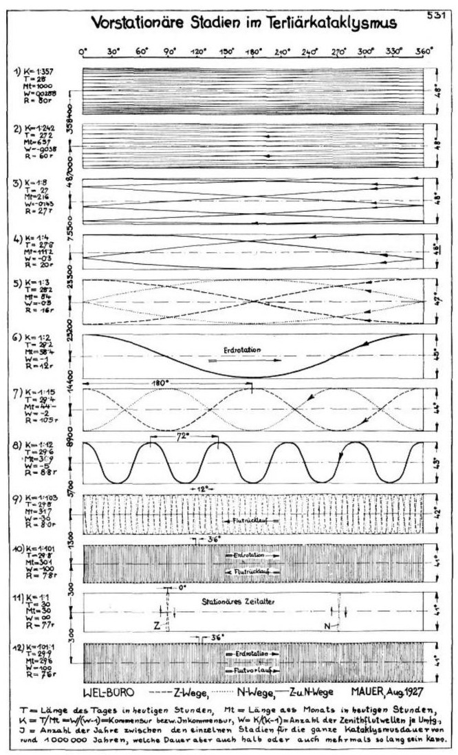
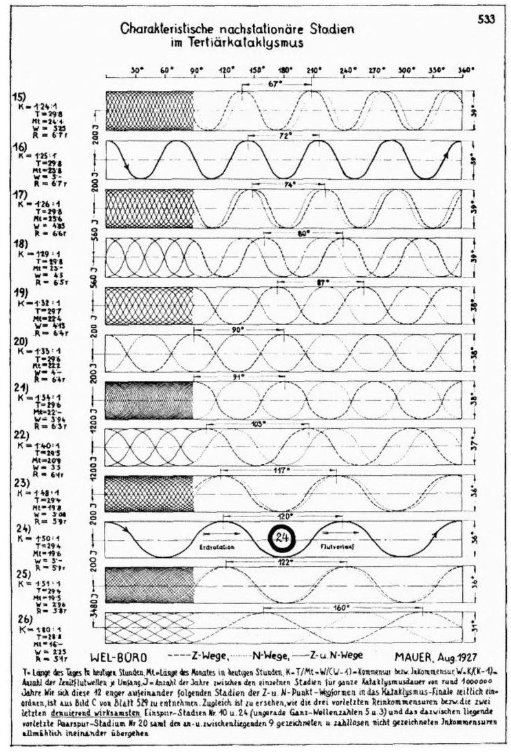
That they still had to follow the daily oscillations of the hastening moon, albeit already weakened, should only be mentioned briefly, because it underlines the necessity that the Tihuanacu bay along the Y-strandline had to have a north-south orientation, and a tight, almost river-like and southward directed entrance, as it indeed must have existed to protect against the sprawling, abrading shore breakers of the advancing equilibrating waters out in the open ocean. Figure 8 shows the frequently mentioned Y-strandline as it cuts into the former seabed south of Oruro. The bay was thus nearly enclosed and may have only had a narrow exit to the south, which effectively intercepted the inflow of floodwaters from the breathing ocean, keeping the flood variations within the Tihuanacu sea basin limited.
In Figure 88, the equilibrium stage 24 is marked with a bold circle, as it approximates the Tihuanacu stage of the slanted Y-strandline. According to the legend on the left at stage 24, the duration of the day was T = 29.4 current hours. This indicates that during the equilibrium period of the Y-strandline and the port and Sun Gate city of Tihuanaku, days were longer than they are today, as currently a day is known to have 24 hours, not 29.4 hours. This is also quite understandable when considering that the pre-stationary receding flood had slowed down the Earth's rotation for long millennia, and that the effective propulsion of Earth's rotation, initiated by the advancing flood mountains and which was yet to be fully effected by the water masses of the beginning advancing belt high flood, had not yet advanced Earth's rotation to the current 24 hours. The lasting effect of the immense "belt high flood watermill" was still to come, and thus during the time of the Tihuanacu Y-strandline, Earth's rotation occurred in a still slow manner, taking 29.4 current hours. Therefore, the days of the post-stationary equilibrium were considerably longer than today, and since the number of hours in a solar year — which practically had the same length as today — measured in current hours was then as now 8760 hours, it is clear that based on Hörbiger's calculations, the Tertiary solar year at the time of the post-stationary Tihuanacu equilibrium must have had 8760 / 9.4 = 298 longer days and not 365 shorter ones, as is the case today. These longer Tertiary days also fit into the solar year without significant remainder, just as the shorter days of today do.
If the day lengths were completely different from today, the lunar orbit in the solar year showed even greater differences from today. In our time, Luna does not orbit the Earth quite thirteen times in a year, but during the time of the Tihuanacu Y-strandline, it orbited significantly more often! The legend in Fig. 88 at stage 24 shows us the duration of a lunar orbit around the Earth in current hours, namely, it was 19.6 hours in stage 24 of the Hörbiger drawing. This means that the lunar month in the twelfth part of the year, which we can no longer misleadingly call a "month" as we inaccurately do today, orbited not less than about 37.2 times, and calculated annually, around 447 times! At an Earth proximity of the Tertiary moon of only about 6 Earth radii distance (R = 5.9 r from the legend at the edge of stage 24 in Fig. 88), the inhabitants of Tihuanacu might have experienced about 200 solar eclipses and possibly as many lunar eclipses in a year! Summarizing the mentioned conditions at the time of the Tihuanacu Y-strandline once again:
Question 1. Was the solar year then as long as it is today? Answer: Yes, because the slight shrinkage the Earth's orbit has undergone in the few million years until today due to resistance in the interplanetary space can be disregarded.
Question 2. Did the solar year back then also have 365 days or did it have more or fewer days? Answer: It had fewer days, specifically 298 longer days according to stage 24 of the Hörbiger drawing 533 (Fig. 88). Since the solar year then, as today, had 8760 current hours, the number of Tertiary days is calculated as 8760 divided by 29.4, approximately 298 longer Tertiary days.
Question 3. Was the day length T then the same as today, or is it possible that the days were shorter or even longer than today? Answer: The days were longer than today, and therefore the solar year could not have our 365 days but only about
Question 4. 298 days, but each day was individually 5.4 current hours longer than today's days. Was the solar year back then divided according to the actual lunar orbits into real months, or did they do the same as today, dividing the year into a number of sections, perhaps twelve? Answer: Whether a division into real months, i.e., actual lunar orbits, took place is not evident from Hörbiger's calculations. However, it is unlikely they did this, as a calendar division into about 447 lunar orbits, thus a much greater number than there were days in the year, would have been quite impractical. They probably refrained from doing so and may have based the division on the number 12, just like today. It is entirely possible that the zodiac signs were used for this purpose. Whether such a division of the solar year into twelve parts occurred will be seen later in the discussion of the stone calendar of Tihuanacu.
Question 5. Did the ancient calendar indicate the actual number of true lunar orbits, i.e., the true moons or months, or did they omit it in the same way we sometimes do today? Answer: This is also not apparent from Hörbiger's drawing No. 533. There, only the lunar orbits per year are included, calculated from the lunar orbit in current hours (Mt = 19.6 h of stage 24). Whether the calendar carver of Tihuanacu indicated the actual number of lunar orbits, the true moons or months, will be seen during the renewed discussion of the Sun Gate calendar based on the insights of the World Ice Theory.
We have now found the basis for unraveling the calendar from the WEL geological finding of the slanted Y-strandline of Tihuanacu and from Hanns Hörbiger's calculations about the post-stationary calendrical state, and we can now turn to the WEL discussion of the calendar itself, which was a calendar from Tihuanacu and not one of the present time.
During the discussion of Posnansky's interpretation, we saw that the calendar was laid out in tabular form and that the meander frieze had to be used to place the solstices and equinoxes at the correct positions. This was also practical because, as we have seen, the Sun Gate in the Kalasasaya was positioned so that at the time of the equinoxes, the sun was exactly over the center of the Sun Gate, also over the center of the equinox figures of March and September, and the sun deviated northward and southward during the solstices in the same way as the solstice trumpeters stand north and south of the center figures. We acknowledged that Professor Posnansky succeeded in interpreting the twelve annual segments with their solstices and equinoxes as well as the year and spring beginnings, but we were of the opinion that his interpretation regarding the days and other calendar details was not satisfactory. And what did not satisfy us here was significant! We are still waiting for the interpretation of the 290 wreath signs directly connected to the heads of the annual twelfths, 157 individual signs on the actual calendar table (Fig. 82) remain unexplained, and the interpretation of another 660 independent signs on the thirty winged and running scepter bearers of the special table to the right and left of the main figure of September, which Posnansky thought represented decadal weeks, is still missing. Not only the numerical clarification but also the symbolic interpretation is still lacking, though it must be admitted that interpreting symbols can be tricky. Therefore, on the entire relief of the Sun Gate, there are 1107 independent signs that have not yet been interpreted or counted. These independent signs, which are almost without exception mounted on stalks, give the impression that they must be counted in the same way as Posnansky counted the individual coronal heads and the thirty scepter bearers, because surely a calendar must be a counting calendar, as is the case with all calendars. We cannot therefore disregard the 1107 signs that have not yet been counted or even explained without attempting to incorporate them all into the calendar as numerical signs—sign = 1. Only in this way can we do justice to the calendar as a counting calendar.
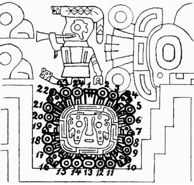
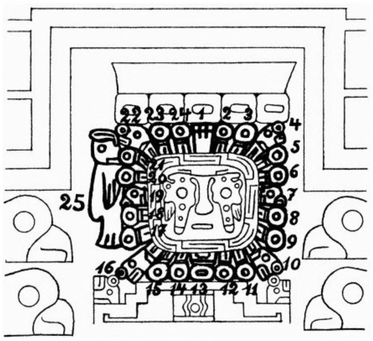
In conclusion, we note: The stone calendar from Tihuanacu lists 290 days for the solar year.
Further, we note: The twelfth part of the year, incorrectly called a "month" today, had 24 longer days than today, except for February and April, which each had 25 days.
Thus, the puzzle of the stone calendar's days, a puzzle that gave Posnansky such great difficulty that he eventually came to believe that the wreath signs, despite their high number of individual symbols, must mean something symbolic, like the positions of the zodiac signs in each year's segment. With the key of the World Ice Doctrine, the clarification becomes simpler and, I hope, more convincing. The calendar indicates the correct actual numbers for the days at the correct places, and the symbolic meaning recedes into the background, at least for now.
Now, to the real months!
Did the calendar also indicate them?
A glance at the exceedingly large number of independent simple and compound symbols shows that this is not initially apparent. If we want to search for the real months, i.e., the moons or lunar orbits around the Earth on the calendar, we must first understand approximately how many lunar orbits of the Tertiary moon there must have been.
Since the solar year, then as now, had approximately 8760 current hours, it contained around 447 months during the time of the Y-strandline in stage 24 of drawing 533 (Fig. 88). These were real months, actual lunar orbits, not false months as today, that is, those that do not correspond to the moon's orbit. Given that during the time of the Y-strandline there necessarily were 447 orbits of the already very Earth-near, shrunk to about 6 Earth radii Tertiary moon per solar year, it was presumed that these lunar orbits as real months might also be readable on the stone table of the Sun Gate of Tihuanacu.
Placing this high number of real months on the calendar frieze seems at first glance nearly impossible without condemning the whole table to opacity, and the task was truly not easy for the sculptor of the Tertiary period if he wanted to make the number 447 readable somewhere, and indeed in his sign-pictorial script, always maintaining the principle that one sign equals one.
We modern humans have it easier. We simply write three numbers next to each other, namely 4, 4, and 7, and the number 447 of the real lunar orbits is legibly displayed in a small space.
The sculptor of the Tertiary period had to proceed differently. Having already depicted the number 12 by repeating the twelfth segment of the year twelve times, and by placing the solstice trumpeters, he also alerted the illiterate that they were dealing with an annual calendar. Furthermore, he placed the 290 day signs around the faces of the twelfths in groups of 24 or 25 symbols, so he still had the challenging task of somehow incorporating the large number 447 of the real months into the calendar. And if this was not clear enough, he had the task to clearly and distinctly indicate how the months should be read and counted, for the entire year as well as for each individual twelfth. If it was possible to provide all, or at least one or the other of the twelfths with the real months, this could not be welcome enough for understanding.
Thus, for each twelfth, 447 / 12 = 37.2 independent individual signs needed to be placed as the number of actual lunar orbits. That this was not possible due to lack of space for most of the small twelfth faces within the meander frieze is clear. Sufficient space for this was only available on the full figure of September, which, beneath its sign-encircled head, still had the body lacking in his 11 siblings in the meander, and on which the necessary large number could be accommodated. And since fractions are not expressible in pictorial script, or only with great difficulty, instead of 37.2 lunar orbits, only 37 or, counting the beginning of the thirty-eighth orbit, 38 numeral signs had to be represented.
The reader is asked to verify the numerals highlighted in dark and provided with counting instructions in Fig. 91 and compare them also with the photograph of Figs. 93 and 94, which represent the same September section. On September, we already know the 24 day signs lying in the wreath around the face. Besides them, we find on the body and on the scepters of the full figure of September 38 independent numeral signs. This number must stand out as it almost exactly matches the above-calculated number 37.2 for the lunar orbits per twelfth. Knowing that representing fractions in pictorial script is difficult, we can speak of a full match. For now, the reader might still think it quite arbitrary not to count the 24 known day signs in the head wreath of September, but will later realize that these 24 day signs, indeed per the sculptor's instructions, are not to be counted. More on this instruction will be discussed later.
Let us stick with the found 38 further signs for now. We suspect that the Tertiary sculptor managed, at least on the September twelfth where there was sufficient space, to place the number of real lunar orbits, i.e., the months, for the September twelfth. The discovery has, of course, no evidential value for now, as it might just be a strange coincidence that deceives those who insist on reading something from an ancient artwork at any cost! And for now, we also lack any definitive indication that the sculptor actually meant these 38 signs to represent the months and not something entirely different. That the same number 38 could not be placed on the small heads within the meander frieze is immediately apparent, and we save ourselves the effort of searching for something like that from them. But once we've entertained the suspicion that the 38 signs on September might indeed represent the lunar orbit per twelfth, we may hope that the sculptor also represented the number 12 times 38, namely about 447, that is, the number of lunar orbits in the whole year. And since it concerns the lunar orbits within the entire year, logically the number 447 had to be poured over the entire annual frieze, so to speak, to express that during 290 longer days in the solar year, 447 lunar orbits took place. Initially, this seemed quite unlikely to the author, so he only began counting one evening, considering that so far all figures had come to their calendrical sense through pure counting of individual signs. After all, it was a counting calendar!
Counting all the individual signs on the entire annual table (Fig. 82) yielded 447 independent signs! The surprising result was thus about twelve times the number 38 found in September. More could not actually be expected from a stone calendar!
Since the lunar moon at about 6 Earth radii distance had to orbit the Earth 447 times a year (stage 24 of Fig. 88), with the month counting 19.6 current hours (stage 24 of Fig. 88), the result of the count of the 38 (37.2) signs in September and the 447 signs on the entire annual frieze (Fig. 82) was so astonishing that the suspicion was close that here lay a double coincidence.
Should no coincidence be present, then the number Mt = 19.6 h of stage 24 of Hörbiger's calculation on drawing 533 from August 1927 (Fig. 88) would not need correction, but rather agrees with 100 percent accuracy with the indications of the Sun Gate!
The legend of Hörbiger's drawing No. 533 (Fig. 88) reads:
K = 1.48:1
T = 29.4 h
Mt = 19.6 h
W = 3.0
R = 5.9 r
The reader will immediately recognize that the number Mt = 19.6 h matches the indications of the Sun Gate calendar exactly, but the number T = 29.4 h does not show this exact match, showing only about a 98 percent approximation, which however is completely sufficient to recognize the number of current hours for a Tertiary day in stage 24, namely about 30 current hours (30.2). And it must be emphasized again that drawing No. 533 by Hanns Hörbiger was not "made to fit" the findings on the Sun Gate, but rather existed almost three years before the first drawings of the calendar frieze were made after the casting of the Sun Gate on the author's drawing board.
To facilitate the verification of the counting, the following counting method is proposed, for which special images 91, 92, and 95 with highlighted numerals and counting instructions are provided in the text.
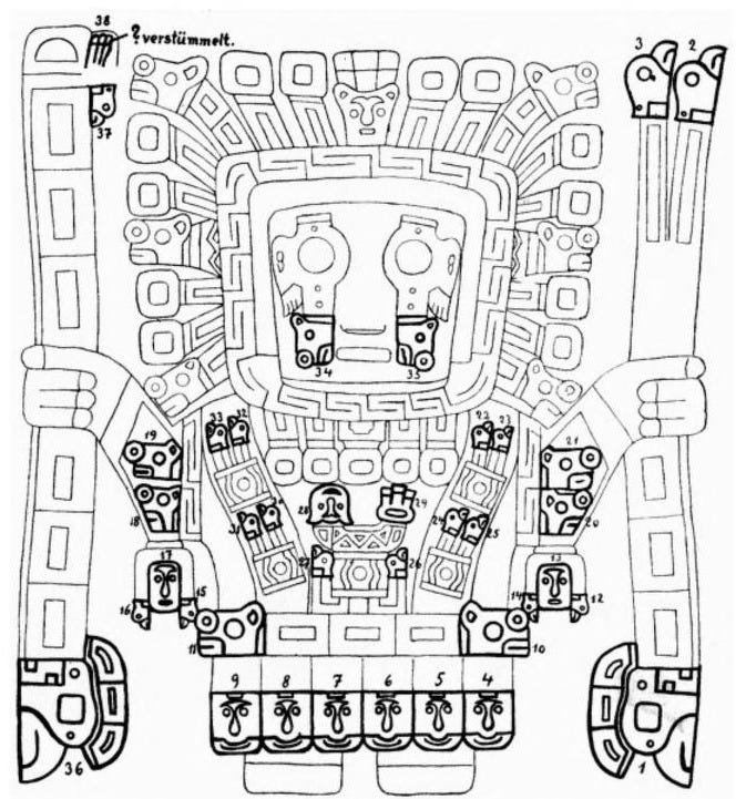
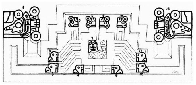
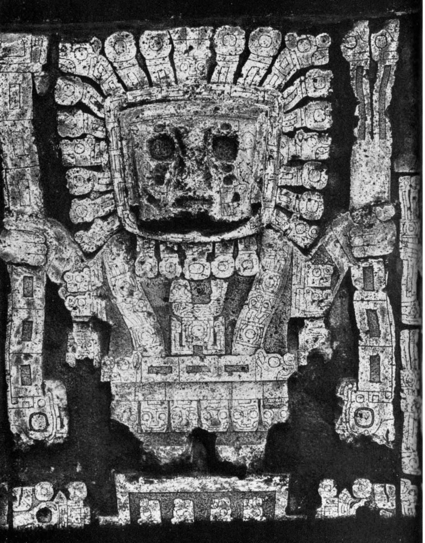
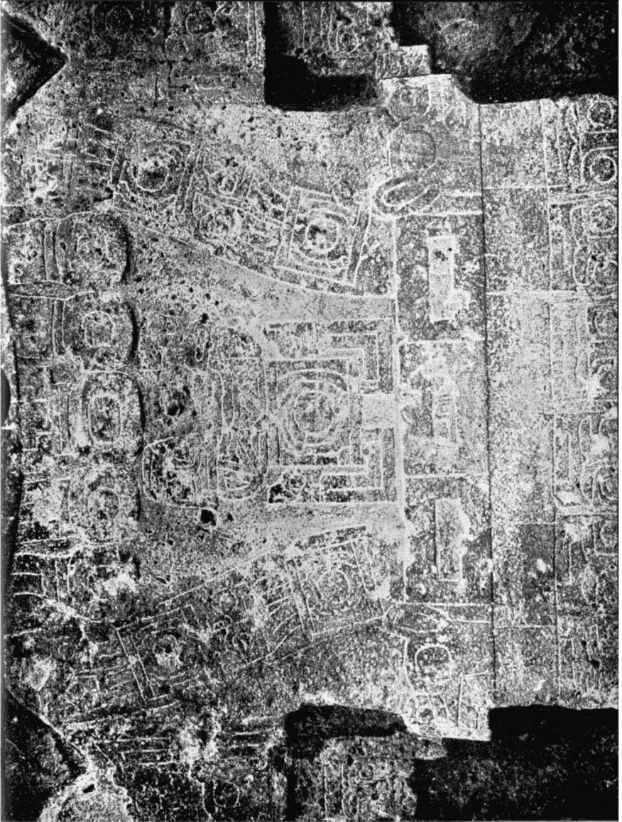
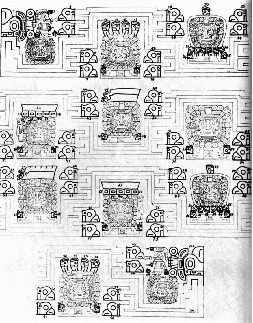
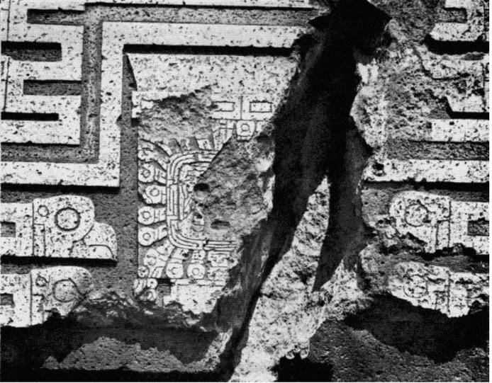
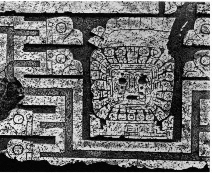
Middle main figure (Fig. 91) 38 characters (excluding the 24 day symbols)
Base of September (Fig. 92) 13 characters
Meander frieze of the 11 twelfths of the year (Fig. 95). 106 characters (excluding the 266 day symbols)
Total excluding the day symbols: 157 characters. Including the day symbols: 290 characters. 447 characters in total. Furthermore, for verification, attention is drawn to the following.
Only Figs. 91, 92, and 95 are suitable for counting, as there are minor symbol errors in Figs. 79, 80, and 96. To demonstrate the accuracy of the slight modifications compared to Figs. 79, 80, and 96, the corresponding photographs (Figs. 93, 94, and 84) have been placed alongside the drawings, as the photographic plate does not err, as happened rarely to the author’s eyes when he was drawing Figs. 79, 80, and 96 from the cast of the Sun Gate. In the individual count, crowned, uncrowned, and double-crowned condors were not differentiated, as the difference is unknown. Presumably, this difference is merely symbolic.
The twelfths of the year February and April each carry a block (?) on 5 moon symbols. The block is apparently unfinished or damaged (Fig. 97), but shows a clear tail end of a condor, as a comparison with the twelfths of August and October shows (Fig. 98), where two condors sit one above the other. Thus, the "block" on the twelfths of February and April has been counted as one symbol each.
In counting, only those symbols were used that we have already encountered in counting the days in the halos of the twelfth-of-the-year heads, such as condor, toxodon, puma heads, and similar symbols like the three-split (the crown of a toxodon head) and the moon symbol (double circle on a band).
The symbol at the elbows of the trumpeter figures of the solstices, despite its small size, must be included in the count. It is severely mutilated in the original (Fig. 84) but fortunately can still be clearly recognized as a small condor head.
The 660 characters on the special table of the winged and running scepter bearers to the right and left of September, of course, must not be counted, because the lunar cycles can only be contained and allowed in the annual frieze. The table of the winged runners on both sides of September will be discussed and counted separately below.
After verifying the presence of the 447 independent numeral symbols on the annual frieze by the reader, there should hardly be any doubt about the surprising agreement of the counting result with the information on drawing 533 by Hanns Hörbiger (Fig. 88), Mt = 19.6 current hours of orbital period of the Käno-moon per Tertiary day (genuine months) or 38 (37.2) genuine months in the twelfth-of-the-year or 447 genuine months in the solar year. The reader is likely still skeptical and missing the strict logic when he sees that these two numbers, 447 and 38, appear scattered across the entire area of the annual frieze and again only on the figure of September, without making it clear that they are indeed meant to represent the sought number of lunar cycles, i.e., the genuine tertiary months. Notably, the number of lunar cycles per day may be missing from the demanding reader's expectations.
It is virtually impossible for a sculptor working with ideographic symbols to visually represent fractions. For if he wanted to depict the number of genuine months per day, he would have had to express the number 1.6 (approximately) with his primitive counting symbols - symbol = 1 - and he simply could not do that. Already the difficulty of accommodating the genuine months in the twelfth-of-the-year was so great that the sculptor had to limit himself to placing them only once, namely in September, the main twelfth-of-the-year. That he perhaps knew how imperfect this one-time depiction was, precisely because of the impossibility of representing the fraction 37.2 - the artist set it at 38 and counted the thirty-eighth, started orbit as complete - will become clear to the reader below.
In representing the fraction of the number of lunar cycles per day, the sculptor seems to have helped himself in another way. From the research by Posnansky, it is apparent that the double circle on the band, the most common symbol of the day numbers around the twelfth-of-the-year faces, represents the moon. This depiction of the moon occurs within the 24 longer Tertiary days of the twelfth-of-the-year no less than 17 times. The 7 remaining symbols of each twelfth-of-the-year face (excluding the flying fish), namely the toxodon and condor heads, mean "light" and "sun."
Thus, 17 days of the twelfth-of-the-year are dedicated to the moon, and 7 to the sun and light (Fig. 89).
Perhaps, or even likely, this was not done without reason. The brittle material and the equally brittle depiction in pictorial script failed when it came to representing all the orbits in all the twelfths-of-the-year individually on each halo face. It succeeded - with two exceptions, which will be discussed below - only once, namely on the body of September. However, it was indeed possible to make the days during which the moon "defeated" the sun and thus dominated the day apparent. The sun and moon were at least equally significant celestial bodies for the post-stationary Tertiary humans, perhaps even the moon, which orbited the Earth at a distance of only about 6 Earth radii, made a much more significant and also more terrifying impression than the much smaller sun. On the days when the sun was eclipsed by the Käno-moon crossing its path (the Käno-moon, in contrast to the sun, rose in the west and set in the east), the moon prevailed in the sky and was stronger than the sun because it had the power to eclipse it for a certain time of the day. These days, when the moon was predominant, could therefore be marked on the stone calendar with the moon symbol (double circle on a band). On the other days of the twelfth-of-the-year, when this did not occur, the sun dominated over the Käno-moon and was thus stronger than it. Thus, these days, when the sun was predominant, could be marked with the sun-light symbol.
Had the Tertiary satellite's orbit been exactly in the plane of the ecliptic, which almost coincided with the Earth's equatorial plane due to the leverage effect of the Käno-moon on the Earth's equatorial bulge, the sun would have been eclipsed every time the orbits crossed. However, since the orbit of the Käno-moon, like that of our current Luna, was probably inclined at a certain angle to the Earth's equator, it might have been that the solar eclipses did not occur from time to time. However, it must have been more frequent that such eclipses occurred.
How often the solar eclipses did not occur and at what daily intervals this happened seem to be indicated by the condor and toxodon light symbols within the radially arranged day symbols around the twelfth-of-the-year heads. This non-occurrence of eclipses happened 7 times during a twelfth-of-the-year of 24 or 25 longer Tertiary days. On these 7 days, the light, the sun, prevailed. On the other 17 days, it was subdued. These were the days of moon dominance, the solar eclipses. And it is quite plausible and likely that during the post-stationary Käno-moon period of the Tihuanaco epoch of "adjustment," the twelfth-of-the-year with its 24 or 25 days and its 37.2 genuine months had a solar eclipse on 17 days. This would be a convincing explanation for why the post-stationary Tertiary sculptor so frequently (17 times) applied the moon symbol as a day digit symbolically. If this interpretation is correct, and it is at least likely, then the Tertiary people of the city on the slanted lake would have experienced 204 solar eclipses during a solar year with 447 genuine months over 290 longer Tertiary days of 30.2 current hours, namely 17 per twelfth-of-the-year.
It can no longer be proven today that the Käno-moon in the stage of the post-stationary Y-beach line caused 204 solar eclipses a year, since neither the inclination angle of its orbit against the terrestrial equatorial plane nor the duration of the nodal and apsidal rotation or its librations are known, yet this number of 204 solar eclipses per solar year with a satellite distance of 5.9 Earth radii and a satellite orbital period of 19.6 current hours does not seem entirely unlikely. And as the reader becomes more familiar with the calendar during the course of further discussions and begins to trust it, he will also trust the symbolic interpretation of the day symbols that names the number of solar eclipses.
This depiction of 17 solar eclipses per twelfth-of-the-year or 204 solar eclipses in the solar year are what prompted the author of this work to make use of the so surprisingly found 447 Käno-moon orbits per year and 38 (37.2) per twelfth-of-the-year. Their presence on the annual table, for the reader initially only visible as a pure numerical indication without any hint of their meaning and transparent, also justified the interpretation of the solar eclipses and the days that were spared from them. All this, because at the time of the Y-beach line, the depicted and on the Sun Gate indicated conditions could have been no other way.
However, the sculptor also made the statements directly and literally, that these 447 and 38 symbols actually refer to lunar cycles in the year and in the twelfth of the year, and nothing else, as will be explained further below.
Upon closer examination of the moon and light symbols in the day symbols of the annual twelfths, it becomes clear that after two "moon" days (i.e., solar eclipse days!), a "light" day (a day without a solar eclipse) always followed. But the incompleteness upon the occurrence of solar eclipses also seems to be indicated in the halos, when a "sun day" was missed, when the regular arrangement of alternating two solar eclipse days and one light day did not work, resulting in five solar eclipse days occurring in a row. The five consecutive "moon" symbols beneath the chins of the faces seem to suggest that such irregularities occurred (Fig. 89).
Since the calendar has so far proven to be a logically constructed entity— as logically as the mode of representation and material allowed—it seems entirely conceivable to the author that the sculptor, as well as possible under the given circumstances, intentionally inscribed the number of genuine months in the year, namely 447, on his annual calendar. Similarly, he intentionally placed the 38 (37.2) Käno-moon orbits per twelfth of the year on the full figure of September, ensuring that the number of solar eclipses and those that did not occur were shown, which were significant for the post-stationary Tertiary people with the frequent Käno-moon orbit and the significant proximity of the Earth’s satellite (R = 5.9 r). Thus, the artist had every chance of being understood by the people of his time, for whom he created the stone calendar, not for the pre-stationary Quaternary humans of the Lunar time, i.e., for us who live today and to whom the calendrical conditions of the post-stationary Tertiary time are foreign.
The author would certainly have refrained from attempting to put such monstrous things under the guise of proof, namely to interpret the Käno-moon orbit of the post-stationary Tertiary period of the often-mentioned stage 24 of drawing 533 (Fig. 88), if the almost complete agreement of the number 447 with the quotient 8760:19.6 ≈ 447 had not been so striking. It is indeed an easy calculation to form the same quotient in all other stages of figures 533 and 531 (Figs. 88 and 87) and compare it with the quotient 8760:19.6 ≈ 447. All these quotients will not correspond with the found number 447 of the Sun Gate calendar, especially the number of stage 24, and the further one distances oneself in the examination of the quotient from stage 24, the less this number will match in terms of both past and future. It is advisable to carry out this re-examination oneself in order to ascertain the astonishing correspondence of the statements of the calendar frieze of Tihuanaku with those of stage 24 of Fig. 88.
And since stage 24 is roughly that of the Y-beach line, the stage of the slanted lake and the harbor metropolis Tihuanaku, and thus also of the Sun Gate and stone calendar, the assumption gains likelihood that the found numbers 447 and 38 indeed represent the number of Käno-moon orbits or the genuine months in the year and in the twelfth of the year, specifically and solely in this stage and in no other.
Had the author made a personal assumption of the lunar orbit at a time of a specially created and highlighted stage "24a-Sun Gate," a hundred percent agreement with the information of the stone calendar might be more contestable, although there is certainly justification for creating and highlighting such a stage. However, since the number Mt = 19.6 h (current hours) for the Käno-moon orbit was taken from an already existing equivalent stage drawn by Hanns Hörbiger in 1927, it is difficult to believe this coincidence is mere chance.
Nonetheless, the discovery of the numbers of the Käno-moon orbit would be virtually impossible for someone who has not delved deeply into the stone calendar. The calendar would be unusable for common use, at least concerning the genuine months. It would thus be necessary to state that the sculptor must have given an unambiguous instruction indicating how the part of his calendar indicating the number of Käno-moon orbits should be read. And indeed, he has provided such an instruction!
Once for finding the number of lunar orbits in the solar year and once for finding the lunar orbits in September. In connection with this, the sculptor has made a third instruction to eliminate any possible error in counting the lunar orbits in September.
Of course, one cannot expect this instruction to be in German print, but it is, as the reader will see, of a transparency and clarity that is hard to surpass. Such clarity was absolutely necessary for a pictorial script calendar. The instruction had to be such that errors were excluded, that it could only be read unambiguously. Any other interpretation would lose its meaning, and only one, very simple and strictly literal instruction had to be followed.
The author asks to partake in this brief symbolic interpretation, or rather in the reading of a simple pictorial script, which in his opinion is presented with such clarity that even a child could read it, found on the stair base of the main figure of September (Fig. 92). According to the importance of the instruction, it is located at the focal point of the entire frieze layout, at the place one encounters when passing through the Sun Gate (Fig. 78).
The author is well aware that interpretations of pictorial scripts can be troublesome. Everyone will read something different from a pictorial script. However, the pictorial script on the base of September on the stone calendar of Tihuanaku is unambiguous. It essentially consists of twelve independent symbols that we recognize as numeral symbols from the halos of the moon faces and from the other symbols of the annual frieze, as well as a thirteenth symbol, namely a crescent-shaped worm-like creature that has a puma head, thus the moon symbol. Usually, the puma, which is considered a moon creature in the ideography of prehistoric South Americans, carries the moon disk around its neck on a band in Tihuanaku ceramics. The puma head is carved on the base into a crescent-shaped body and is recognizable by its wide mouth and whiskers (Fig. 100). Its worm-like body is clearly intentionally curved in a crescent shape and is enclosed in a box that opens upward, toward the main figure of September, with a widening gap, a "road." Surrounding the box are the 12 other symbols shaped in such a way that they form the box in which the puma-moon is enclosed.
And this enclosure of the puma-moon is the core of the very simple pictorial script and thus the core of the calendar.
The observer, the Tertiary person of the post-stationary Tihuanaku epoch, now asks two questions about the calendar, which relate to the lunar orbits:
How many times does the moon orbit the Earth in a year?
How many times does the moon orbit the Earth in the twelfth of the year?
To the first question, regarding how often in the year, the pictorial script of the base answers literally in German translation, but also in the translation into any language of the Earth (Fig. 92). "In us twelve symbols is the moon enclosed (contained)!"
The reader may try to give the pictorial script another interpretation. He will not succeed. Clear and unambiguous is the meaning of the many individual symbols inscribed in the twelve annual sections on the base. We see the 12 sun animal heads (condor and toxodon) as abbreviated symbols of the twelve annual twelfths of the calendar frieze, and to exclude any mistake in the interpretation of the 12 symbols, the endpoints of the caesura are marked with vigorously raised double-crowned sun animal heads, just as it has been done at both ends of the annual table behind the solar solstice trumpeters, where the double-crowned sun animals also raise their heads as closure symbols. Enclosed in the box is the crescent-shaped puma moon within the 12 sun symbols, thus surrounded by the abbreviated symbols of the twelve annual twelfths of the calendar. The given hint, "In us twelve is the month enclosed!" is, in my opinion, so compelling that the Tertiary observer is almost led to the solution by the head. He had nothing further to do than to adhere exactly to the given instruction. He recognized particularly from the meaningful repetition of the endpoints on the stair base that it must indeed be a brief repetition of the 12 annual twelfths. He saw the puma moon enclosed in these "abbreviated" twelfths of the solar year and had to think that it probably referred to the larger annual twelfths in the entire table of the calendar frieze, which could only be indicated briefly on the stair base.
In all of these, the number of genuine months in the Tertiary year should be hidden? The observer followed the hint of the pictorial script and began to count all the symbols on the annual frieze without exception, which he already recognized as numeral symbols - symbol = 1 - and found, presumably supported by the previously colored treatment of the individual symbols, perhaps also under the guidance of a Tihuanaku astronomer, the correct number 447 as the number of genuine months, namely the Käno-moon orbits in the solar year.
To the second question, how often the moon orbits in the twelfth of the year, the pictorial script of the base also answers very simply and clearly to the Tertiary observer. From the box in which the puma moon is enclosed, a road leads upward, to the main twelfth of the year, September. There, search further!
The Tertiary observer of the calendar followed this hint as well, counted the known numeral symbols on the body, face, and scepters of the full figure of September, and found the correct number 38 (37.2) of genuine months in the twelfth of the year. He knew he should not count the numeral symbols of the day attributes arranged radially around the face of September, or at least he could have known this, since the instruction for the total count in the pictorial script was only given for question 1, regarding the number of annual orbits, namely that the annual number of Käno-moon orbits should be sought and found within all twelve annual twelfths. For the second question, the pictorial script only indicated the direction where the relevant numeral symbols could be found, not the counting method, and that it could not be much more than 35 to 40 symbols, the observing Tertiary person knew from daily experience. Therefore, it was already easy for him, without renewed and special counting instructions, to find and count the 38 symbols of the Käno-moon orbit in the twelfth of September. The remaining day symbols were no longer relevant to him because including them would have resulted in a number far too high compared to the number of orbits he was approximately familiar with from daily observation.
Nevertheless, it seems the sculptor anticipated that there would still be viewers among the observers who would not understand the road hint of the September base and might contrary to all expectation count the 24 day symbols as well. Since the artist seems to have had the ambition to design his calendar so clearly and distinctly that even those with limited abilities could read it, he decided to provide a renewed hint that would eliminate any doubts regarding the counting of the 38 Käno-moon orbit symbols in September.
He laid down this instruction in the middle of the body of the twelfth of September to exclude any last doubts about how to find and count the 38 symbols of the moon orbit. To this end, he placed a repetition of the crescent-shaped puma moon exactly above the road gap of the base, right in the middle of the body of September and under the halo of the day symbols of this twelfth of the year. This puma moon sits on a symbol (Figs. 91, 93, 94, and 96) that clearly indicates the gender of Lady September, namely on the so-called "female" symbol, as Professor Posnansky calls it. This gender symbol thus briefly means "body." On the right and left of this "body" symbol stand two poles upright, ending in condor heads. They clearly point to the large, upright poles that the September figure holds as a scepter in its hands. It is evidently a brief repetition of the larger body of September with its two scepters, and the artist emphasized that it is indeed a repetition of the entire body with head and scepters. Notably, only the body with head and scepters, as the halo around the face of September is bound around the chin and forehead and is conceptually separated from the body. The inclusion of the symbols on this halo band was thus out of the question, only the other symbols were relevant, for otherwise, the sculptor would not have specifically mentioned the scepters but also the halo. In itself, the scepters do not belong to the body, but since the symbols on these scepters were to be counted, they were specifically named.
Thus, the observer only needed to follow the pictorial script instruction on the body of September literally, and he could no longer make mistakes in the counting method. And since the puma moon stands on the body of the September figure, this pictorial script indeed removes any last doubts about the counting method of the 38 Käno-moon orbits from the post-stationary Tihuanaku period and conveys something like this: "I, the puma moon, can be found on the body of September, but also on the upright scepters to the right and left of the September figure."
If the observer now followed this completely clear instruction, there could be no doubt anymore. He only needed to adhere strictly to the instruction and count the orbit symbols. He then found the correct number of Käno-moon orbits in the twelfth of September and thus the same for all other annual twelfths, because these were equal among themselves. He found the correct number 38 for the moon orbits in the twelfth of the year!
Could this also be mere coincidence? Or could it be the forced invention of a man who wants to interpret the calendar of the Sun Gate of Tihuanaku at all costs? Then indeed, the coincidences would accumulate alarmingly!
No, the interpretation of this pictorial script is not forced; it emerged naturally after the interpretation of the pictorial script in the base was once found. The three hints regarding where to find the Käno-moon orbits per year and per twelfth of the year, and how to count them, are of such compelling logic that the mode of representation on the calendar must be called absolutely genius. The sculptor evidently placed the greatest value on ensuring that the moon orbit symbols in September could be easily found and correctly counted; thus, he pointed out twice, once on the base through the "road" upward to September, and then on the body of September itself, that in the case of counting the moon orbits in the twelfth of September, only the symbols on the body of September should be counted, as well as on the scepters. Since he specifically names the scepters, but not the "feathers" of the halo, the hint is unambiguous.
In my opinion, the Tertiary sculptor expressed his intention so clearly that even the Quaternary, i.e., the modern observer, can easily follow these hints, despite having been unaccustomed for generations to the ability and practice of reading pictorial scripts.
The Glacial World Theory demands for the equilibrium state of the post-stationary Tertiary period (Stage 24 of Fig. 88) 447 Käno-moon orbits in the solar year and 38 (37.2) Käno-moon orbits in the twelfth of the year. The stone calendar of Tihuanaku shows 447 Käno-moon orbits in the solar year and 38 (37.2) Käno-moon orbits in the twelfth of the year. It thus fully meets these demands of the Glacial World Theory, namely one hundred percent, and the base indicates that the found 447 and 38 symbols are the actual Käno-moon orbits.
One thing should therefore remain uncontested: the interpretation of the pictorial scripts on the base of September and on the body of September itself is only correct and understandable with regard to the found tertiary lunar orbits, and is thus only possible based on the tertiary, genuine months. In all other cases, the base remains silent, and the puma moon on the body of September becomes incomprehensible, along with the two pictorial scripts in general.
Here, however, at the core of the tertiary calendar of Tihuanaku, the pictorial scripts speak simply and clearly, and we can only understand them from the Tertiary time of the Tihuanaku period. A few words only express the pictorial scripts, but they do so with a certain humor that seems to indicate the satisfaction of the prehistoric sculptor, having depicted the difficult problem of representing 447 genuine months in the year and 38 genuine months in the twelfth of the year as genially and understandably as possible.
After we have found the twelfths of the year, the solstices, the equinoxes of the tertiary solar year, after we have succeeded in also identifying the number of days in the twelfth of the year and in the year, and after the sculptor has clearly inscribed the number of months, that is, the genuine lunar orbits, on the calendar, one hesitates almost to demand even more accuracy from this stone calendar. Perhaps, however, the artist suffered from the slight inaccuracy he could not quite master, namely the indication of 38 months in September, when he knew full well that in reality, it was about 37.2 months. That he also tried to create complete clarity here seems to emerge from the mode of representation.
Earlier, we mistakenly counted the annual twelfths in the wrong order. We started with January and ended with December. This was a concession to our modern way of counting. However, the Tihuanaku calendar begins with its own New Year, September, the twelfth of the spring equinox, and then continues counting to the left. Left, because the positioning of the Sun Gate toward the actual sun simply required this leftward counting. In the same counting direction, it is therefore logical to count the individual month symbols on the body of September along with the scepters, so that the 38th symbol can be found at the top left on the left scepter of the September figure (Fig. 91). This scepter is adorned with diamond cuts, rectangular fields. All these diamond cuts are rectangular, except for the top one next to the 38th symbol! There, instead of the rectangular field, there is a decorative recess in the shape of a not quite half moon.
Since nothing on this calendar seems to be created by chance, one could recognize a hint that the 38th Käno-moon orbit of September is only present halfway, or perhaps even only by a third, which indeed corresponds to the reality. This could suffice for the accuracy of the representation.
But what if the Tertiary artist was still not satisfied with that?
Within the meander frieze, two very distinct pictorial scripts appear that favor 37, and not 38, orbits of the Käno-moon in the twelfth of the year, and the reader might be interested in examining this pictorial script as well.
It concerns the twelfths of July and November enclosed with veils (Fig. 101). At the top of each of the two veils is a fish head as a coat of arms. The fish is not only a symbol of rain and water, but like the puma and the double circle on a band, also a symbol of the moon.
Each of these symbols seems to say: "If you, observer, want to learn about the moon orbits in the twelfths of July and November, you must this time count all 24 day symbols, which I expressly include with my veil for this purpose."
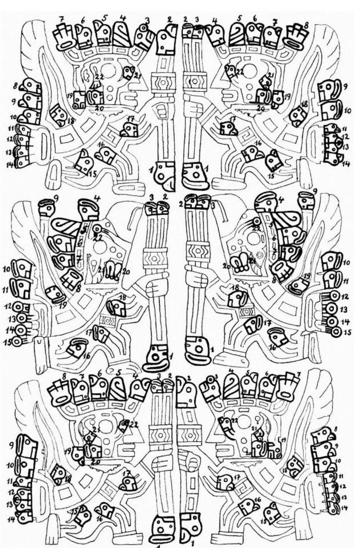
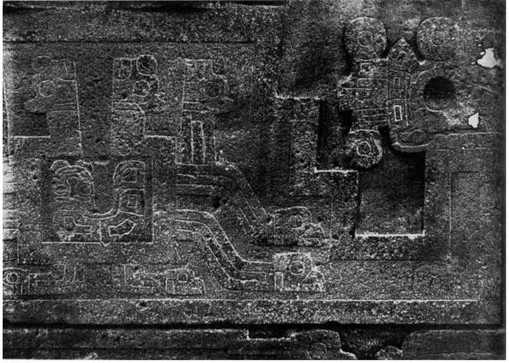
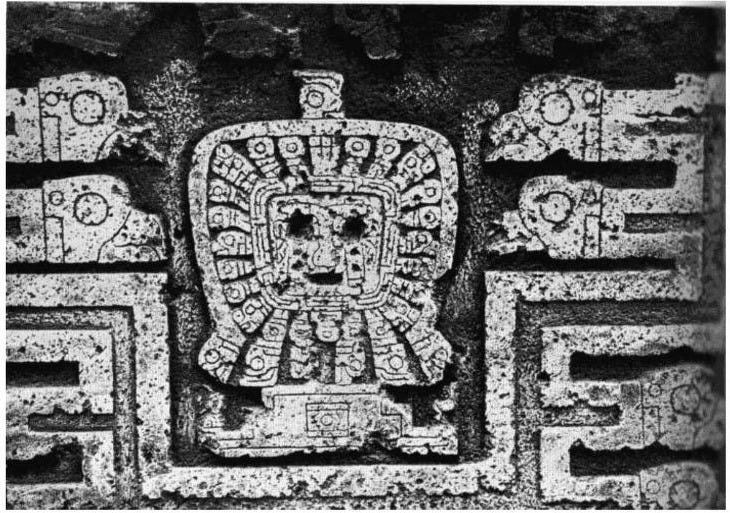
Counting all symbols, including the 24 day symbols in the twelfths of July and November, yields the number 37 each! This seems to explain that September, according to the above statements, shows 37.5 orbits, if one wishes to acknowledge the indicating half-moon next to the 38th symbol on the left of the September scepter.
If we have 37.5 orbits in three twelfths, then we arrive at an average of 37.2 orbits, more precisely 37.17 orbits, which sufficiently accurately characterize the actual orbits in the twelfth. Thus, we would have discovered the method by which the Tertiary sculptor could express fractions.
The slight inaccuracy in counting for September would thus also be resolved. It should certainly not be insisted upon this last interpretation, not least because the accuracy for a stone pictorial script calendar is already sufficiently precise without this last interpretation, but in connection with the other results of the calendar deciphering and in connection with the previous "coincidences," it remains striking.
Thus, based on Hanns Hörbiger's Glacial World Theory, we have deciphered the annual calendar of Tihuanaku, a calendar that offers far more than is typical in our modern calendars. We could therefore be satisfied and close the book on the riddle of the larger Lake Titicaca.
But the Sun Gate calendar is even richer! The triple frieze of the winged and scepter-bearing figures to the right and left of the main figure of September remains, which additionally carries 660 independent symbols, the deciphering of which is still pending.
It should be explicitly noted here that the deciphering of the actual annual calendar is thus completed, a deciphering that is based on clear instructions from the sculptor, so that essential doubts cannot arise. The situation is different with the subsequent deciphering of the table of winged scepter bearers to the right and left of the main figure of September. Everything that is now presented in terms of interpretation or deciphering is merely the author’s assumption. There is no unequivocal indication on the entire calendar that the deciphering should be done this way and not otherwise.
Moreover, within the figures themselves, there are ambiguities, some of which will be mentioned later. The methods used for deciphering the frieze of the winged figures are the same as those used for the annual calendar. Therefore, there is a probability of correctness in the interpretation, but no more. Consequently, no special emphasis is placed on this interpretation because it is completely sufficient to have uncovered the mystery of the exceedingly rich annual calendar, the interpretation of which is approaching proof based on the content of the pictorial scripts. The additional frieze of the winged figures will therefore only be treated for the sake of completeness, without the author being able to provide evidence from the pictorial scripts of the calendar itself that only the provided interpretation is correct.
This frieze of the winged figures is regarded by the author as a table, specifically as a side table for the representation of Käno-hours and Tertiary minutes.

The creator of the Glacial World Theory in Mauer near Vienna, Hanns Hörbiger, has prepared a significant drawing for this publication, which is presented in Fig. 102. It shows the 30 Tertiary hours of the longer day. The twenty-four inertial hours of today are drawn beneath for comparison. The current day runs from midnight to 24:00 and is divided into 4 hours of "morning," 4 hours of "forenoon," 4 hours of "afternoon," 4 hours of "evening," and 4 hours of "midnight." This was done to apply the same division to the 30 hours of the Tertiary calendar, where in each section corresponding to 4 hours on the 24-hour table of today, there are 5 Tertiary hours, not today's. These Tertiary hours approximate our hours in length but are not equal to them. According to the calendar, the Tertiary day has 30.2 current hours.
The individual hours of the 30-hour table are winged and, as the author believes contrary to Posnansky's view, presented as running figures, for the hour "runs" and "flies away." The possible symbolic meaning of the thirty Tertiary hours can be easily read from the drawing in Fig. 102. Whether the symbolic interpretation of the 10 condor-headed figures as daytime hours, during which the royal birds frolic in the warm sun, is accurate cannot be claimed, but it is not unlikely. The running and winged human figures would thus represent the embodiments of darkness and twilight. However, this symbolic interpretation should not be presented as unassailably correct.
It should again be emphasized that the thirty Tertiary hours are not today’s hours. Exact correspondence might be conceivable, but then the year of the Tertiary calendar would have to have had two additional days, so not 290, but 292 days. However, these are not present on the calendar, only 290, calculated including the "flying" fish.
With the division of the stone calendar of Tihuanaku into twelfths, days, hours, and months, one could now be satisfied and conclude the interpretation. However, it appears that the sculptor of the hour frieze was not yet finished with the establishment of the 30 hours of his day and continued with the subdivision.
On the individual winged and running scepter bearers, both those with human heads and those with condor heads, there are again various symbols that we recognize from the annual calendar as numeral symbols, regardless of their otherwise likely very simple symbolic meanings, except that a symbol of a shell is added to the previously known symbols. If all numeral symbols could thus far be counted as units - symbol = 1 - it can be analogously concluded that the individual independent symbols on the bodies and on and in the heads of the hour figures are also meant to represent numerical units, especially since it is evident that the same number of symbols appears on all figures, with some uncertainties that will be mentioned later. This same number of symbols also appears where it was sometimes difficult to place them due to lack of space. There are 660 independent symbols arranged in groups of 22 symbols on the individual figures (Figs. 79, 80, and 99). The counting is particularly easy this time and can be clearly conducted in Fig. 99. It should be particularly noted that the sculptor clearly intended to place 22 symbols on all 30 figures. And where it did not quite work out, for example, on the condor head in a "praying" position (Fig. 85), he adapted it. Since the condor head in Fig. 85 is depicted with its beak raised upward, the small condor head or toxodon head that the human heads in Fig. 86 have in their necks could no longer be added at that point on the neck. Instead of this neck symbol, the artist carved a fish head on the inner sides of the upright large wings between the large condor head and the large wing as a substitute for the neck symbol (Fig. 85), restoring the desired and necessary number of numeral symbols.
If a symbol was missing on the scepter of the top human figure in Fig. 86, it was additionally placed on the back of the wing to restore the desired number of symbols. The intention is therefore very clear: to always present the same number of symbols.
In this way, each figure contains 22 symbols, making a total of 660 symbols on all figures. If one wants to regard these, like all other independent numeral symbols on the Sun Gate frieze, as independent numeral symbols - symbol = 1 - one must logically conclude that they serve only to divide the hour into 22 subdivisions, thus into somewhat long Tertiary minutes of about 2.72 current minutes in length. Since the minutes must logically sit on the hours, doubts can hardly arise.
Nevertheless, this explanation should not be insisted upon, as on some figures with human heads, a three-split symbol appears in place of the small condor head on the eye shield of the head, which we already know from the three-splits of the annual frieze (Fig. 86). This three-split on the eye shield looks very much like a tiny wing, at least in the photograph of Fig. 86. Since the wing eyes do not belong to the independent numeral symbols, but symbolically represent the fleeting gaze of the eye, thus symbols of passing time, it would mean that on these few figures, where instead of the little condor head, a tiny wing sits on the eye shield, there would be one symbol too few present, meaning instead of 22 symbols, only 21. However, it could just as well be that with the considerable weathering of the original, the small three-split symbol does not represent a wing but rather a puma crown, a three-split, and the author would like to assume this as likely.
One should only point out the clear endeavor of the sculptor in other cases to always represent the number 22 exactly on each hour runner, even in instances where he somewhat unorganically and somewhat unartistically allows a fish head to protrude from the back of a wing to complete the number 22. The possibility of an error by the sculptor is excluded by the author for such a precise and logically structured calendar, for the sculptor would have checked the number of symbols for accuracy under all circumstances, even if he had partly left the carving of the hour figures to a student. It was a stone calendar that could not be wrong but had to be completely correct.
Therefore, the tiny three-split is likely indeed a numeral symbol and only bears great resemblance to a tiny wing, which can also easily be represented as a three-split. And if the reader is willing to agree with this assumption, then the minute calendar is also correct. The reader might ask how the Tihuanaku people measured these minutes? How they did it is, of course, not revealed by the calendar, but if we think of our hourglasses, which our housewives still sometimes use today for boiling eggs, one might imagine that the Tertiary minutes were measured in a similar way.
Thus, the description and explanation of the stone calendar on the Sun Gate of Tihuanaku is concluded. It can be said that according to the author's interpretation based on the Glacial World Theory, the stone calendar is likely to provide an almost seamless proof of the slanted beach line of Tihuanaku, just as the slanted beach line became proof for the stone calendar. Both, the beach line and the calendar, which stands near them, mutually condition each other.
No arbitrariness and no interpretive frenzy led to the result that this third section brings from the riddle of the larger Lake Titicaca, but rather the application and strict execution of the theory of engineer Hanns Hörbiger regarding the Glacial World. And the strict execution of the mutual proof led to a surprising success.
The jest of a skeptical friend, that the Sun Gate must have been carved by an enthusiastic follower of the Glacial World Theory, despite the powerless mockery that is supposed to lie within it, touches the essence of the matter. Although the sculptor of the stone calendar of Tihuanaku lived a long time before Hanns Hörbiger and died only a little earlier, a follower of the Glacial World Theory could indeed not carve such a stone Tertiary calendar better than that prehistoric stonemason did. He may therefore be regarded as the oldest follower of the theory of the Glacial World, and one can well appreciate such an intelligent, even genial companion.
In summary, the two interpretations presented in this section regarding the deciphering of the ideograms of the Sun Gate of Tihuanaku are briefly summarized once more.
Posnansky's interpretation based on an actualist, Quaternary, i.e., modern foundation. The explanation of the months seems successful in that case, as these would be months of the same type as our current months. The interpretation of the 3 decade weeks, if they could be acknowledged, seems less successful, as they only fill the year imprecisely, are illogically separated from the months, and must cause the observer much mental calculation and headache. Posnansky assumes 5 or 6 uncounted days, which are not represented and thus must be thought of additionally. The separation of the day table in Posnansky's sense from the monthly faces is misleading and illogical… The interpretation of the solstices and the equinoxes is Posnansky's merit. The 288 or 290 symbols around the faces of the annual table are not interpreted, nor is the total number of 447 symbols on the annual calendar without the table of the winged scepter bearers. The 660 symbols in the table of the winged and kneeling scepter bearers are also not interpreted. All these symbols, totaling 1107, have only symbolic meaning according to Posnansky. No further clarification is provided here.
The author's interpretation based on the Glacial World Theory of Hanns Hörbiger. Solar year with 12 annual twelfths, solstices, and equinoxes are present, as well as 290 longer Tertiary days, with 30 Tertiary hours each divided into 22 Tertiary minutes. 447 lunar orbits in the solar year, thus genuine months, 37.2 lunar orbits (genuine months) in the twelfth of the year, 204 solar eclipses per solar year, and 17 solar eclipses per twelfth of the year. Interpretation of the pictorial scripts on the base of September, on the body of the September figure, and the "veil" twelfths of July and November. Origin of the gate and its frieze during the post-stationary Tertiary period of Stage 24 of drawing 533 (Fig. 88), the time of the slanted Y-beach line, when Tihuanaku was a port city at the sea bay of Tihuanaku and experienced its main construction period. All 1107 symbols have been taken into account for explanation.
Additionally, a brief comparison of the author’s interpretations regarding the proximity of values to those of drawing 533 (Fig. 88) is provided.
Stage 24 of drawing 533
Stage 24 Sun Gate
Percentage proximity
T = 29.4 h
T = 30.2 h
97.35%
Mt = 19.6 h
Mt = 19.6 h
100.00%
There is no need to mention a few symbols that cannot be numeral symbols:
Symbols Fig. 83, Nos. 16 and 13. According to Posnansky's research, these two symbols represent "male" and "female" gender. They are placed on the bases of the annual twelfth faces and very clearly on the figures, so that hardly any doubt can arise regarding the accuracy of the interpretations.
Composite symbols. These are the headdresses over the annual twelfth faces. They may have symbolic meaning and may perhaps also denote constellations of the zodiac, as Posnansky suggests. However, we can no longer decipher them from the artist's pictorial script with sufficient accuracy, except perhaps for the "veil headdress" of Fig. 101 (cf. page 185). The attempt to interpret the symbolic meaning of the emblematic headdresses of the annual twelfth faces follows below.
The wing eye symbol. According to Posnansky, it represents the gaze of the eye bending into the distance, in a figurative sense also the winged time.
The stair base symbol. According to Posnansky, it is the symbol of the Earth, which the Tihuanaku people allegedly imagined in a stepped form. He may have been influenced by the structure of the stepped Cordilleras, or perhaps by the countless stepped fields covering the mountains of his homeland.
The reader will likely agree with the author in the conviction that the symbols listed under 1 to 4, particularly in their compositions, can hardly have significance as numbers, and will understand the reason why they could not be counted as numbers in the interpretation of the calendar frieze, as has been the case with the other independent individual symbols, such as the heads, moons, three-splits, and shells.
Regarding point 2, composite symbols, the attempt at a symbolic interpretation of the emblematic headdresses over the annual twelfth faces will be presented. The reader is asked to follow these interpretive attempts with reference to Fig. 82, which do not deal with the counting of the symbols but with their symbolic meaning.
January.
The emblematic headdress consists of four side-by-side fish heads, the symbols of water, rain, but also of the moon. Possible meaning: rainy season. The headdress consists of a condor brooding on (moon) eggs, assuming that the bar over the (moon) eggs represents an unfinished or mutilated condor. Possible meaning: condor breeding season. No emblematic headdress present.February.
Assumption as in point 1. Possible meaning: condor breeding season.March.
April.
Assumption as in point 2. Possible meaning: condor breeding season.May.
Designation as in point 1. Possible meaning: rainy season.June.
Trumpeter headdress. Possible meaning: winter solstice.July.
Veil headdress. Possible meaning: twelfth of the year with 37 moon orbits.August.
Double condor headdress. Possible meaning: mating season of the condor.September.
October.
No emblematic headdress present. Headdress as in point 8. Possible meaning: mating season of the condor.November.
Headdress as in point 7. Possible meaning: twelfth of the year with 37 moon orbits.December.
Headdress as in point 6. Possible meaning: summer solstice.
Thus, the attempt to explain the stone calendar of Tihuanaku can be considered completed, first on an actualist basis and then especially on the basis of tertiary post-stationary conditions using the theory of Hanns Hörbiger's Glacial World. This attempt cannot and does not wish to claim the character of a mathematical proof. It should only be noted that there is a very high probability of the correctness of the interpretation. The findings of the astronomical and calendrical conditions at the time of the Y-beach line and the contemporaneous port city of Tihuanaku at its "slanted" shores indicated that:
Day length was about 29.4 current hours,
Number of these days in the solar year was about 298,
Käno-moon orbits per solar year were about 447,
Käno-moon orbits per twelfth of the year were about 37 to 38,
Solar eclipses per solar year were about 200 (estimated)
(as noted on page 113), so says the Sun Gate calendar found in the ruins of the city on the slanted lake:Day length is about 30.2 current hours,
Number of these days in the solar year is 290,
Käno-moon orbits per solar year is 447,
Käno-moon orbits per twelfth of the year is 37.2,
Solar eclipses per solar year is 204.
Whether the interpretation of Professor Posnansky, who approaches the riddles of the Sun Gate frieze from an actualist, thus modern foundation, is useful, or whether it is the author’s interpretation based on tertiary conditions using the theory of the Glacial World, is left to the critical reader.
Perhaps, while reading this third and final part of the book on the riddle of the larger Lake Titicaca, even the skeptical reader may have developed a suspicion that the problems of solution can be approached on the basis of Hanns Hörbiger's Glacial World Theory, which mock the scientific armament of researchers today who adhere to an actualist perspective. Up until the beginning of this section, the skeptic might still have argued that the continent of South America has indeed tilted, risen again and sunk, risen once more, tilted again, and then leveled out, all while carrying the salty remains of the sea along with flora and fauna to an elevation of 4000 meters. However, he may, as the author hopes, have become at least thoughtful while reading the section about the Sun Gate of Tihuanaku and the attempt to decipher its ideograms.


